Tropical Storm Gonzalo Heads West Tropical Depression 8 Gulf of Mexico Douglas Hawaii Bound
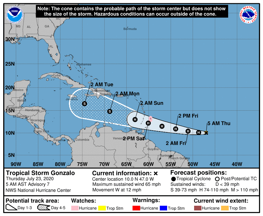
LOCATION…10.0N 47.0W
ABOUT 970 MI…1565 KM E OF THE SOUTHERN WINDWARD ISLANDS
MAXIMUM SUSTAINED WINDS…65 MPH…100 KM/H
PRESENT MOVEMENT…W OR 270 DEGREES AT 12 MPH…19 KM/H
MINIMUM CENTRAL PRESSURE…997 MB…29.44 INCHES
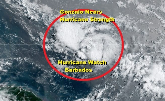
A Hurricane Watch is in effect for Barbados and additional hurricane watches are likely to be posted later today. Tropical Storm Gonzalo strengthened overnight with top winds at 65 mph. Thunderstorms continue to blow up near the center and there is no evidence of any wind shear or dry air getting entrained into the structure of Gonzalo. It does however remain a rather small cyclone with gales only extending out about 35 miles from the center. Small cyclones tend to be volatile strength wise in both directions so I would not be shocked to see this strengthen to a hurricane rather quickly today.
TROPICAL STORM GONZALO
Westward motion continues at a steady 12 mph This should bring Gonzalo over the Windward Islands later Saturday into Sunday morning. Gonzalo has outperformed the global weather models from the get go. These models barely showed anything a few days ago. It could be the small nature of the storm that gives the global models headaches.
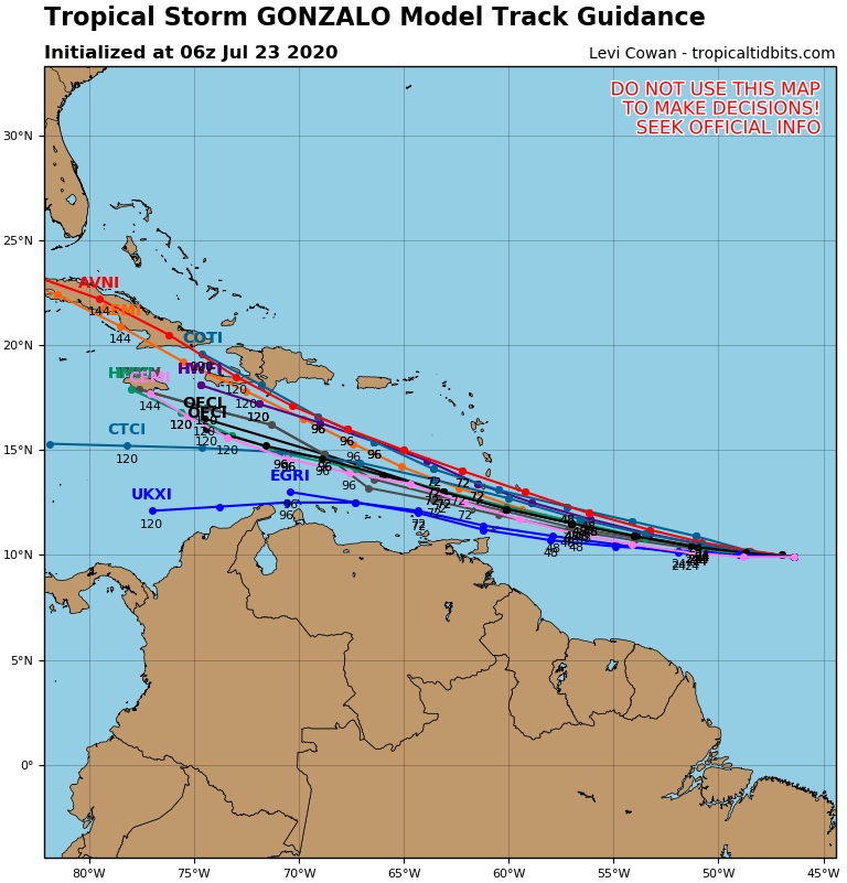
There isn’t much change in the forecast track of Gonzalo but the spread among the models is growing wider. Also interestingly enough, the European is the furthest north of all the models and it now seems to be holding on to the system as it moves through the Northeastern Caribbean vs the Southern Caribbean on the GFS. Gonzalo looks to thread of fine needle staying away from strong upper air winds that will like just to the north of the current forecast track.
Hurricane model track guidance is further south and tightly clustered so this lends confidence to the National Hurricane Center’s forecast. The spread widens in the long range which it always does. The strong east west upper high to the north favors the westerly track until proven otherwise.
TROPICAL DEPRESSION 8 IN THE GULF OF MEXICO
LOCATION…26.0N 90.0W
ABOUT 425 MI…685 KM ESE OF PORT OCONNOR TEXAS
MAXIMUM SUSTAINED WINDS…30 MPH…45 KM/H
PRESENT MOVEMENT…WNW OR 290 DEGREES AT 9 MPH…15 KM/H
MINIMUM CENTRAL PRESSURE…1009 MB…29.80 INCHES
Low pressure that developed in the Gulf of Mexico yesterday has gotten better organized and a new tropical depression has formed. Satellite pictures show a ball of convection that has formed around a broad center. This system is going to develop slowly as it heads to the northwest.
GULF OF MEXICO SATELLITE
Clearly there is nothing rain wise that is occurring along the Gulf coast as this system is well offshore. It seems that the biggest threat from this will be heavy rains when it eventually moves into Texas regardless of whether this becomes a tropical storm or not.
REGIONAL RADAR
Hurricane track models favor a mostly westward track which again is due to the strong east west upper high that lies across the Southern US and extends out across the Atlantic. It is the same east west ridge that is driving Gonzalo. The National Hurricane Center forecast strengthens this to a minimal tropical storm before landfall sometime around midday Saturday along the coastal bend of Texas.
HURRICANE DOUGLAS BECOMES A MAJOR HURRICANE HAWAII BOUND
We want to make a quick mention of Hurricane Douglas out in the Pacific now that it has become a major hurricane. Top winds are 120 mph and Douglas is located less than 1500 miles to the East of Hilo Hawaii.
Douglas is likely to strengthen a bit more before leveling off. The same east west ridge over the US extends out into the Pacific and will likely keep Douglas on this west northwest course. On its present course, Douglas will near the big island of Hawaii late Saturday. We will examine this further as well as update you on Gonzalo and Tropical Depression 8 on my Weather in 10 video for Patreon Members later today
BE SURE TO DOWNLOAD THE FREE METEOROLOGIST JOE CIOFFI WEATHER APP &
ANGRY BEN’S FREE WEATHER APP “THE ANGRY WEATHERMAN!
MANY THANKS TO TROPICAL TIDBITS FOR THE USE OF MAPS
Please note that with regards to any severe weather, tropical storms, or hurricanes, should a storm be threatening, please consult your local National Weather Service office or your local government officials about what action you should be taking to protect life and property.


