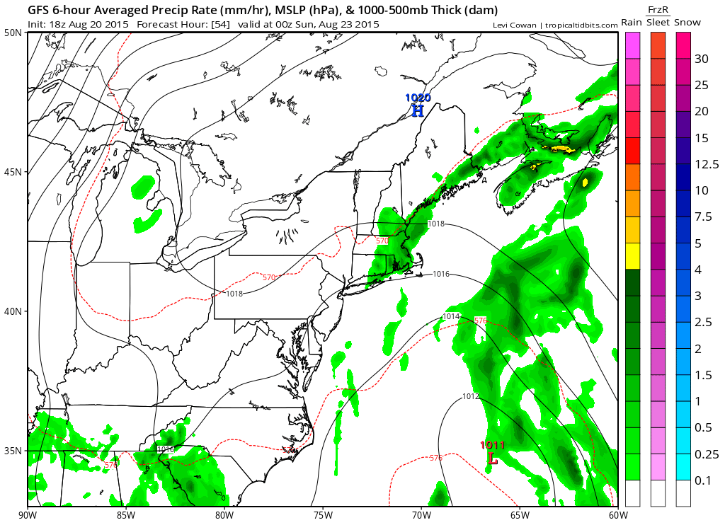
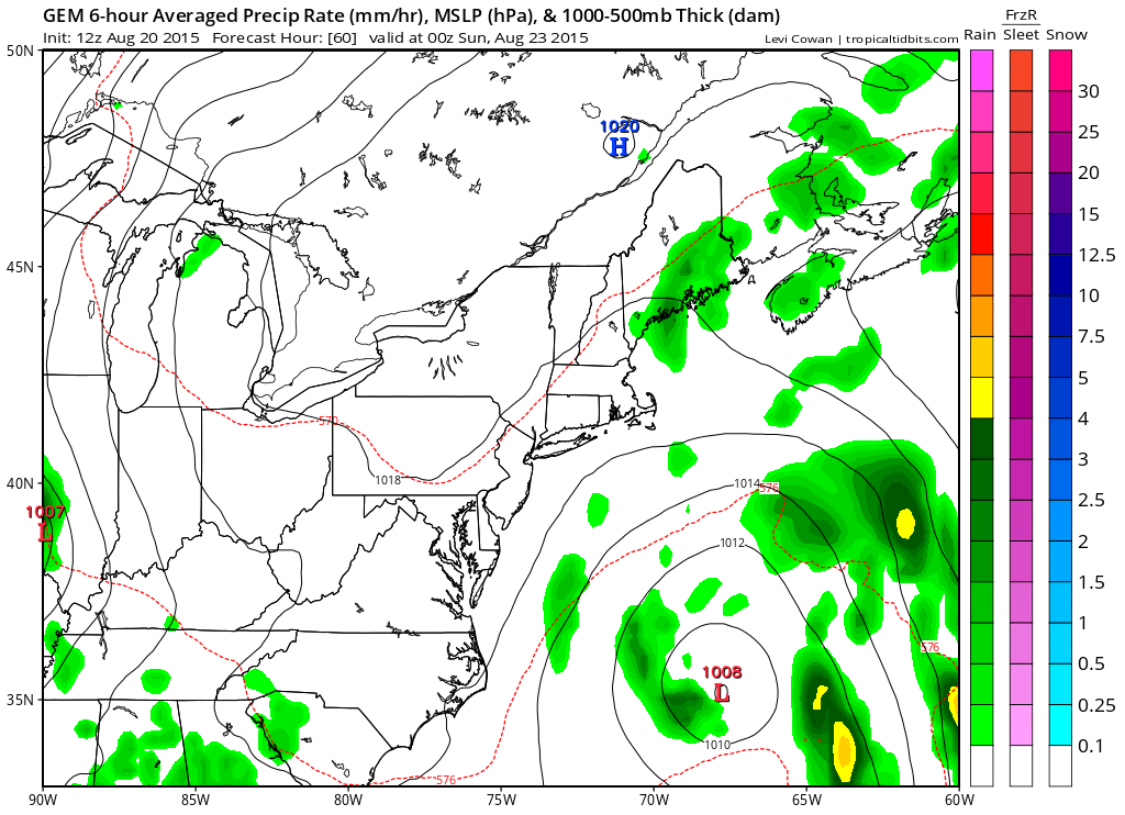
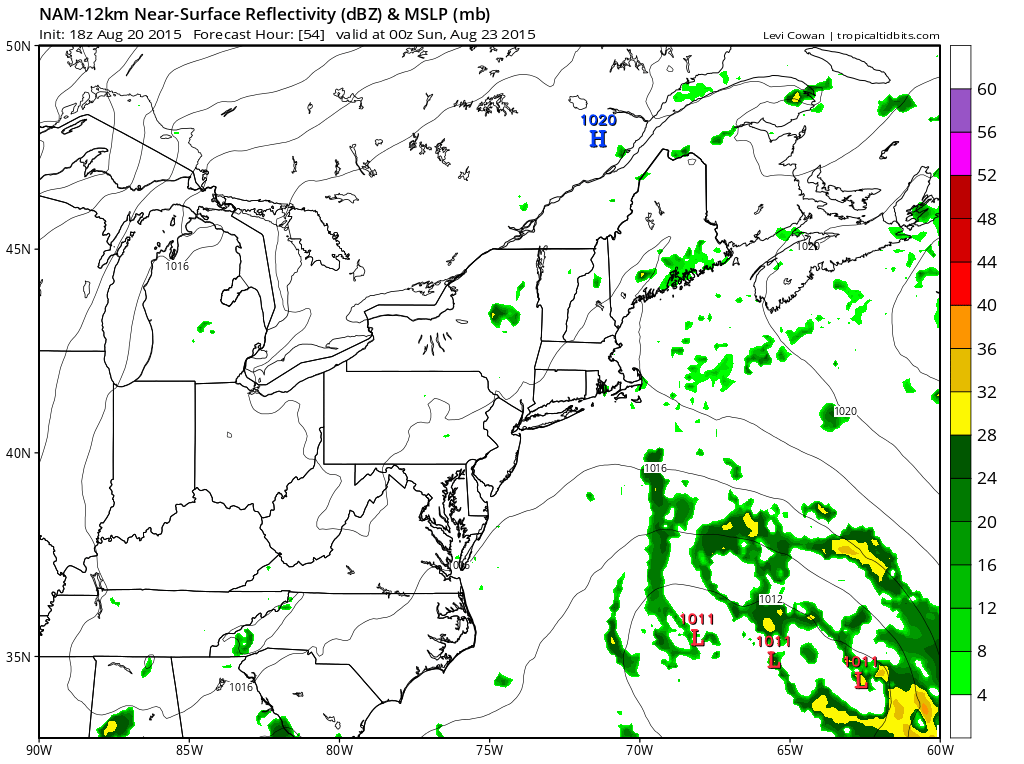
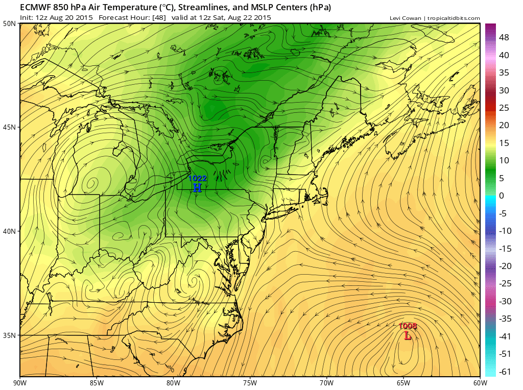
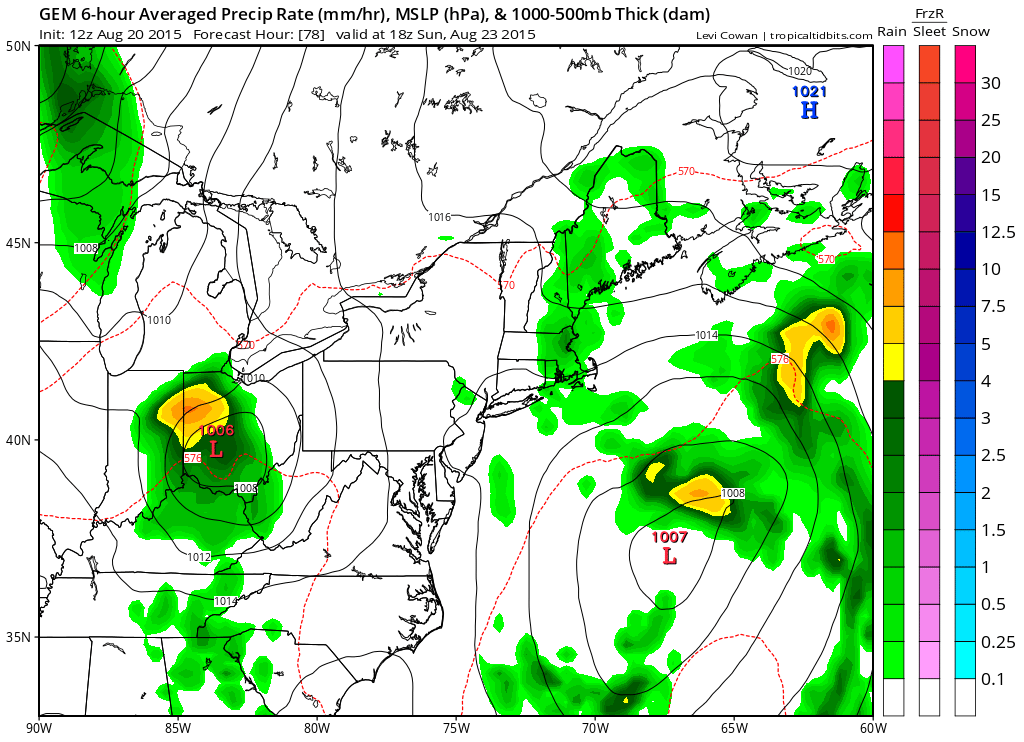
We have been talking about an upper low off the east coast of the United States that has been sitting there for the last several days and this afternoon’s model runs were all very interesting in that they all develop some sort of surface low off the east coast over the weekend. Above is the Canadian model for Saturday evening. Other models below have a similar idea with the surface low offshore and strands of convection scattered all around the surface system. The European is for Saturday morning since there is no map publicly available for the matching time frame but it has the same scheme.
What does this all mean? Well when it comes to cold core to warm core transitions the models are usually slow on the uptake but the fact that they all have something off the east coast warrants attention in my view. Satellite pictures and the loop show the system with convection that developed during the day. Usually what happens with these systems is that the thunderstorms fire up during the day in the cold core environment and then wind down and disappear at night only to fire up again during the day. When the transition is taking place the thunderstorms do not disappear at night so we will be watching tomorrow morning to see what exactly we have. To see the loop click on the picture below.