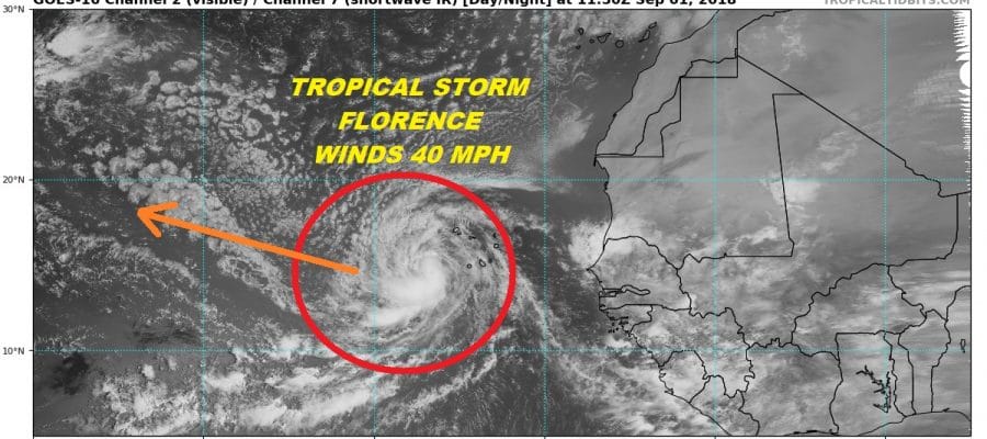
TROPICAL STORM FLORENCE 40 MPH WINDS
FORECAST TO MOVE WEST OR WEST NORTHWEST NEXT SEVERAL DAYS OR MORE
NO THREAT TO LAND AREAS IN THE SHORT RANGE
Overnight & morning satellite loops show that Tropical Depression 6 has now organized enough to be classified as Tropical Storm Florence. The Cabo Verde Islands were getting lashed by some of the rain bands but this should diminish as the storm tracks a way from the islands and begins a long journey to the west or west northwest for the next week or longer.
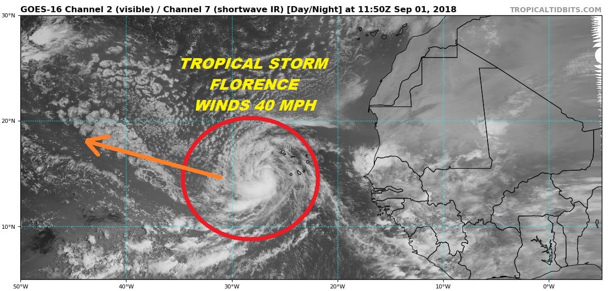
Florence does have a large circulation compared to some of the other storms we have seen so far this season. The future course here appears to be west or west northwest for at least the next several days. Overnight models have also trended away from earlier forecasts of the storm turning northward in the Central Atlantic. Models continue to react to changes in the upper flow across the North Atlantic as well as the east west ridging that exists from African westward to the Southeastern US.
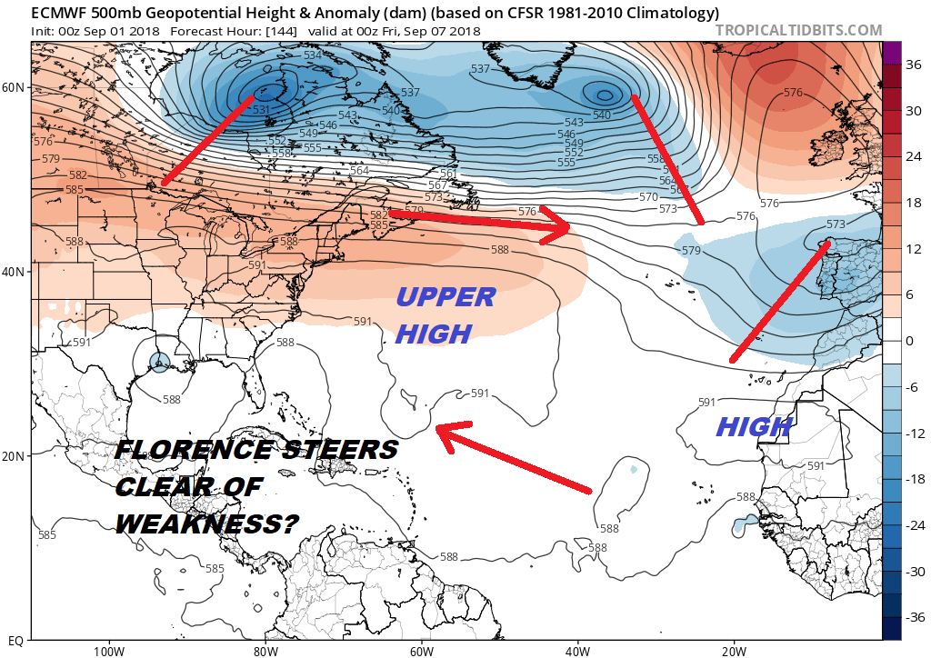
The European model is the most bullish of all the models regarding this and even the GFS seems to be sniffing out the stronger though flat east west ridge and the weakness in the Central Atlantic being much less pronounced then previously modeled. The steering flow across the Atlantic doesn’t appear to be particularly fast so Tropical Storm Florence may take awhile to journey across. As far as strengthening is concerned Florence will have to wait until it gets west of 40 degrees west to find warmer water and the upper air conditions aren’t exactly ideal for strengthening going forward. That said we should see some increase in strength over the next several days.
WIDE ATLANTIC TROPICAL SATELLITE

WESTERN ATLANTIC TROPICAL SATELLITE

Meanwhile a tropical wave is moving westward across the Dominican Republic and Cuba today and Sunday and will make its way into the Eastern Gulf of Mexico come Monday. Upper level winds remain hostile for development at the moment and you can tell that by the disorganized nature of the system as convection comes and goes and cloud tops get blown off to the northeast. However once it gets into the Eastern Gulf where pressures are low, we could see some development. Heavy rains are likely to spread across Central and Southern Florida Sunday and Monday regardless of whether the system develops or not. Overnight the European model went back to its bullish ways and actually develops this system early next week and moves it across the Gulf of Mexico. Since upper air conditions are going to be more conducive in the Gulf of Mexico we can’t rule out the possibility of something coming out of this.
THANKS TO TROPICAL TIDBITS FOR THE USE OF MAPS
Please consult your local National Weather Service office at weather.gov for the latest information on any tropical or storms or hurricanes that could be a threat to your area. Consult your local government officials regarding action you may need to take to secure life and property
FiOS1 News Weather Forecast For Long Island
FiOS1 News Weather Forecast For New Jersey
FiOS1 News Weather Forecast For Hudson Valley