
Tropical Storm Eta Inland In North Florida On & Off Rain Continues Northeast Today

Weather in 5/Joe & Joe Weather Show Latest Podcast
Tropical Storm Eta Inland In North Florida On & Off Rain Continues Northeast Today
Weakening Tropical Storm Eta is now inland as the storm made landfall near Cedar Key, north of Tampa along what is known as the Florida big bend. The storm never really looked particularly impressive. Even yesterday as it briefly became a hurricane for a few hours, the satellite presentation was lackluster. Cooler Gulf of Mexico waters this time of year effectively take their toll on storms and we have an approaching cold front to the northwest creating increasing wind shear conditions. What is left is a tropical storm with some heavy rains and gusty winds and a storm that is manageable for the most part.
SATELLITE

REGIONAL RADAR

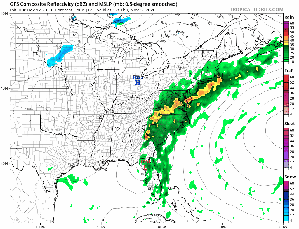
The broad circulation is inland. The radar echos imply a sheared look to the storm with most of the rain now to the east of the center and very little going on to the west. Bands of heavy rain continue today as the center of circulation moves across the state. Jacksonville and Melbourne radars are now the most active in the state.
LOCAL RADAR JACKSONVILLE FL

LOCAL RADAR KEY WEST FL


The forecast track for Eta is to move off the Northeast coast of Florida and continue to move northeastward along the boundary of a cold front now bringing rain to the Northeast and Middle Atlantic states. The track of Eta away from the US will cause it to merge with the frontal boundary and dragging the moisture offshore.
LOCAL RADAR KEY WEST FL


Our weather here is rather dreary. Clouds cover much of the Northeast and Mid Atlantic states and we have seen rain overnight that was on the heavy side in many areas. Not much is forecast to change today other than the front will be passing to the east and that should allow a wind shift to the northeast. Temperatures will eventually settle in the 50s later today.
SATELLITE

REGIONAL RADAR

Regional and local radars are showing the northern fringe of the rain has pushed south so there really isn’t much happening north of NYC and Long Island. The rain area continues to slowly slide to the east.

–

As far as today is concerned, we will be on the edge of the rain for much of the day. At times we will see it push northward and then at other times it shifts southward. In the end the trend will be for more dry time that wet time today. The further south you go from say Philadelphia to NYC line, it may be more wet than dry.
We are going to have more work to do on Friday with lots of leftover clouds around. Temperatures will be mostly in the 50s. There could be a few showers running around midday into the afternoon as one last upper air disturbance goes by. Tropical Storm Eta passes well offshore as a post tropical cyclone and then we are on our way to a decent weekend.
High pressure builds in for Saturday which will be a nice but chilly day. Most highs will be just into the 50s though we should have a fair amount of sunshine. Sunday look for sun and arriving clouds as a strong cold front approaches. Highs will be in the 50s. There is a change in the upper air pattern going on this weekend and into next week that will lead to colder windy conditions for Monday into early Wednesday.
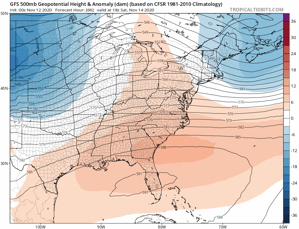
The strong upper ridge along the East Coast that gave us the record breaking weather for 6 days is breaking down allowing a strengthening upper trough to drop into the East late this weekend and it actually holds on for the first part of next week. A cold front comes through Sunday night with some showers ahead of it. Behind it we will see breezy to windy conditions develop Monday into Wednesday as the gradient tightens between a strengthening storm in Eastern Canada and high pressure to the west. Temperatures Monday will be in the leftover 50s however Tuesday and Wednesday will be rather cold with highs everywhere not getting out of the 40s. Temperatures will actually run below average for the first half of next week.
BE SURE TO DOWNLOAD THE FREE METEOROLOGIST JOE CIOFFI WEATHER APP &
ANGRY BEN’S FREE WEATHER APP “THE ANGRY WEATHERMAN!
MANY THANKS TO TROPICAL TIDBITS FOR THE USE OF MAPS
Please note that with regards to any severe weather, tropical storms, or hurricanes, should a storm be threatening, please consult your local National Weather Service office or your local government officials about what action you should be taking to protect life and property.


