
Poorly organized and still getting hit with tons of shear it is a wonder that Erika can still be a closed off system but it is managing to hold on.

Two loops for your viewing pleasure with the enhanced loop above and the water vapor image below

You can see how the cloud tops are being blow off. Also and this is very important. The weakened state has allowed this to take a track further south much like Danny did last week. Storms in weakened states respond more to low level easteries then the high level forces that would give it a more northward component if this were a deeper more vertical system. You have to wonder whether the track is going to wind up being south of most models since they are continuing to make the mistake of intensifying this system, when in fact it is doing nothing of the sort.
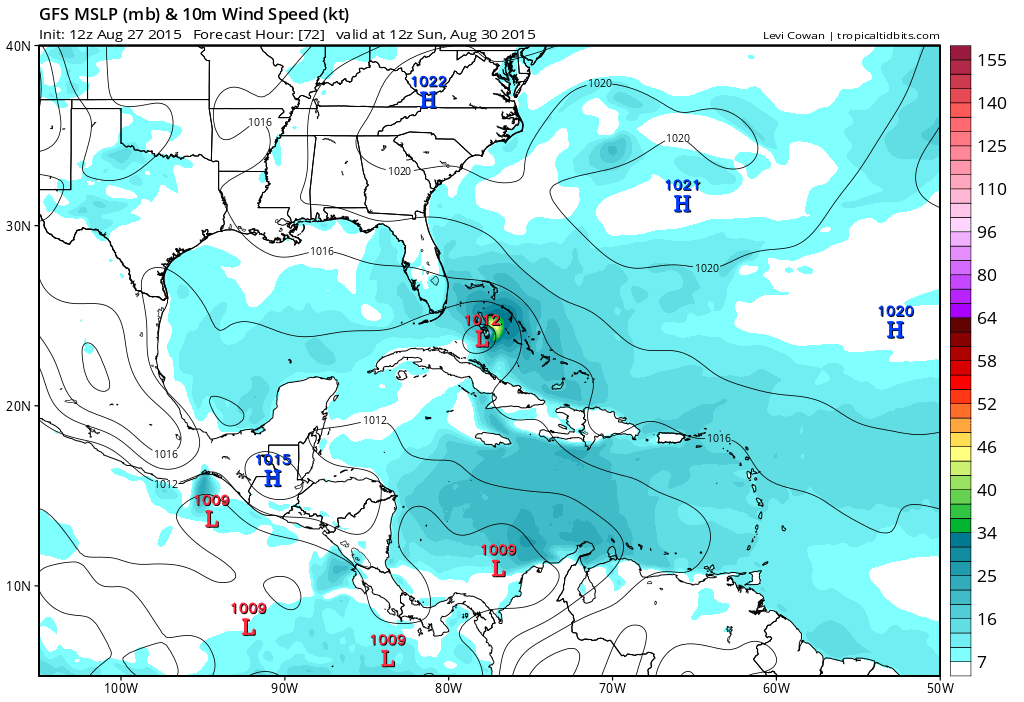
This is the GFS position and strength for Sunday morning 8am as the tropical storm is in the Bahamas. The other models continue to show more robust systems at this point but how are we going to believe this after what we have seen so far?
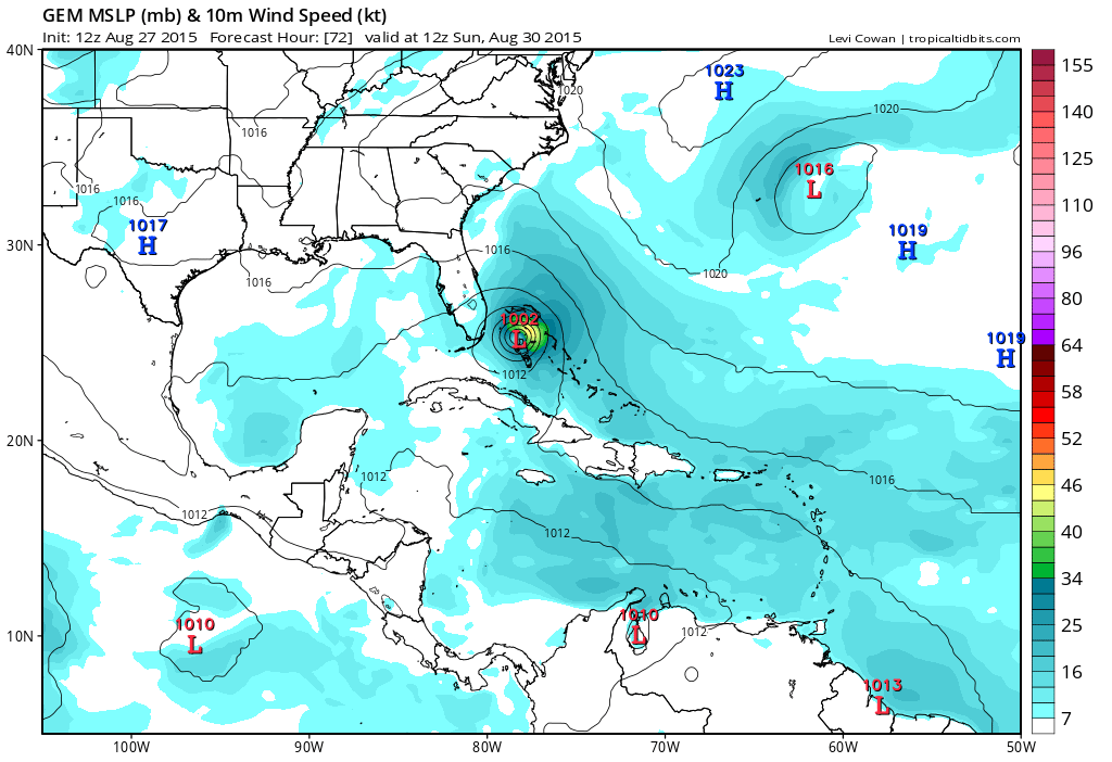 Canadian 72 hour has a much more developed tropical storm over the Bahamas and getting close to south Florida. From positioning they aren’t that far off. Strength is the issue here. Conditions should be favorable for develoment west of 70 west but as I have been saying for days it needs to get there first. Meanwhile the longer range solutions for this are all over the place and border on silliness as far as a practical forecast is concerned. The threat area for now the Florida coast northward to the Carolinas and I don’t see any reason to change that idea at this point. However if Erika does not make its move to the northwest soon, then we have to consider whether the threat will be in the southern part of that area (Florida) vs the areas more to the north. Complicating all of this is the ridge to the north and whether Erika will respond to any weakness in that ridge.
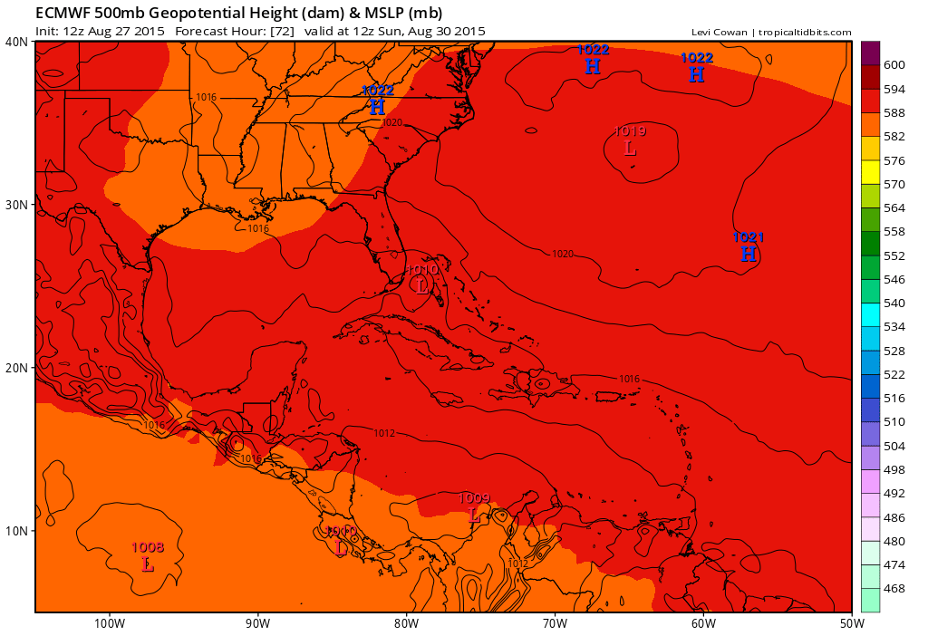
Take a good luck at the 96 hour European upper air map below and the ridge in the Atlantic is strong. If Erika remains weak (and I’m beginning to lean in this direction) then you will see it track even further west as per the European which brings a weak tropical storm into the Florida Keys and and then up the west coast of Florida as a weak system.

Im not going to discount any possibility here because the main variable is strength which will dictate how much northward component of motion Erika has. If it tracks south of Puerto Rico then it needs to reform north of the Dominican Republic (in an hostile environment) and then track from there. Models have continually over developed and over strengthened this and I just can’t have confidence that this will happen given what we have seen so far. Long range models amount to all sorts of fantasy/wishcasting by weather weenies in every direction. Responsible forecasting is what I aim for here. The situation remains puzzling through 72 hours and mind numbing beyond that. The one thing we can conclude for our area (Middle Atlantic States northward to Southern New England) is that nothing is going to happen here into early next week. The weather will continue on a quiet summery path that it has been on. Still not a threat to the northeast at this time.