SUMMARY OF WATCHES AND WARNINGS IN EFFECT:

A Tropical Storm Watch is in effect for...
* Montserrat
* Antigua
* Barbuda
* St. Kitts and Nevis
* Anguilla
* Saba
* St. Eustatius
* St. Maarten
SUMMARY OF 1100 AM AST...1500 UTC...INFORMATION
-----------------------------------------------
LOCATION...15.2N 51.0W
ABOUT 730 MI...1170 KM E OF THE LEEWARD ISLANDS
MAXIMUM SUSTAINED WINDS...45 MPH...75 KM/H
PRESENT MOVEMENT...W OR 280 DEGREES AT 20 MPH...31 KM/H
MINIMUM CENTRAL PRESSURE...1003 MB...29.62 INCHES
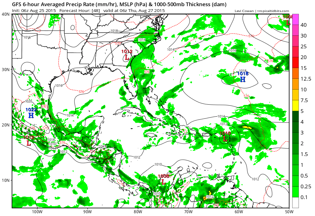
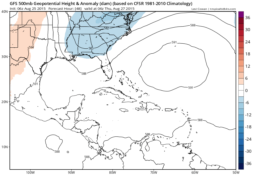
The satellite loop this morning shows a poorly organized tropical storm at this point with one main cluster of convection in the northern semi-circle. There are a few things going on with Erika that make it a little different from Danny in terms of the environment for strengthening. The North Atlantic at this point still remains dominated by strong upper lows which create shearing environments for tropical storms to over come. Erika has bypassed the first one and seems to be in a favorable place for the time being. There is another upper low over the Domincan Republic which is creating shear there and you can see evidence of that with the remnant low of Danny producing thunderstorms over Puerto Rico that are moving west and the tops gettting blown off to the northeast. Eirka does seem to have a broader larger circulation and this may aid in helping it overcome shearing as long as it (the shrearing is not too strong). Motion appears to be west for the time being at a quick pace and that is likely to continue for awhile longer.
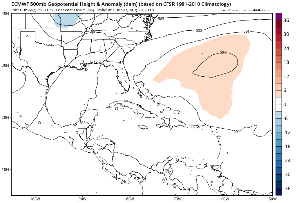
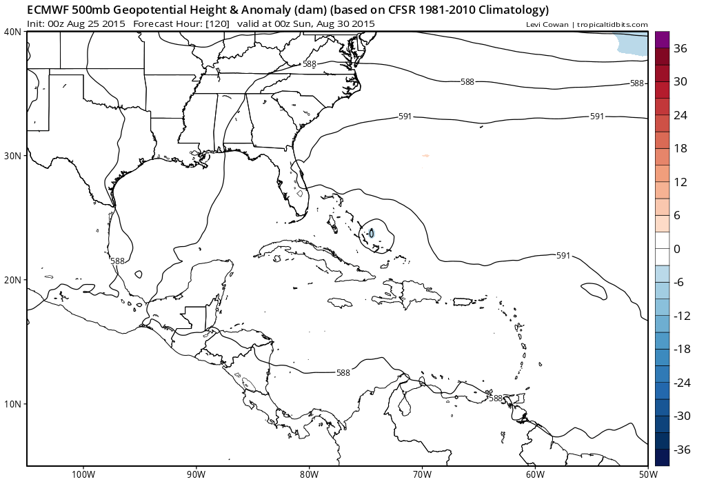
With regards to the future, remember this is an el-nino year and if storms can find a way to fall apart, they probably will. Models seem to want to take Erika north of the islands down the road and then vary on whether that continues or does it responding to troughing in the east and make a hard right turn. At this point it seems to me that it needs to get to at least 60 or 65 west longitude before we consider the future of this for later in the weekend and early next week.