
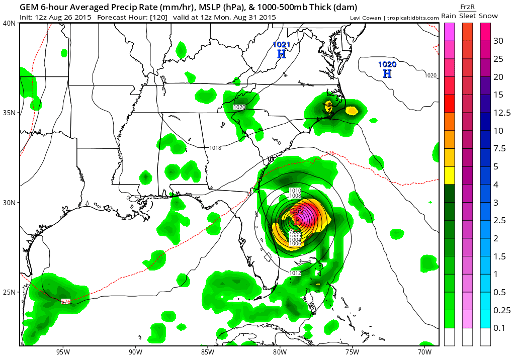
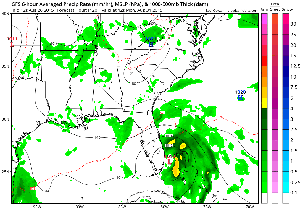
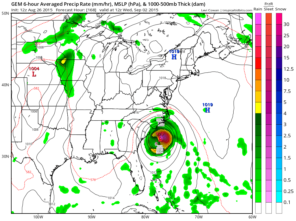
This afternoon we are going to take a look at what the global models are telling us with regards to Tropical Storm Erika to see what they have and where the tropical storm winds up by 8am Monday morning August 31. Starting off with the Canadian model which is most aggressive with development and it shows what would be a category 1 hurricane or strong tropical storm sitting off the central Florida coast. Surface highs are draped around it. We of course are just continuing a rain free warm pattern here which is an extension of what we will have this weekend
The GFS has a much weaker system further south, either a minimal tropical storm or a depression approaching south Florida. In terms of determining intensity this is of course the toughest part of the forecast. We have been indicating for days that the semi-hostile environment Erika is in now is going to be a determining factor as to what we will be dealing with down the road. Strong shearing exists between where it is now to at least 65 west and possibly even to 70 west. If that shear enviornment is still there when the storm moves through, at the very least it would prevent if from strengthening.
 Now let us look at what the 2 models indicate aloft as the driving forces. Both models have similar 500 structures in that they have westerlies from us northward. This keeps us protected for awhile at least. Both models show weakness in the ridge off the east coast which opens a alley way for the storm to track.
 The Canadian model as well as the gfs affords several possibilities and the Canadian is drawn above. You have a strong ridge to the northwest of the storm..weakness along the coast..troughing to the northeast. Now this is for a given moment in time. How the ridge in the east changes over the next 48 hours will be important. The Canadian as would the gfs show that northwest flow in the northeast relaxing and lifting northward as a ridge builds overhead. This would favor a northward component of motion especially if the system is more intense. The GFS on the other hand keeps it week and this causes the system to respond to the ridging to the northwest and pushes the track into Flordia and then dragging it slowly northward.
 Now lets look at the numerous hurricane model plots from this morning and what they tell us if anything.
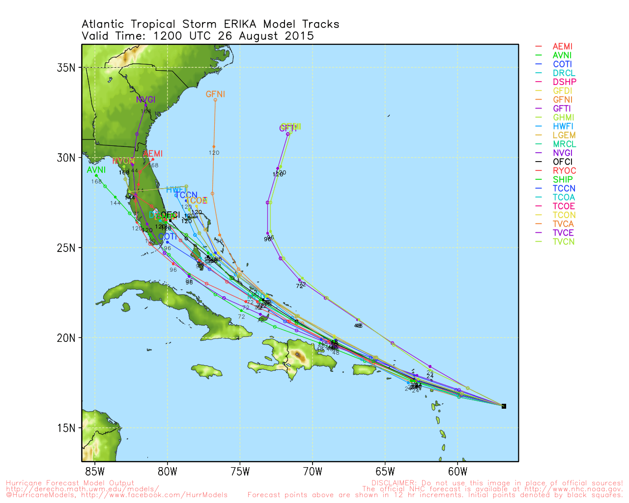 Toss out the 2 outliers that are furthest east for now and you can see the main cluster of models takes the storm through the Bahamas and toward Southern Florida by the Sunday Monday timeframe. What they don’t tell us is intensity. This will be key here and the toughest part of this forecast in determining what exactly will we be dealing with when the system approaches the coastline. Models continue to insist on strengthening west of 70 west but as we have said repeatedly it has to survive the shearing environment that exists until it gets there.
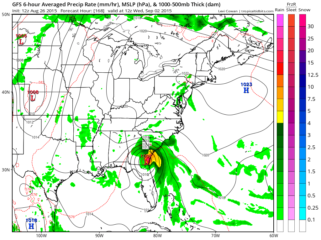
 This is the Canadian model a week from today with a hurricane off the South Carolina coast. Is this possible? Sure is. Is it likely? Right now the variables and unknowns are just too large to grasp. And we haven’t even touched on the European yet which will be out shortly. So here are my conclusions on this so far. The threat period will be late in the weekend. A weaker Erika means a track further west and south as per the gfs. The threat area would be from Southern Florida to the South Carolina coast. With regards to us we will be protected from this with the ridge to the north. With the absence of a deep trough to the west it will be difficult to bring a hurricane up the coast for a direct hit. The focus of attention right now is the southeast and Florida, assuming Erika survives the next 48 hours as it tracks west northwestward and past 65 degrees west.