Tropical Storm Development Probable Off Southeast US Coast
Satellite pictures and loops this afternoon show that the system that passed north or Puerto Rico and now is east of the Bahamas continues to become much better organized. There is a distinct curvature developing and while a low level circulation isn’t there yet, conditions are favorable for this system to develop into at least a tropical depression. The National Hurricane Center has an 80 percent chance of tropical storm formation over the next few days. The next tropical storm name is Kate.
Now with regards to any impact the the US east coast, the only possibility is if the system does not truly develop and all the tropical mositure winds up getting absorbed by low pressure that will be moving up the coast and bringing rain here Tuesday. If that moisture were to somehow get involved it could mean for more robust rains but this appears to be a long shot and it is more likely that the tropical moisture stays offshore. The other scenario is that it develops as a separate entity and then it turns north and northeast out to sea. The upper air flow along the east coast is not favorable for a coastal track.
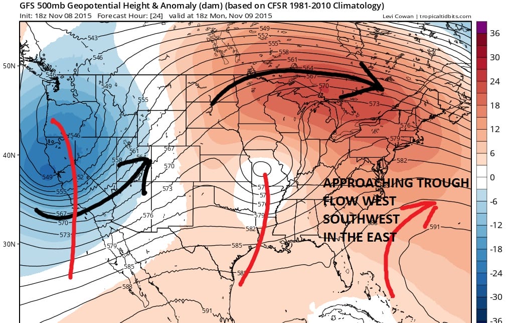
The approaching upper air disturbance over Missouri is forecast to move east and slowly weaken as it then lifts northeast. The effect of this is for the flow across the east coast to become more west southwest aloft which would carry any tropical system out to sea. The wins across Canada are westerly which does not allow for the type of trough you would need to bring any tropical system up the coast.