Tropical Depression Forms Southeast North Carolina Coast
Tropical Depression Forms Southeast North Carolina Coast
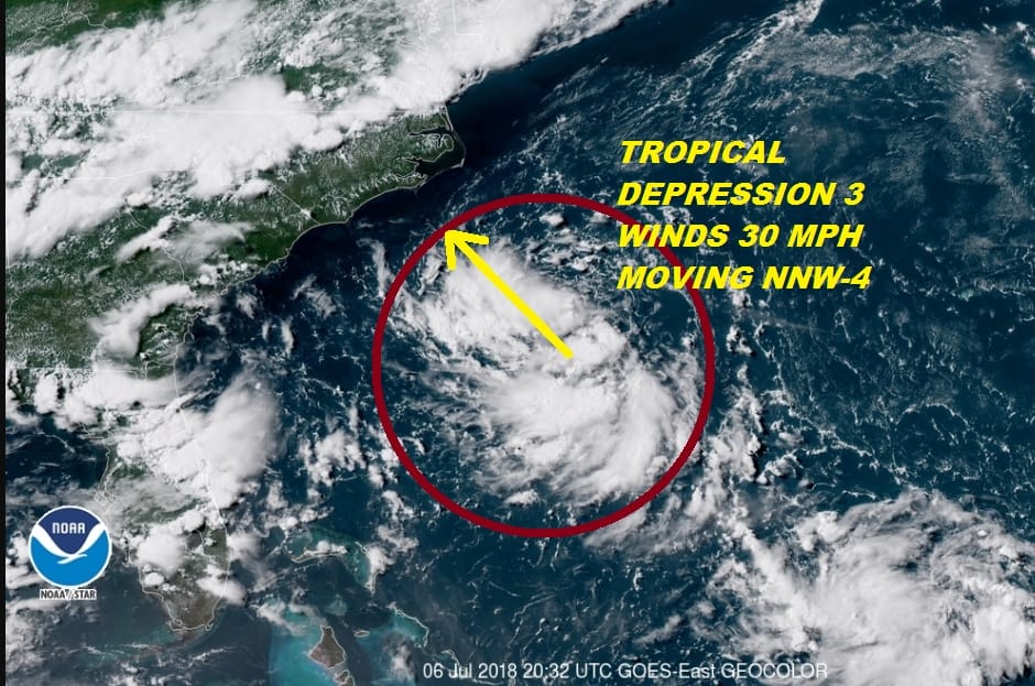
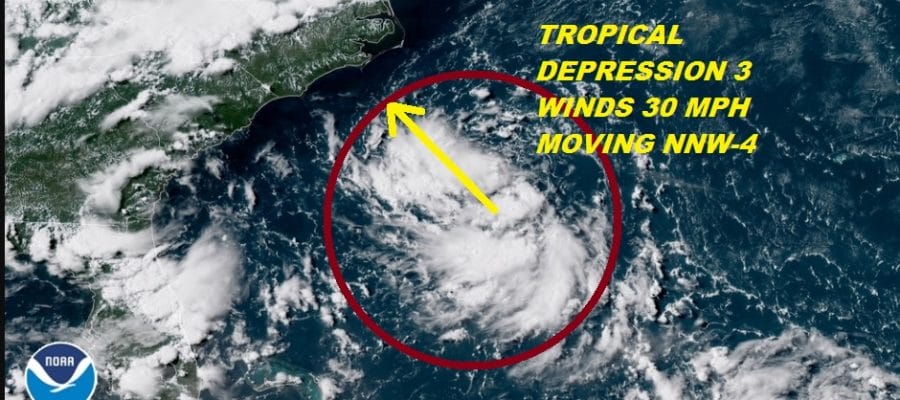
It was evident this afternoon that something was happening with the low pressure area off the Southeast US Coast. Satellite loops showed thunderstorms developing in and around the low level circulation. There is enough of a concentration of thunderstorms around the circulation center to designate this tropical depression 3 and the National Hurricane Center has done just that. You can see on the satellite loop below a distinct low level circulation and the blow up of thunderstorms that occurred during today.
WESTERN ATLANTIC TROPICAL SATELLITE

...TROPICAL DEPRESSION FORMS WELL OFF THE NORTH CAROLINA COAST...
...EXPECTED TO REMAIN OFFSHORE...


SUMMARY OF 500 PM EDT...2100 UTC...INFORMATION
----------------------------------------------
LOCATION...32.2N 73.8W
ABOUT 230 MI...370 KM SSE OF CAPE HATTERAS NORTH CAROLINA
MAXIMUM SUSTAINED WINDS...30 MPH...45 KM/H
PRESENT MOVEMENT...NNW OR 335 DEGREES AT 5 MPH...7 KM/H
MINIMUM CENTRAL PRESSURE...1016 MB...30.01 INCHES


WATCHES AND WARNINGS
--------------------
There are no coastal watches or warnings in effect.

Interests along the coast of North Carolina should monitor the
progress of this system.


DISCUSSION AND OUTLOOK
----------------------
At 500 PM EDT (2100 UTC), the center of newly formed Tropical
Depression Three was located near latitude 32.2 North, longitude
73.8 West. The depression is moving toward the north-northwest near
5 mph (7 km/h).  The depression should slow down and meander of well
offshore of the coast of North Carolina through Monday.

Maximum sustained winds are near 30 mph (45 km/h) with higher gusts.
The depression is forecast to become a tropical storm on Saturday,
with gradual strengthening expected through Monday.  A
reconnaissance plane is scheduled to investigate the cyclone on
Saturday.

The estimated minimum central pressure is 1016 mb (30.01 inches).


HAZARDS AFFECTING LAND
----------------------
None
This depression is likely to strengthen to a tropical storm over the next few days and eventually could reach hurricane status. As far as its future is concerned, it is likely to meander off the Southeast Coast at least into Monday as steering currents will disappear and it gets trapped south of the cold front that is passing through us now.
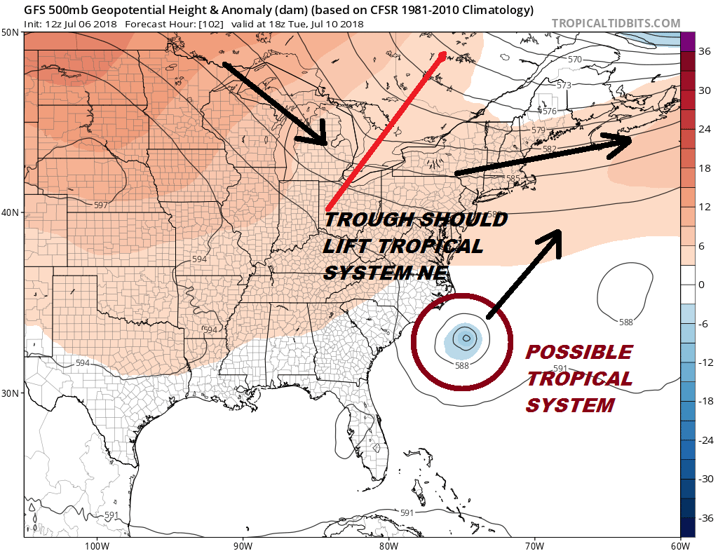
The upper flow would suggest that the next trough and associated cold front that arrives here on Tuesday will pick up this system and kick it along to the northeast. As long as that trough is deep enough to extend the jet stream south to about 35 degrees north, then there are no worries from this other than for marine interests next week.
FiOS1 News Weather Forecast For Long Island
FiOS1 News Weather Forecast For New Jersey
FiOS1 News Weather Forecast For Hudson Valley