
Tropical Cyclone Formation Not Likely

Tropical Cyclone Formation Not Likely
As we take a look a the various satellite loops this morning we can see that there isn’t too much happening at the moment from the standpoint of the tropics. There isn’t much activity at all in the Gulf of Mexico other than some showers over Western Cuba and Florida.
Tropical Cyclone Formation Not Likely Gulf of Mexico Satellite Loop

The wider Western Atlantic view however does show disturbed weather over the Western Caribbean as a weak are of low pressure migrates to the west northwest. Much of the activity is over land and it will not be able to develop until it emerges into the Southwest Gulf of Mexico during the weekend.
Tropical Cyclone Formation Not Likely Western Atlantic Satellite Loop

The Tropical Atlantic is quiet and almost cloud free which is not unusual for this time of year. Waves coming across are weak and this area usually doesn’t get going until late July or August in most years.
Tropical Cyclone Formation Not Likely Tropical Atlantic Satellite Loop

With regards to development of the low in the Southwest Gulf of Mexico, models overnight were not very bullish on this. While pressures are low the proximity to land lessens the chance for development.
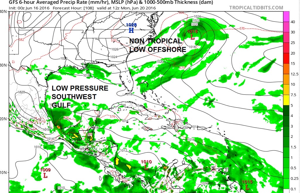
With regards to low pressure in the Atlantic, some have suggested that this could become a tropical storm. Given the time of year and the upper air structure, this low is a frontal wave and non tropical in nature in my view. This is strictly a cold core system and it would have to sit out there for days in order to become anything tropical. That is very unlikely.
JOESTRADAMUS HURRICANE SEASON GUEST FORECAST
FiOS1 News Weather Forecast For Long Island
FiOS1 News Weather Forecast For New Jersey
FiOS1 News Weather Forecast For Hudson Valley
NATIONAL WEATHER SERVICE SNOW FORECASTS
LATEST JOESTRADAMUS ON THE LONG RANGE
Weather App

Don’t be without Meteorologist Joe Cioffi’s weather app. It is really a meteorologist app because you get my forecasts and my analysis and not some automated computer generated forecast based on the GFS model. This is why your app forecast changes every 6 hours. It is model driven with no human input at all. It gives you an icon, a temperature and no insight whatsoever.
It is a complete weather app to suit your forecast needs. All the weather information you need is right on your phone. Android or I-phone, use it to keep track of all the latest weather information and forecasts. This weather app is also free of advertising so you don’t have to worry about security issues with your device. An accurate forecast and no worries that your device is being compromised.
Use it in conjunction with my website and my facebook and twitter and you have complete weather coverage of all the latest weather and the long range outlook. The website has been redone and upgraded. Its easy to use and everything is archived so you can see how well Joe does or doesn’t do when it comes to forecasts and outlooks.
Just click on the google play button or the apple store button on the sidebar for my app which is on My Weather Concierge. Download the app for free. Subscribe to my forecasts on an ad free environment for just 99 cents a month.
Get my forecasts in the palm of your hand for less than the cost of a cup of Joe!
![]()
![]()

MENTION JOE CIOFFI AND GET A 5% DISCOUNT