
Thunderstorms Snow Wind Latest Snow Maps

STRONG THUNDERSTORMS ARRIVING
Satellite and radar loops are continuing to show the powerful upper air disturbance that is now swinging into the northeast. Radar is showing a strong line of developing thunderstorms moving across New Jersey and heading into New York City, the Hudson Valley and Long Island. Thunderstorms have been producing strong wind gusts and there have been reports of hail as well. It is quite possible that some individual cells could be severe in nature when they move through.

Thunderstorms Snow Wind Latest Snow Maps LATEST RADAR LOOPS


The latest short range models are continuing to show a strong comma head signature that will develop overnight and move across the area between 3am and 7am. Those inside the comma head will experience bursts of heavy snow which when combined with winds of 50 mph, will produce some rather dangerous travel conditions so do exercise care when driving overnight.
Thunderstorms Snow Wind Latest Snow Maps HRRR RADAR 5AM
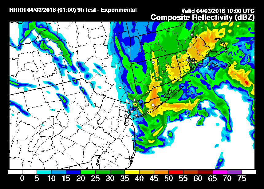
The HRRR model simulated radar for 5am shows the comma head over Long Island and Connecticut. It will be moving rapidly eastward which will limit any snowfall from this. The HRRR model as well as the RAP model are showing some areas getting 1 to 2 inches of total snowfall
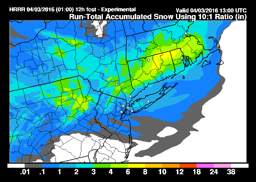
Thunderstorms Snow Wind Latest Snow Maps HRRR SNOWFALL FORECAST
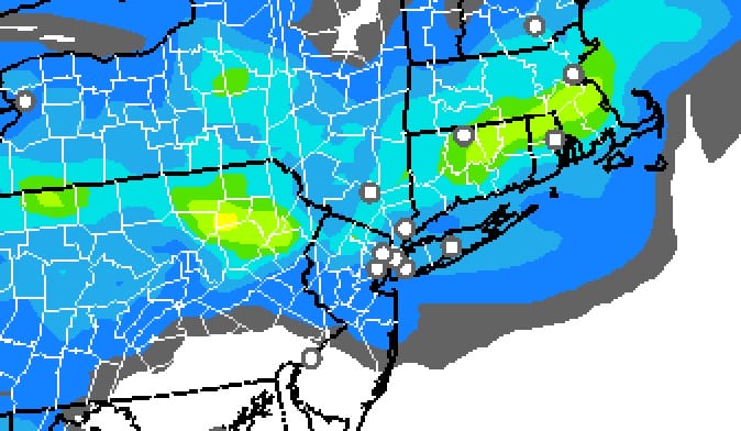
RAP MODEL SNOWFALL FORECAST
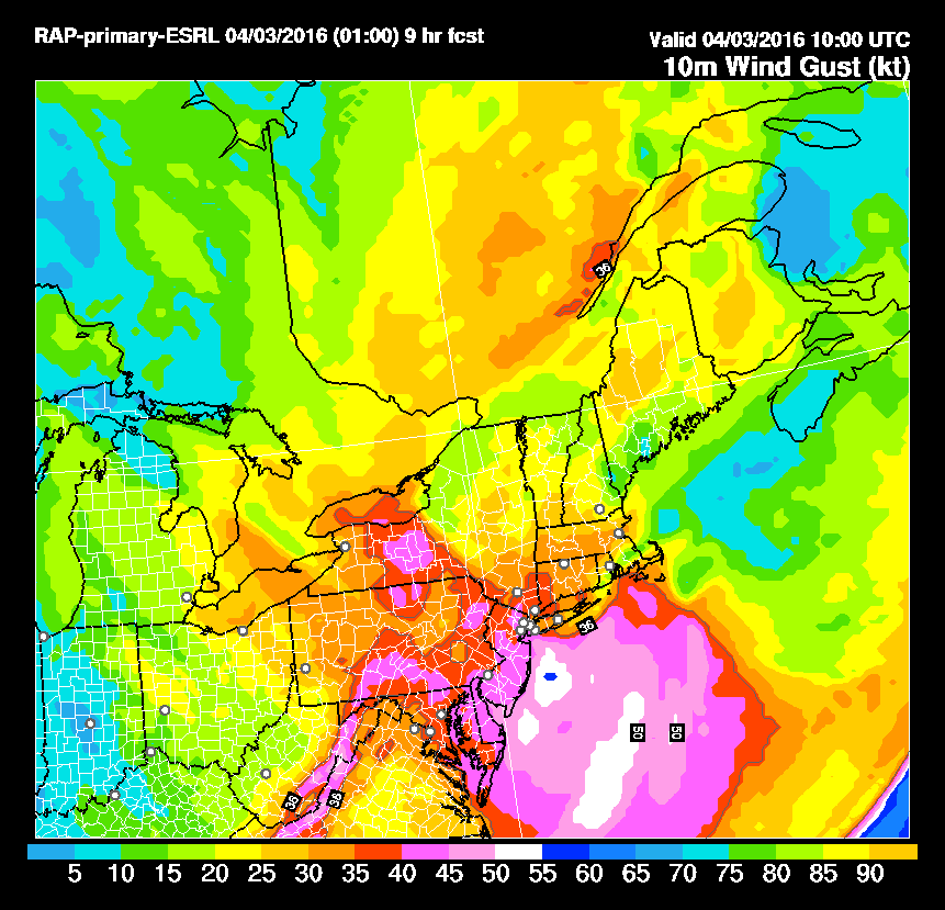
RAP model wind gust forecasts for Sunday morning at 5am show a large area of New Jersey experiencing wind gusts to 45 knots or over 50 mph. Those wind gusts will be commonplace throughout the area.
Thunderstorms Snow Wind Latest Snow Maps RAP MODEL WIND FORECAST 5AM
FiOS1 News Weather Forecast For Long Island
FiOS1 News Weather Forecast For New Jersey
FiOS1 News Weather Forecast For Hudson Valley
NATIONAL WEATHER SERVICE SNOW FORECASTS
LATEST JOESTRADAMUS ON THE LONG RANGE
Weather App

Don’t be without Meteorologist Joe Cioffi’s weather app. It is really a meteorologist app because you get my forecasts and my analysis and not some automated computer generated forecast based on the GFS model. This is why your app forecast changes every 6 hours. It is model driven with no human input at all. It gives you an icon, a temperature and no insight whatsoever.
It is a complete weather app to suit your forecast needs. All the weather information you need is right on your phone. Android or I-phone, use it to keep track of all the latest weather information and forecasts. This weather app is also free of advertising so you don’t have to worry about security issues with your device. An accurate forecast and no worries that your device is being compromised.
Use it in conjunction with my website and my facebook and twitter and you have complete weather coverage of all the latest weather and the long range outlook. The website has been redone and upgraded. Its easy to use and everything is archived so you can see how well Joe does or doesn’t do when it comes to forecasts and outlooks.
Just click on the google play button or the apple store button on the sidebar for my app which is on My Weather Concierge. Download the app for free. Subscribe to my forecasts on an ad free environment for just 99 cents a month.
Get my forecasts in the palm of your hand for less than the cost of a cup of Joe!
![]()
![]()

MENTION JOE CIOFFI AND GET A 5% DISCOUNT


