Thunderstorms Possible Tonight
Thunderstorms Possible Tonight
Some Sunshine Wednesday Thursday
Downpours Friday

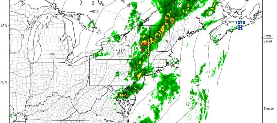
Overnight and morning rains that occurred over parts of the area are now offshore. Attention now shifts to the northwest as some thunderstorms are developing across Central Pennsylvania and upstate New York. The cold front is stalled overhead and these storms will swing eastward late this afternoon. There could another round of downpours and thunderstorms this evening and tonight.
Thunderstorms Possible Tonight Regional Radar

Thunderstorms Possible Tonight Local Radars


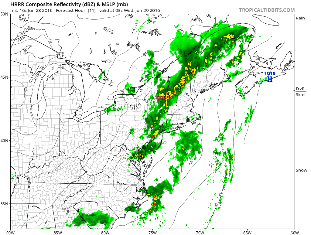
The HRRR model shows some of these storms around this evening between 7pm and 11pm. After this time frame the showers fall apart rather quickly and weather conditions improve overnight.
HRRR MODEL 11PM
Some Sunshine Wednesday Thursday
The cold front will kick out to the east over night which should set us up for a better day Wednesday with sunshine and clouds. Im leaving any mention of a shower or thunderstorm out of the forecast for Wednesday. Highs will be back in the 80s everywhere with only local sea breezes at the beaches. Thursday looks good with plenty of sunshine and highs in the 80s.
NAM MODEL FRIDAY AFTERNOON
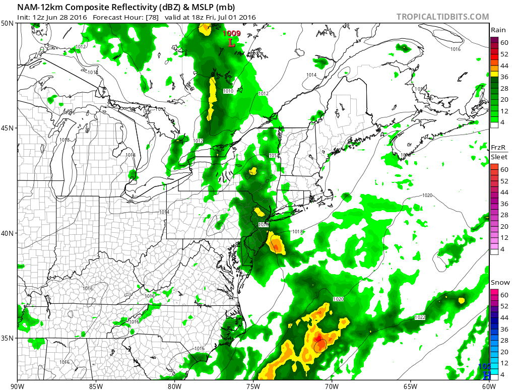
Friday brings the next cold front with the chance for showers and thunderstorms. The next cold front will get hung up temporarily Friday night into Saturday but right now models remain optimistic for Saturday and no issues for Sunday and Monday, the fourth of July.
FiOS1 News Weather Forecast For Long Island
FiOS1 News Weather Forecast For New Jersey
FiOS1 News Weather Forecast For Hudson Valley
NATIONAL WEATHER SERVICE SNOW FORECASTS
LATEST JOESTRADAMUS ON THE LONG RANGE
Weather App

Don’t be without Meteorologist Joe Cioffi’s weather app. It is really a meteorologist app because you get my forecasts and my analysis and not some automated computer generated forecast based on the GFS model. This is why your app forecast changes every 6 hours. It is model driven with no human input at all. It gives you an icon, a temperature and no insight whatsoever.
It is a complete weather app to suit your forecast needs. All the weather information you need is right on your phone. Android or I-phone, use it to keep track of all the latest weather information and forecasts. This weather app is also free of advertising so you don’t have to worry about security issues with your device. An accurate forecast and no worries that your device is being compromised.
Use it in conjunction with my website and my facebook and twitter and you have complete weather coverage of all the latest weather and the long range outlook. The website has been redone and upgraded. Its easy to use and everything is archived so you can see how well Joe does or doesn’t do when it comes to forecasts and outlooks.
Just click on the google play button or the apple store button on the sidebar for my app which is on My Weather Concierge. Download the app for free. Subscribe to my forecasts on an ad free environment for just 99 cents a month.
Get my forecasts in the palm of your hand for less than the cost of a cup of Joe!

MENTION JOE CIOFFI AND GET A 5% DISCOUNT


