Thunderstorms Moving East Cold Front Approaches
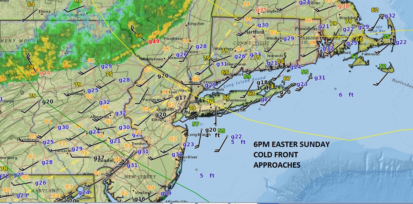
Thunderstorms Moving East Cold Front Nears
After reaching highs in the mid to upper 80s we have seen some scattered showers that developed late this afternoon and have now moved to the east. Now we wait as thunderstorms moving east are with the cold front that will be moving through tonight. This puts an end to the one day heat. Temperatures have already eased a bit off their highs especially along south facing shore areas where winds have gone either south or southwest. We don’t expect these storms to be severe.
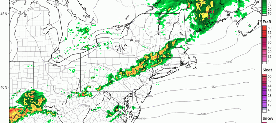
THUNDERSTORMS MOVING ON HRRR MODEL AND WEAKENING
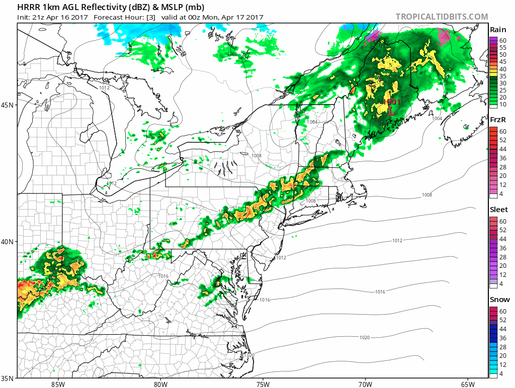
The latest HRRR model shows thunderstorms moving east but it shows the line weakening as it approaches the coast in a few hours. Once the front goes by winds will shift to the west and northwest and the cool down will begin. The satellite loop does not show much cloud cover behind the front so weather conditions should improve rather quickly overnight.
SATELLITE LOOP

REGIONAL RADAR

LOCAL RADAR NEW YORK CITY

LOCAL RADAR PHILADELPHIA


Monday and Tuesday should see a gradual return to more seasonal conditions though Monday will still be rather warm for this time of year with highs reaching the 70s. Tuesday should be cooler with highs in the low to mid 60s and the flow will gradually become more onshore later Tuesday into Wednesday as the next weather system begins its appraoch with some rain or showers later Wednesday or Wednesday night into Thursday.
 GET JOE A CIGAR IF YOU LIKE

LANDSCAPE COMPANIES FOR YOUR NEEDS
LONG ISLAND ROCKLAND COUNTY Connecticut

![]()

ROCKLAND COUNTY TRI STATE SNOW REMOVAL JOHNSTOWN PA


FiOS1 News Weather Forecast For Long Island
FiOS1 News Weather Forecast For New Jersey
FiOS1 News Weather Forecast For Hudson Valley
NATIONAL WEATHER SERVICE SNOW FORECASTS
LATEST JOESTRADAMUS ON THE LONG RANGE
Weather App

Don’t be without Meteorologist Joe Cioffi’s weather app. It is really a meteorologist app because you get my forecasts and my analysis and not some automated computer generated forecast based on the GFS model. This is why your app forecast changes every 6 hours. It is model driven with no human input at all. It gives you an icon, a temperature and no insight whatsoever.
It is a complete weather app to suit your forecast needs. All the weather information you need is right on your phone. Android or I-phone, use it to keep track of all the latest weather information and forecasts. This weather app is also free of advertising so you don’t have to worry about security issues with your device. An accurate forecast and no worries that your device is being compromised.
Use it in conjunction with my website and my facebook and twitter and you have complete weather coverage of all the latest weather and the long range outlook. The website has been redone and upgraded. Its easy to use and everything is archived so you can see how well Joe does or doesn’t do when it comes to forecasts and outlooks.
Just click on the google play button or the apple store button on the sidebar for my app which is on My Weather Concierge. Download the app for free. Subscribe to my forecasts on an ad free environment for just 99 cents a month.
Get my forecasts in the palm of your hand for less than the cost of a cup of Joe!


