Thunderstorms Mostly South Move Offshore Tonight Beautiful Holiday Weekend Ahead
This evening marks the last day of rain for awhile around here. It may not rain again until late next week. Also we have to deal with some thunderstorms that are on the strong side. Some have been severe. The bulk of these are moving through Southern New Jersey, Southeastern Pennsylvania and Delaware. The northern fringe of the storms reaches up about half way up the state of New jersey.
SATELLITE
REGIONAL RADAR
The cold front is pushing through an area of thunderstorms and we can see them on the regional and local radars below. Again the strongest storms are further south as they cross Central and South Jersey.
LOCAL RADAR PHILADELPHIA

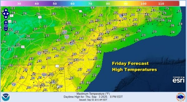
Once the storms are done it is on the Friday which is getaway day for the Labor Day holiday weekend. Weather conditions will improve tonight and while Friday day side will start off humid, humidity levels will drop Friday afternoon on a freshening northwest wind. We should see a good deal of sunshine. High temperatures will be up in the middle 80s.
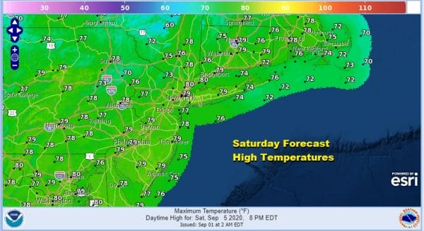
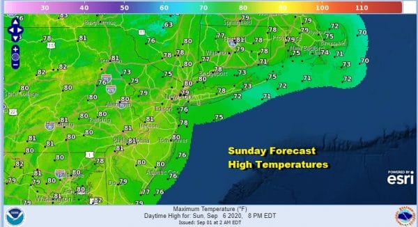
We will enjoy clear skies Friday night into Saturday morning and again Saturday night into Sunday morning with lows in the upper 50s to 60s except mid 60s in warmer urban centers. Saturday and Sunday will be two days with lots of sunshine, low humidity and highs both days in the 70s to near 80 degrees which is perfect early September weather.
We will be holding on to the dry air for Monday as well. Labor day will be mostly sunny with highs back into the 80s with reasonable humidity. No rain is forecast here until late Thursday or possibly not until Friday. In the meantime it will turn warmer and more humid Tuesday into Thursday with some sunshine each day and highs in the 80s.
BE SURE TO DOWNLOAD THE FREE METEOROLOGIST JOE CIOFFI WEATHER APP &
ANGRY BEN’S FREE WEATHER APP “THE ANGRY WEATHERMAN!
MANY THANKS TO TROPICAL TIDBITS FOR THE USE OF MAPS
Please note that with regards to any severe weather, tropical storms, or hurricanes, should a storm be threatening, please consult your local National Weather Service office or your local government officials about what action you should be taking to protect life and property.


