Thunderstorm Risks Into Wednesday,
Hurricane Lee Risks Rising for Eastern New England Late Week

Thunderstorm Risks Into Wednesday,
Hurricane Lee Risks Rising for Eastern New England Late Week
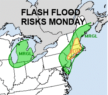
This is going to be a very interesting week of weather ahead. We continues to deal with a stalled front across Eastern Pennsylvania to Southern New England and we will be seeing downpours and thunderstorms around today though it is not going to be raining all the time nor is it going to be raining everywhere. The ground is saturated thanks to rain and thunderstorms in many areas for the last 4 days and this will be day 5. The Weather Prediction Center is indicating the risk for localized flash flooding in some heavier downpours.
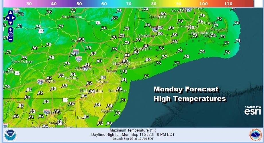
In the meantime it remains very warm and humid but at least the extreme heat of the 90s is gone. Highs this afternoon will be in the upper 70s and lower 80s. The satellte and radar showing moisture and downpours along with a few thunderstorms and this is likely to remina the case all day and into tonight. Lows tonight will likely be in the 60s to some lower 70s.
SATELLITE WITH LIGHTNING STRIKES

WEATHER RADAR

Tuesday we continue to see warm and humid conditions with the risk that there could be some downpours or a thunderstorm or two. However the risk is somewhat less Tuesday and thunderstorms and downpours are likely to be more scattered around. Highs Tuesday will be in the upper 70s to some lower 80s.

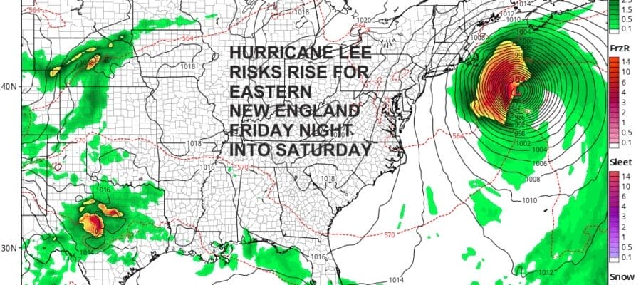
Wednesday we have a cold front approaching and on the lower right of the GFS you can clearly see Hurricane Lee making its way northwestward. This front will bring showers and thunderstorms along with the risk for severe weather later in the day into the evening with highs in the 70s. Then attention will turn to Hurricane Lee as it looks to move up the East Coast offshore Thuresday and Friday.

The cold front will stall just offshore and this creates a path for Hurricane Lee to travel along. The upper flow along the East Coast will turn sharply to the south offshore and this should bring Lee northward to the west of 70 west and then take a north northwest hook into Eastern New England Friday night into Saturday morning. If this track idea is correct by the overnight weather models, and they all line up rather closely, we will see rain possibly back westward to Eastern Connecticut and Eastern Long Island Friday night into Saturday morning but the main issue will be for strong winds and heavy rain from Southeastern Massachusetts north northeast along the coast to coastal New Hampshire and Maine. We haven’t completely locked into this idea but it is becoming the most likley solution when it comes to the path of Hurricane Lee. A landfalling hurricane has not occurred in New England since Hurricane Bob in 1990 so it has been 33 years. We will continue to monitor the developmens here with regards to Hurricane Lee in the coming days. Assuming that this is track is correct impacts to areas from Coastal New Jersey to Long Island will be minimal. A tracking hurricane to the east means a northerly wind and that is a wind that blows offshore. There won’t be any important tidal issues along the coast. Actually the upside could be some rather nice cool and super dry weather setting up for late this week and this coming weekend which is the last weekend of the summer season.
BE SURE TO DOWNLOAD THE FREE METEOROLOGIST JOE CIOFFI WEATHER APP &
ANGRY BEN’S FREE WEATHER APP “THE ANGRY WEATHERMAN!
MANY THANKS TO TROPICAL TIDBITS FOR THE USE OF MAPS
Please note that with regards to any severe weather, tropical storms, or hurricanes, should a storm be threatening, please consult your local National Weather Service office or your local government officials about what action you should be taking to protect life and property.
(Amazon is an affilate of Meteorologist Joe Cioffi & earns commissions on sales.)


