Thanksgiving Week Travel Will Be Difficult Next Tuesday & Wednesday

Thanksgiving Week Travel Will Be Difficult Next Tuesday & Wednesday
This is probably a good time to start talking about the weather for next week as the Thanksgiving holiday approaches. This is a big travel week for lots of people and it does appear that there will be issues for travelers especially in the Eastern half of the US. Ahead of this we have a nice warm day today with sunshine taking highs into the low and even in some places, middle 60s. High pressure is just offshore and moving east and there are no issues on local radars. It will just be a very nice day
SATELLITE WITH LIGHTNING STRIKES

WEATHER RADAR

At the moment we have low pressure developing off the East Coast of Florida and clouds from this system should be no further north than North Carolina. This low is forecast to move northeastward and pass well offshore with no consequence to our weather. Meanwhile a cold front is heading east across the Great Lakes and Ohio Valley and that front will pass through during the day Saturday.

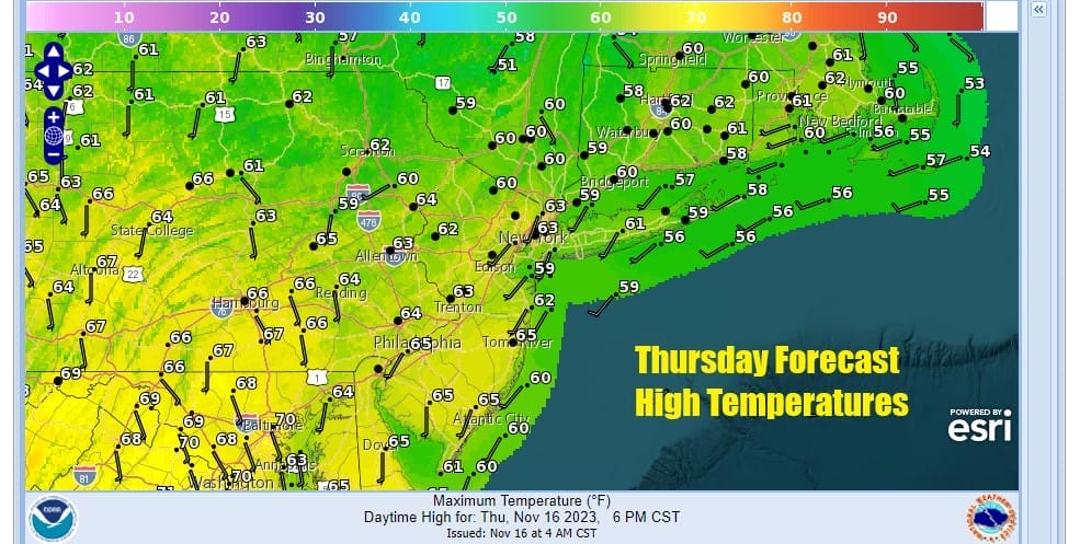
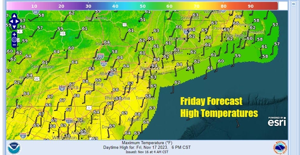
Dayside Friday will be a dry day. We may have some clouds from the offshore low grazing the area as well as some clouds from the approaching cold front but rain is not in the forecast for the daytime Friday at least and it may be late Friday night into Saturday morning that we have to deal with some showers. So this leaves us with some sunshine and a rather warm Friday with highs reaching the middle and upper 60s.
As for Saturday, showers will be more likely in the morning and then they should end from west to east by midday or early afternoon. Also there won’t be much rain out of this look to be under a quarter of an inch and in many places even under a tenth of an inch. It will be a day of shifting winds to the northwest and once showers are done, leftover clouds will remain with highs back in the 50s.

Sunday will be a colder day with clouds and some sunshine as high pressure begins to build in from the Great Lakes and Southeastern Canada. Look for temperatures Sunday to top out in the 40s to around 50 degrees. Sunday will be the better of the two weekend days but it will also be the colder of the two.

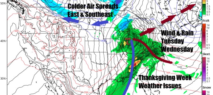
Now lets move on to next week where we have lots of people travelling all over the country to get to and from one place or another. The main weather maker is going to be low pressure that comes out of the Plains and heads east across the Ohio Valley and Lower Great Lakes. With a strong high off the coast of Atlantic Canada the stage is set for a rather problematic Tuesday and Wednesday. You can see from the loop of the GFS model above that this storm system is going to cause problems both from the standpoint of rain and perhaps more importantly, wind. The gradient gets somewhat tight across the Northeast and Northern Mid Atlantic. Tuesday the problem will be in the Great Lakes and Ohio Valley. Tuesday night into Wednesday the issues will be up and down the Eastern Seaboard.
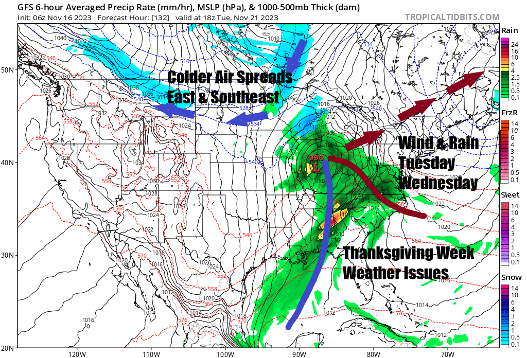
If you are flying clearly you are at the mercy of the airlines and airports so good luck with that. If you are driving over this weekend or into Monday or even early Tuesday I don’t see any issues in the Eastern US but after that it will be wind and rain. If it is snow you want for Thanksgiving, the Great Lakes will probably see some lake effect snows Wednesday into Thursday and Northern New England and Upstate NY will also see some snow on the backside of this next storm system. We will zero in more specifically regarding timing over the coming days.
BE SURE TO DOWNLOAD THE FREE METEOROLOGIST JOE CIOFFI WEATHER APP &
ANGRY BEN’S FREE WEATHER APP “THE ANGRY WEATHERMAN!
MANY THANKS TO TROPICAL TIDBITS FOR THE USE OF MAPS
Please note that with regards to any severe weather, tropical storms, or hurricanes, should a storm be threatening, please consult your local National Weather Service office or your local government officials about what action you should be taking to protect life and property.
(Amazon is an affilate of Meteorologist Joe Cioffi & earns commissions on sales.)


