Thanksgiving Week Sees Showers Late Tuesday into Wednesday
Cold Windy Thanksgiving & Friday
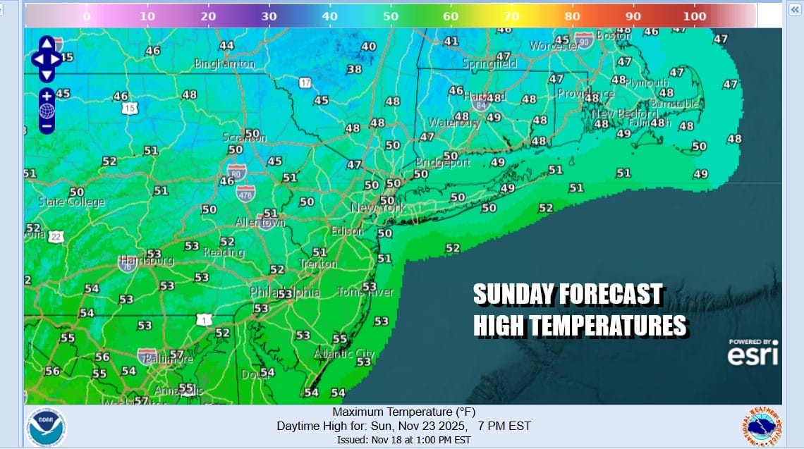
The second half of the weekend is going to be colder temperature wise. We do have an upper air disturbance heading eastward and this is the leading edge of slightly colder air that will cover the Northeast and Northern Mid Atlantic states today and Monday. We will see no worse than partly sunny skies today though there will be clouds rolling through from time to time. High temperatures today will be mostly in the upper 40s to lower 50s. Some precipitation is passing to the north of the coast this morning but we are leaving any mention of showers out of the forecast for today.
SATELLITE WITH LIGHTNING STRIKES
WEATHER RADAR
Weak high pressure settles in overnight and Monday. Skies tonight should clear and morning lows will be in the mid 20s to lower 30s. Monday is shaping up to be a nice day of sunshine but temperatures will struggle a bit. Most high temperatures will be in the upper 40s to some lower 50s and no rain is forecast.
Tuesday is the one day where we will be dealing with precipitation as a cold front heads eastward from low pressure in the Great Lakes. This is not going to be a big deal rain wise as moisture is somewhat limited. Tuesday we will see sunshine giving way to arriving clouds. Highs will be back into the 50s. Some showers will arrive during the mid to late afternoon and they should be mostly done by daybreak Wednesday.
The rain from this weather front should be a quarter of an inch or less. Wednesday we will still be mild because a secondary front has to pass and it will later in the day with another chance for a shower or two. Highs will be mostly in the 50s. However once that second front passes it turns much colder for Thanksgiving Day and for Friday. Thursday looks to be breezy to windy at times with some sunshine. Highs will just be in the low to mid 40s and we will be down in the 20s to near 30 or so at night. Friday will probably be windier as a storm in Atlantic Canada strengthens. Sunshine is forecast but highs will just be in the upper 30s to lower 40s. The remainder of the 4 day holiday weekend looks to be dry and chilly. No major storms are forecast around the US making for slightly easier travelling for the holiday.
BE SURE TO DOWNLOAD THE FREE METEOROLOGIST JOE CIOFFI WEATHER APP &
ANGRY BEN’S FREE WEATHER APP “THE ANGRY WEATHERMAN!
MANY THANKS TO TROPICAL TIDBITS FOR THE USE OF MAPS
Please note that with regards to any severe weather, tropical storms, or hurricanes, should a storm be threatening, please consult your local National Weather Service office or your local government officials about what action you should be taking to protect life and property.