Surprise Some Rain On Radar Today Dry Cool Air Returns Tonight Thursday
We interrupt the dry nice weather we had yesterday with an issue for today. This slow moving upper trough covering the Northeast is swinging across the area today with clouds. We also saw last night an area of rain that was over Kentucky and West Virginia. Guess what? That rain area has held together and it is showing up today on the radars.
SATELLITE

REGIONAL RADAR

Regional as well as local radars are picking up on this area of rain and in Maryland and Northeastern Virginia it is actually raining hard in places. The area is sliding to the east. It should weaken some as it does so but we will obviously have to include the chance for some rain or showers today.
LOCAL RADAR NEW YORK CITY

LOCAL RADAR PHILADELPHIA


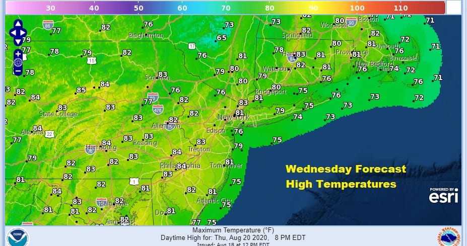
With clouds around for much of the day it is likely that temperatures will remain in the 70s all day though the further north you go (up the Hudson Valley and New England), the better chance you have for some sunshine breaking through the clouds so your temperatures could be a bit higher. Perhaps if we could see some improvement this afternoon and some sun peaks through, temperatures could edge a bit higher.
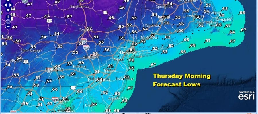
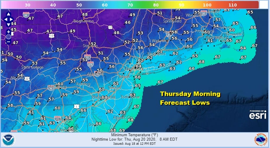
Regardless it clears out tonight and it will be a night where you should sleep with the windows open and let the fresh air in. Morning lows will be in the mid 50s to low 60s. Even the warmer urban areas will bottom in lower 60s.
Thursday will be nice and sunny with most highs in the upper 70s to lower 80s with low humidity. This will be the last day of the low humidity scheme. It will start to climb on Friday as high pressure moves offshore and a southerly flow takes over. This is going to bring some tropical moisture northward that has been hanging out in the Southeastern US and Florida this week. We throw in the chance for some scattered isolated downpours or a thunderstorm into the mix beginning Friday and continuing through the weekend. However for most of you it should be just fine with some sunshine each day. Highs will be mostly in the 80s, humidity will be higher but not off the wall oppressive.
Next week will be a bit of a balancing act thanks to the rather busy jet stream along the US Canadian border which flexes from time to time and moves sourhtward in the Eastern US (trough) while the strong ridge in the Western US responsible for their heatwave flattens out a bit. In between we have 2 tropical systems that might be in play. At the very least we will see cold fronts coming through here keeping any hot humid weather from getting out of hand. It also means we will see see dry shots of air every couple of days. There doesn’t appear to be much in the way of shower or thunderstorm activity except perhaps late next week when a stronger cold front approaches and moves through. All of this will make for a bit of volatility ahead as the summer weekends wind down to the final 3.
BE SURE TO DOWNLOAD THE FREE METEOROLOGIST JOE CIOFFI WEATHER APP &
ANGRY BEN’S FREE WEATHER APP “THE ANGRY WEATHERMAN!
MANY THANKS TO TROPICAL TIDBITS FOR THE USE OF MAPS
Please note that with regards to any severe weather, tropical storms, or hurricanes, should a storm be threatening, please consult your local National Weather Service office or your local government officials about what action you should be taking to protect life and property.


