DOWNLOAD MY NEW FREE JOESTRADAMUS WEATHER APP FOR ALL DEVICES
THE APP IS ABSOLUTELY FREE TO ALL BUT CONSIDERING SUBSCRIBING TO PATREON FOR A WEATHER EXPERIENCE FREE OF ADS, EXCLUSIVE VIDEOS FOR MEMBERS ONLY AND MUCH MORE…STARTS AT $2 A MONTH..MESSAGE ME AT ANY TIME
Super Bowl Sunday Super Nice
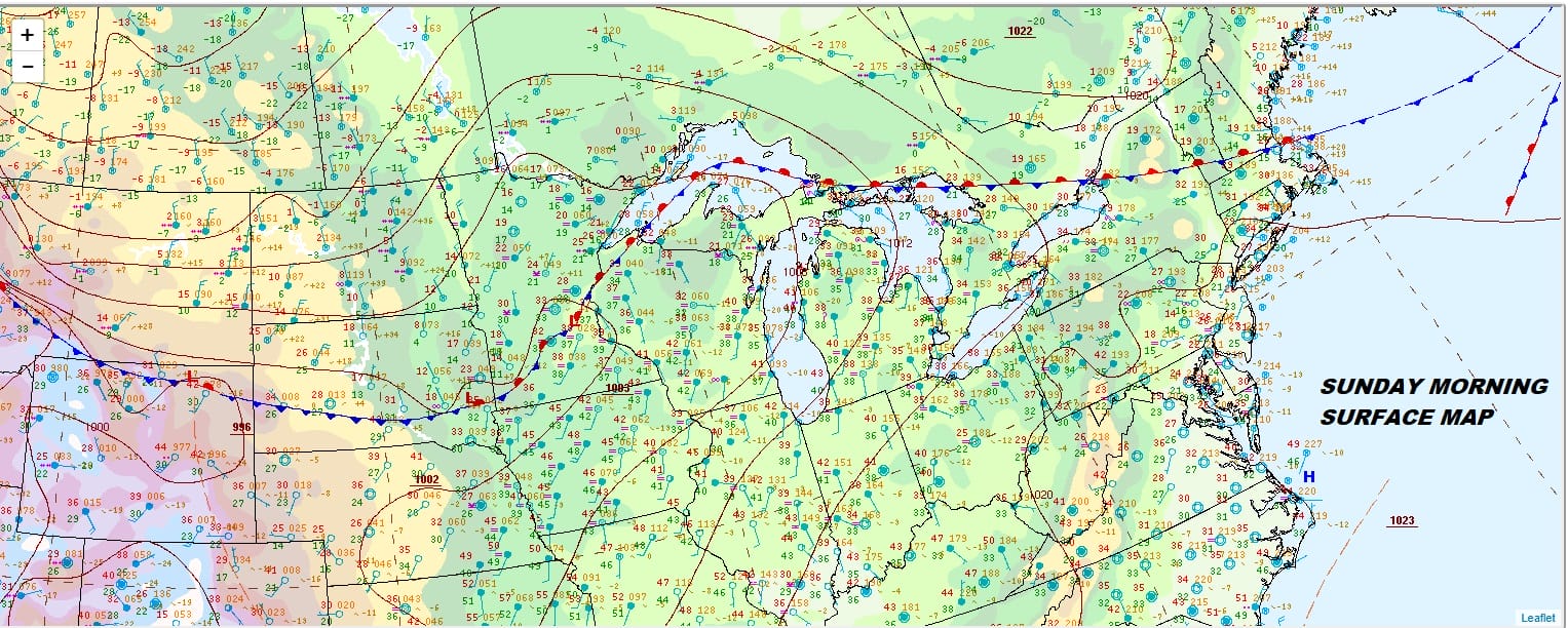
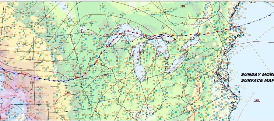
We have finally made it to the place where the cold air is totally gone and we can warm up nicely today. There are no issues to speak of today. Clouds on the satellite are streaming to the north this morning and a few clouds could sneak in from time to time today. Overall though it is a nice day of some sunshine and temperatures will be headed into the 40s everywhere. There are no precipitation issues on the regional radar with quiet conditions lasting into early Tuesday.
EASTERN SATELLITE

REGIONAL RADAR

We are still on course for a good looking Monday with sunshine. Temperatures will start the day in the 20s inland.mostly 30s in the warmer urban locations. Highs will reach the 50s just about everywhere. Along the coast Monday the sea breeze will likely kick in and knock temperatures back down into the 40s.
Tuesday brings a cold front through here and there won’t be much of anything with the front. Tuesday will be the warmest day of the stretch of rising temperatures with highs likely reaching the 60s in many locations however again long the immediate coast Mr Seabreeze will likely kick in again and temperatures will be 10 to 15 degrees lower along the coast. Sky conditions will be nothing worse than a mix of sun and clouds.
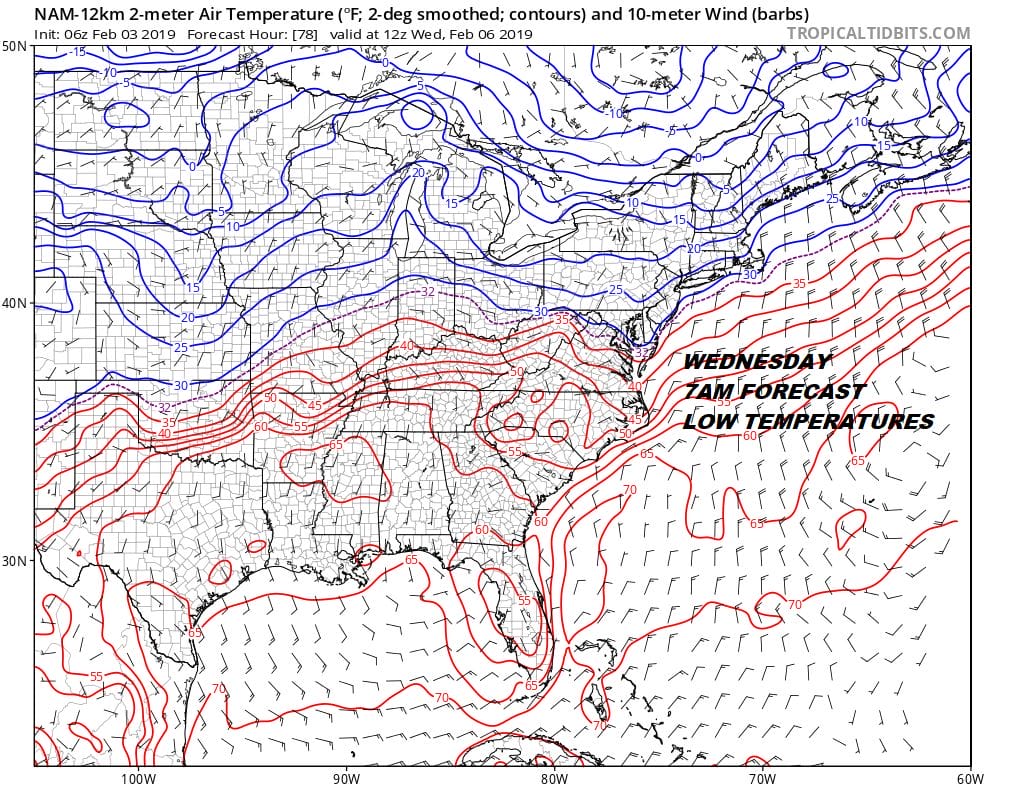
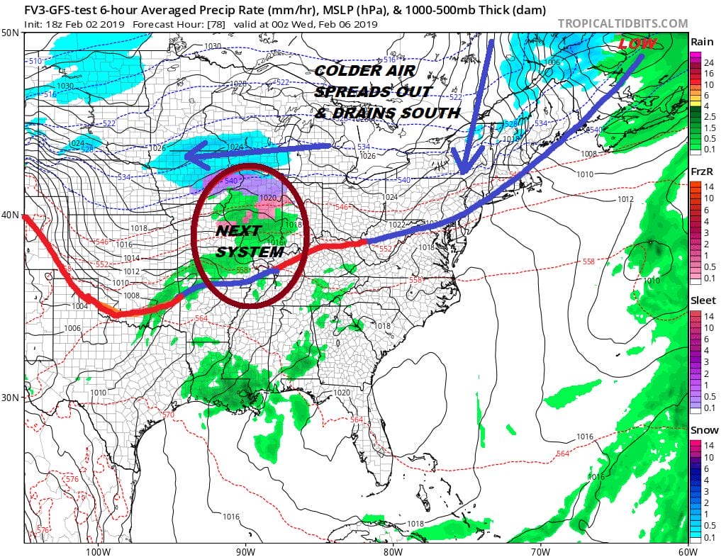
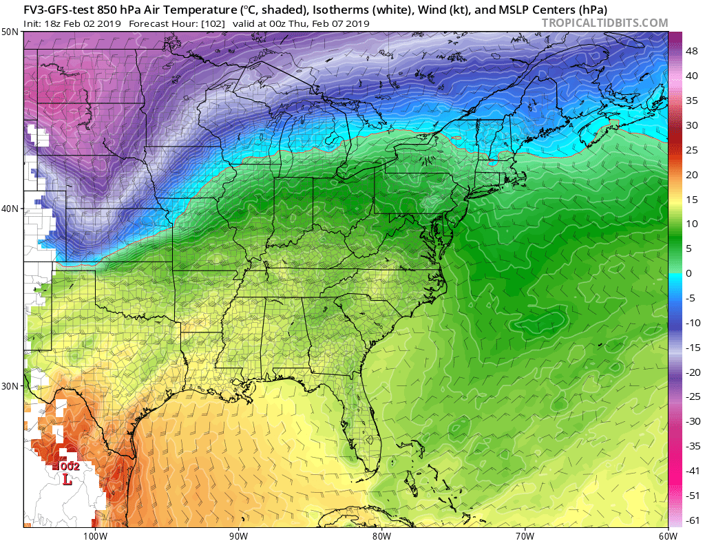
Now we look ahead to the dilemma of Wednesday with cold air spreading across Southern Canada and bleeding southward. How much low level cold air bleeds southward is the question. We have the first of a couple of waves to the west that will be moving eastward. This likely leads to a cold rain or some freezing rain late Wednesday into Wednesday night. The upper air temperatures will remain warm in spite of the lower levels being colder. This is due to the strong upper ridge in the Eastern US and the deep trough in the West. Several wave chances will be playing out next week straddling the line between cold air to the north and warmer air to our south. It is hard to see how snow even plays out in this scenario due to the warmer air aloft.
The pattern for snow is just all wrong. What we have is perhaps opportunities for cold air to sneak in from time to time and you would have to time everything out just perfectly for any snow issues so we seem up against it at this point. The clock for snow lovers in the I-95 Philadelphia to Boston corridor is ticking. Last year if you recall while many of you threw in the towel in mid January (fools) the pattern to me suggested blocking would develop in the long haul and was taken to task by the usual suspects who went silent. This year I have to say feels and looks different to me. The pattern shift underway to a trough in the west is disheartening to snow lovers. There are no signs of blocking at all. Worse every time the model shows it in the long range it completely disappears. The Atlantic jet stream pattern is as bad as the Pacific. There is nothing here that speaks to any long term cold/snow. Your only hope in my view going forward is the chance that something lines up exactly correct for snow and right now, I’m just not seeing it.
MANY THANKS TO TROPICAL TIDBITS FOR THE USE OF MAPS
Please note that with regards to any tropical storms or hurricanes, should a storm be threatening, please consult your local National Weather Service office or your local government officials about what action you should be taking to protect life and property.


