Sunshine Wednesday Warming Up Thursday Friday
Outlook For Mother’s Day Look Good

Sunshine Wednesday Warming Up Thursday Friday
Outlook For Mother’s Day Look Good
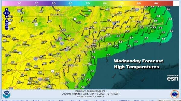
This could very well turn out to be the best weather day of the week as we have high pressure directly overhead today and that will provide us with plenty of sunshine. However over the last couple of days we have seen some hazy skies due to smoke from Canadian wildfires in Alberta province. The northwest flow has been bringing that plume of smoke our way so that might haze up the sky a little. Otherwise it should be a fine day with temperatures into the 70s for highs. There are no precipitation worries on the radar as it is clear not just in the Northeast, but pretty much up and down the entire east coast. Overnight under clear skies lows will be in the upper 40s to mid 50s.
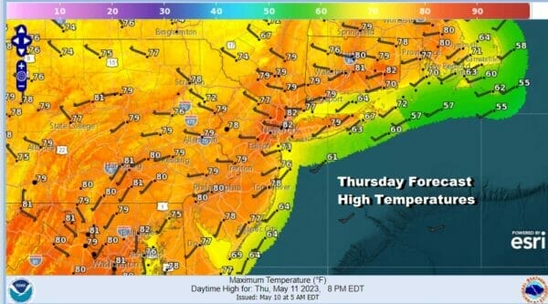
The next 2 days we will see sunshine and an uptrend in temperatures as high pressure moves off the Mid Atlantic coast and a west wind develops. That should take highs Thursday to the upper 70s and lower 80s in many locations and a more west than south wind will allow shore areas to warm up before local sea breezes to move in.
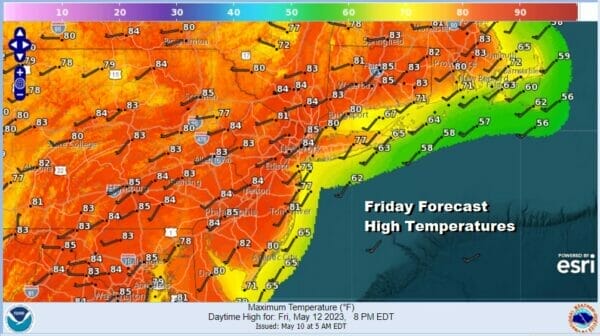
No change in air mass means temperatures will warm up further Friday. There will be enough sunshine to take temperatures up into the low and middle 80s with 70s along south and east facing shorelines before any sea breeze takes hold. This is the time of year where temperatures can find a way to go higher and Thursday and Friday are two examples of where we get some upside.
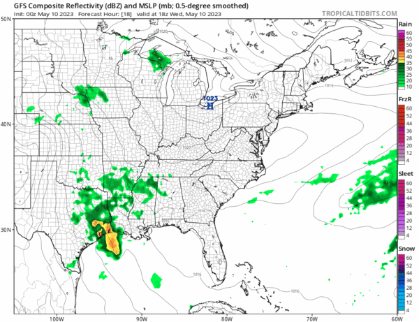
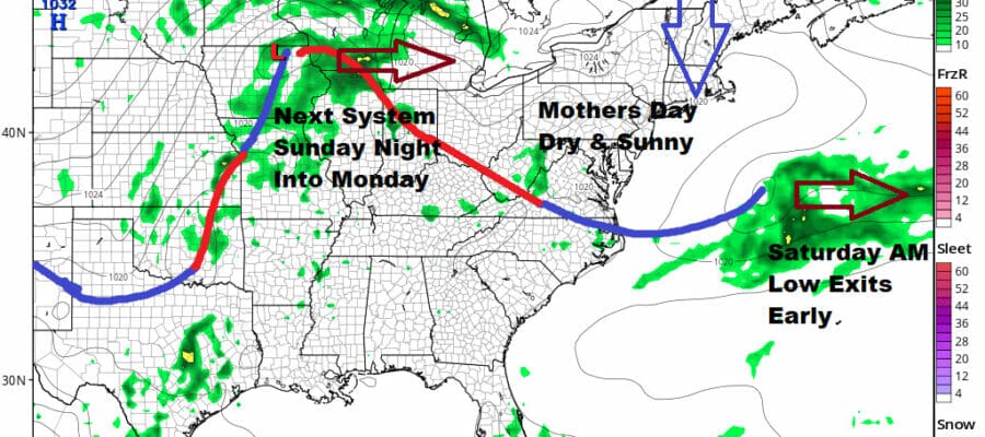
The pattern we are in suggests that storm systems moving up through the Plains states can’t continue to move in a progressive west to east fashion by heading into Canada. Rather they go as far north as they can and then slide east across the Great Lakes and then southeast to the Mid Atlantic coast. We saw that happen yesterday with a weak disturbance and we have another one that will bring the chance for showers Friday night into Saturday morning.
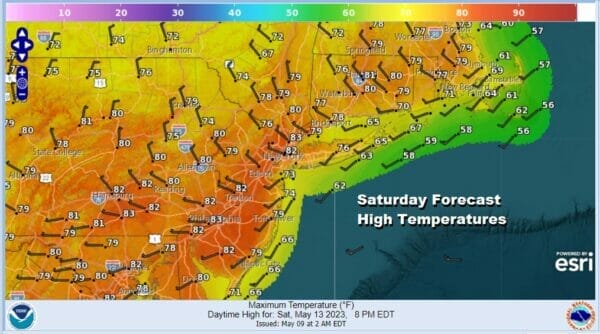
Like yesterday we will see showers end around or shortly after daybreak Saturday with clouds sliding southeast and dry air building in from the north. So look for decreasing clouds and increasing amounts of sunshine Saturday afternoon with highs in the upper 70s to some lower 80s.
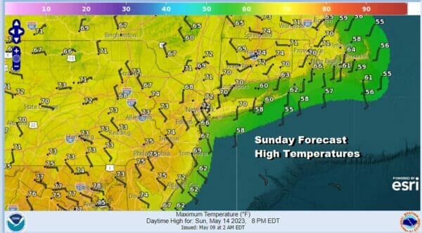
As the GFS loop above shows there is another disturbance that will be heading southeast from the Great Lakes for later Sunday night and Monday but in between that we will have a nice day of sunshine Sunday for Mothers Day, though it will be cooler thanks to a high to the north and more of a north wind at least to start the day and then perhaps going to onshore in the afternoon. High Sunday will be more in the line of lower to perhaps middle 70s. Then we get into some rain Sunday night into Monday morning followed by improvement Monday afternoon. It is basically wash rinse repeat until further notice.
BE SURE TO DOWNLOAD THE FREE METEOROLOGIST JOE CIOFFI WEATHER APP &
ANGRY BEN’S FREE WEATHER APP “THE ANGRY WEATHERMAN!
MANY THANKS TO TROPICAL TIDBITS & F5 WEATHER FOR THE USE OF MAPS
Please note that with regards to any severe weather, tropical storms, or hurricanes, should a storm be threatening, please consult your local National Weather Service office or your local government officials about what action you should be taking to protect life and property.


