Sunshine Warm Temperatures Continue
Showers Thunderstorms Saturday Dry Cooler Sunday
Today marks the third nice day in a row for Eastern Pennsylvania to Southern New England. Nothing much has changed as we remain in a weak pressure pattern. High pressure is long the coast and that is keeping Gulf moisture to the south. It is also deflecting energy in the Northern Great Lakes to pass to our north. It is another day of sunshine and relatively warm temperatures for this time of year. Most highs will be in the middle to upper 70s. Some warm spots could approach 80 while coastal locations will be lower due to local sea breezes. Radars are nice and quiet for a third day in a row.
SATELLITE WITH LIGHTNING STRIKES
WEATHER RADAR
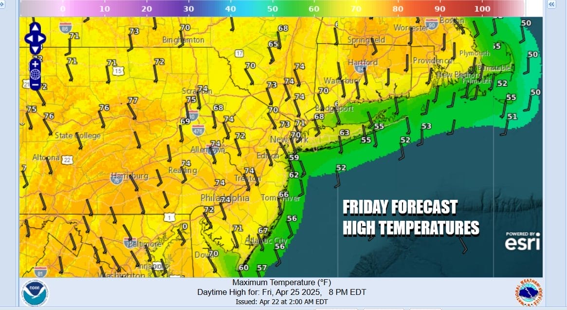
We have a warm night ahead with nothing more than some passing clouds. Lows Friday morning will be in the 50s. Friday will be the last nice day but we will see deterioration with sunshine giving way to some arriving clouds. However no rain is forecast for the daytime Friday. Highs will be in the 70s except 60s at the coast.
The streak of nice weather breaks Friday night as low pressure comes out of the Northern Plains and moves across the Lower Great Lakes. Ultimately the low tracks into New England Saturday. We have a trailing cold front that will be moving east while a warm front moves northward Friday night into Saturday morning. Look for showers to develop Friday night from southwest to northeast though they won’t be widespread.
During the day Saturday we will see showery rains as the cold front moves east along with the risk for a few thunderstorms in the mix. The front will pass during the afternoon so there is a chance for some late day improvement from west to east. Highs Saturday will be mostly in the upper 60 to middle 70s from north to south. There is a chance that we could see some stronger storms in the mix and we will be monitoring the situation for the possibility of some isolated severe thunderstorms.
The front will move offshore and skies should at least partially clear Saturday night though we will have a gusty wind developing on the backside of the front. Sunday will be breezy with sunshine and a few passing clouds. Most highs Sunday will be in the 60s. Rainfall amounts from this weather system for Friday night into Saturday will be on the order of a half an inch or so of rain.
BE SURE TO DOWNLOAD THE FREE METEOROLOGIST JOE CIOFFI WEATHER APP &
ANGRY BEN’S FREE WEATHER APP “THE ANGRY WEATHERMAN!
MANY THANKS TO TROPICAL TIDBITS FOR THE USE OF MAPS
Please note that with regards to any severe weather, tropical storms, or hurricanes, should a storm be threatening, please consult your local National Weather Service office or your local government officials about what action you should be taking to protect life and property.