Sunshine Sunday Low Humidity Continues
Sunshine Sunday Low Humidity Continues
We are starting out the day with deep blue skies and lots of sunshine. It is hard to find any cloud cover across the Northeast down to the Virginia coast. On the southern most edge of the satellite loop is the cloudy cover from the old frontal boundary and just to the south of that is Tropical Storm Chris which formed overnight with top winds of 40 mph. It continues to sit off the North Carolina coast and will do so for another couple of days before it begins to move away to the northeast. Other than some impact to our coastal waters Tropical Storm Chris will have no impact on our weather here. We will discuss this in a separate post later this morning. In the meantime it is sunshine all day long today with highs back into the 80s with comfortable humidity from start to finish.
EASTERN SATELLITE

LOCAL RADAR PHILADELPHIA


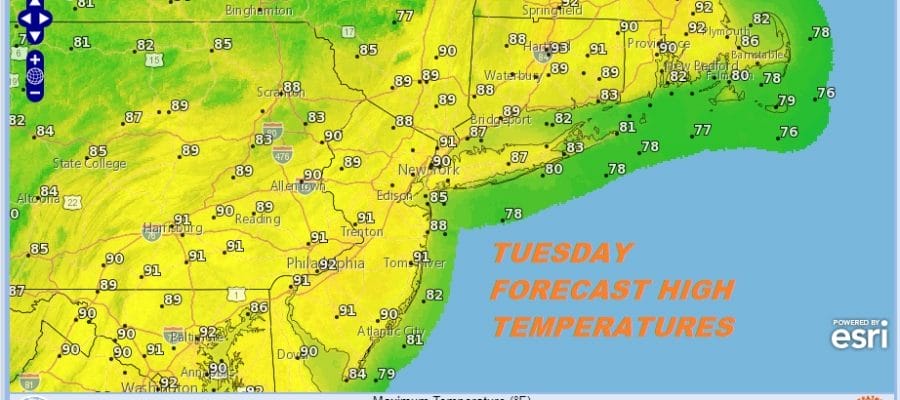
Tonight will be nice and clear and comfortable with temperatures in the upper 50s to middle 60s for most places. Monday looks like a another day of lots of sunshine and though it will be very warm with highs in the mid to upper 80s, the humidity will still be relatively reasonable. It isn’t until Tuesday when it will be hot and more humid to the point of some discomfort with sunshine and some clouds. Highs will be in the upper 80s to lower 90s.
TUESDAY FORECAST HIGH TEMPERATURES
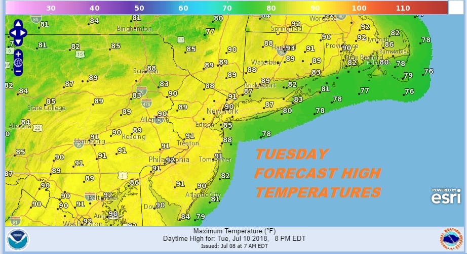
A weak cold front arrives Tuesday evening with a shower or a thunderstorm but the activity at this point appears to be minimal. The front opens the door for Tropical Storm Chris which could be a hurricane at this point to begin to move to the northeast and offshore. Chris will only be impacting marine interests.
GFS FORECAST 8PM TUESDAY JULY 10, 2018
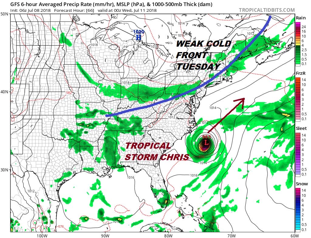
The weather pattern remains one where weather fronts will be coming through every 3 days or so but those fronts do not appear to be especially strong nor do the air masses behind them especially cool. On the other hand could it get hot for day or 2? Sure it could but this doesn’t appear to be a pattern where we string together highs in the 90s for days and days consecutively.
HERE IS THE LATEST ON TROPICAL STORM CHRIS
HERE IS THE LATEST ON TROPICAL STORM BERYL
 GET JOE A CIGAR IF YOU LIKE

LATEST JOESTRADAMUS ON THE LONG RANGE


