Sunshine Summer Saturday Hot Humid Sunday Monday Watching Tropics Later Next Week
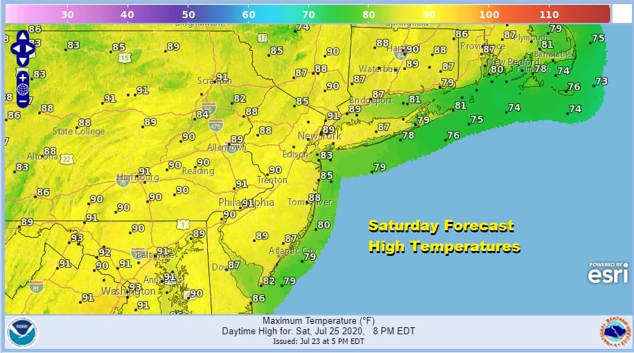
It is a very warm but only moderately humid afternoon across Eastern Pennsylvania to Southern New England. We are seeing a fair amount of sunshine. Temperatures are in the 80s. Dew points are in the reasonable low to mid 60s. All in all it is a nice way to start a weekend where we will see very little if any shower or thunderstorm activity. The satellite does show a few passing clouds under an otherwise mostly sunny sky. There are a couple of tiny pop ups on the radar in Pennsylvania but that is just about it as far as any rain is concerned.
SATELLITE
REGIONAL RADAR
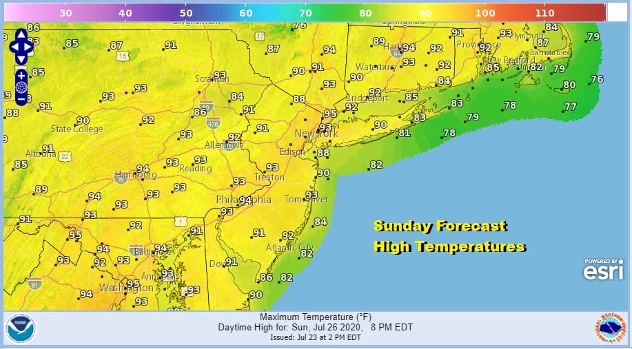
We have a warm humid night ahead of us under mainly clear skies with lows in the upper 60s to middle 70s. Then get set for a hot and humid Sunday with lots of sunshine. Highs will reach the low to mid 90s. The humidity will be higher Sunday but again little if any thunderstorm activitiy.
Our heat continues Monday with sunshine and highs again in the low to mid 90s but finally on Tuesday we could be setting up for one last day of highs reaching 90 or better and then there is the chance for thunderstorms late in the day.
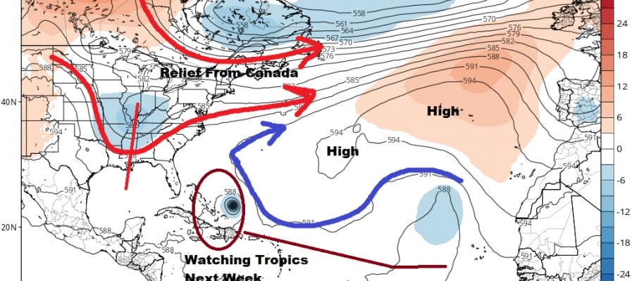
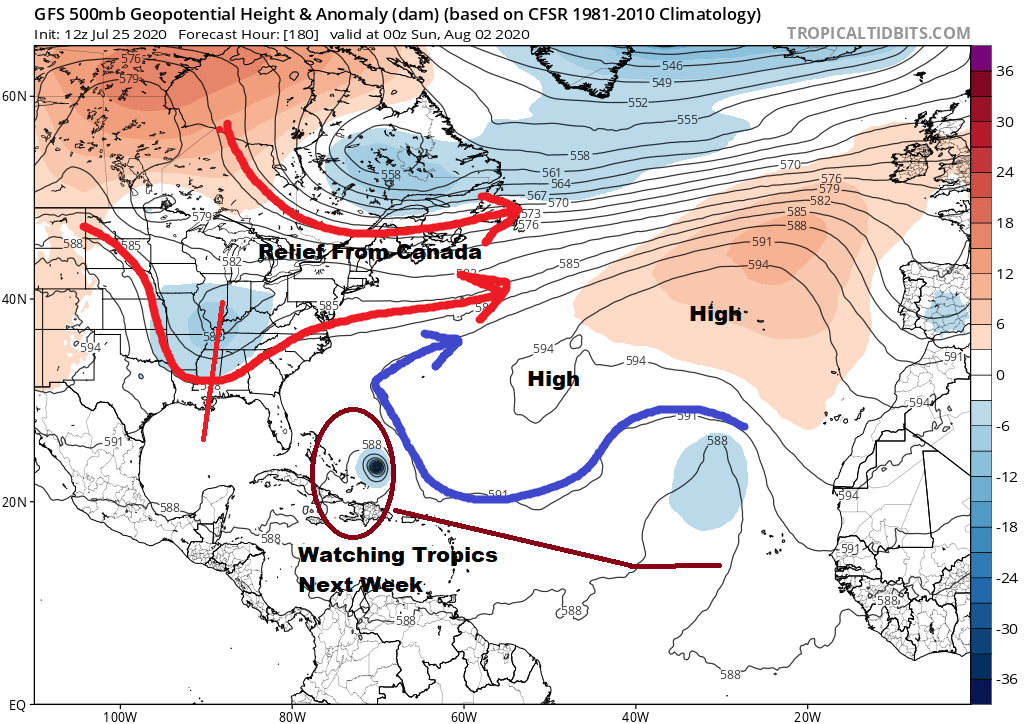
There are some important things that are happening next week regarding the jet stream pattern in the Eastern US and the tropics where another tropical wave now west of the Cabo Verde Islands could develop into a tropical storm by the middle of next week. First things first is the strong trough that drops into the Northeast midweek and that brings an end to the heat and it also brings down humidity for the second half of next week. Notice that there is a short wave trough that follows and drops into the Ohio Valley late next week. Combine that with a ridge off the Southeast Coast of the US and it opens up an alley way for a system to track toward the Bahamas and Southeast US. The loop above shows exactly that.
Whether these puzzle pieces come together like this remain to be seen. The strong ridge in the Atlantic might push any tropical system further west and south into the Caribbean. That stands as a possibility. We are still out about 7 days away from this and there are enough variables here where it all either comes out differently or nothing develops at all. However given that we are on a record pace with developing tropical cyclones, it is hard to see how that suddenly changes in the short term.
We are reasonably sure of a humidity break Wednesday through Saturday of next week with sunshine much of the time. There might be some cloud issues Thursday into Friday with a frontal boundary to the south and some showers across parts of the Southern Mid Atlantic but those showers should not be an issue here. Temperatures by day will be in the 80s with comfortable humidity. If come Monday models are still showing tropical possibilities, I would start to take it more seriously.
BE SURE TO DOWNLOAD THE FREE METEOROLOGIST JOE CIOFFI WEATHER APP &
ANGRY BEN’S FREE WEATHER APP “THE ANGRY WEATHERMAN!
MANY THANKS TO TROPICAL TIDBITS FOR THE USE OF MAPS
Please note that with regards to any severe weather, tropical storms, or hurricanes, should a storm be threatening, please consult your local National Weather Service office or your local government officials about what action you should be taking to protect life and property.


