USE THE COUPON CODE “summer2026” AND GET 10 PERCENT OFF ON ANY PURCHASE
Sunshine Into Friday With Showers Late Friday Weekend Now Looking Dry
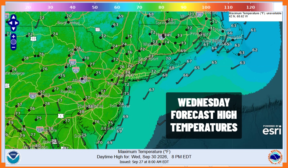
We are enjoying a really nice day of weather across Eastern Pennsylvania to Southern New England. Satellite loops show sunshine in the east though we do have some areas of low clouds which came in overnight and are now slowly dissipating. Temperatures are responding nicely with highs today in the low to middle 70s. High pressure remains over the Middle Atlantic states and it holds into Friday morning. Tonight should see mostly clear skies but we are in the time of year where low clouds could form in some places. Most lows Thursday morning will be in the upper 50s and lower 60s. Radars are nice and quiet and will remain that way into Friday.
SATELLITE WITH LIGHTNING STRIKES
WEATHER RADAR
The high pressure area edges to the coast Thursday with our winds becoming more southwest. This will allow temperatures to reach the upper 70s and lower 80s in most places. Skies will be partly to mostly sunny after any morning low clouds and fog burn off. No rain is in the forecast. It is a nice warm early autumn day.
Friday we have a cold front that will be approaching from the northwest. This is going to be leftover from a storm system heading to the Great Lakes today and Thursday. While this system is producing a lot of rain in the Plains and Southwest US today, by the time it gets here late Friday it will have very limited moisture with it. Friday will see sunshine giving way to arriving clouds with highs reaching into the 80s. A cold front arrives and passes Friday evening with a few showers but it won’t amount to much.
Earlier in the week some models were stalling the front and threatening us with rain for Sunday however it now appears that the front will keep on moving as high pressure builds into New England. Weekend temperatures will be cooler thanks to a northeast wind Saturday and Sunday. Both days will feature some sunshine. Highs Saturday will be in the upper 60s and lower 70s. Sunday highs will be in the 60s. Another cool high will arrive for the first part of next week keeping things dry with sub normal temperatures for the most part.
MANY THANKS TO TROPICAL TIDBITS FOR THE USE OF MAPS
Please note that with regards to any severe weather, tropical storms, or hurricanes, should a storm be threatening, please consult your local National Weather Service office or your local government officials about what action you should be taking to protect life and property.