Sunshine Ends A Chilly Week Dry Through Middle of Next Week

Weather in 5/Joe & Joe Weather Show Latest Podcast
Sunshine Ends A Chilly Week Dry Through Middle of Next Week
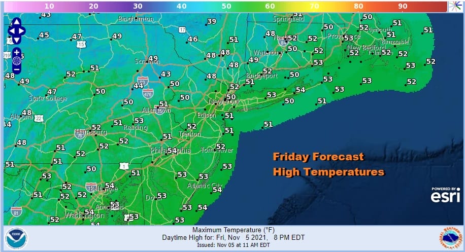
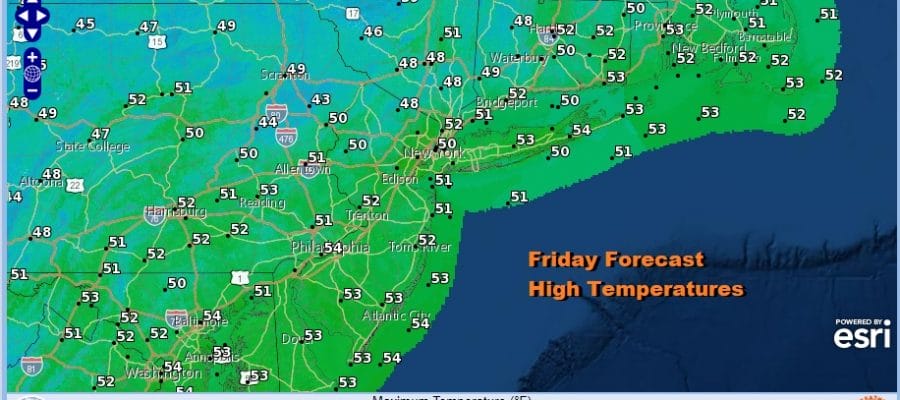
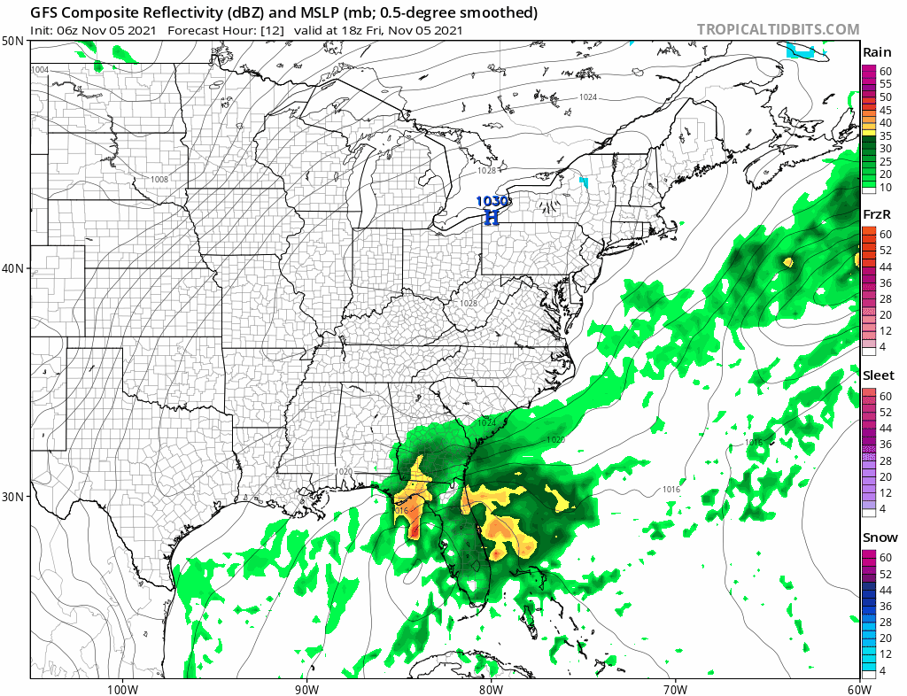
We seem to be in this rather odd pattern where we go for long stretches of no precipitation and then we get hit hard with heavy rains for a long stretch or at least they seem long. We are in the middle of another one of these dry stretches and it looks to last through the middle of next week before the next change. The satellite shows mostly sunny skies from Maine to Virginia and we will be in good shape through the weekend as high pressure holds to our west. The first of two storms has passed to the east and the next one for Sunday will also pass well offshore. Temperatures this afternoon will reach the upper 40s and lower 50s.
SATELLITE

WEATHER RADAR

While the cold high to west is modifying, the uptrend in temperatures will be rather slow because we still have a trough hanging along the East Coast. Fortunately the trough axis is on the coast so the next storm system coming out of the Northeast Gulf of Mexico will not turn northward along the East Coast but rather it will pass offshore.
Saturdat will be a nice day with sunshine and that should take highs up to the low and middle 50s. Sunday we will see high clouds from the southern storm move in and veil the sunshine but temperatures will still manage to make their way to the mid and upper 50s. Once that southern storm moves away and the upper trough shifts east, that should allow temperatures to warm a bit next week. A weak cold front will move through late Tuesday but we are going from one dry air mass to another dry air mass and we don’t expect anything from that front other than a few clouds. Monday’s highs should reach 60 or lower 60s. Tuesday highs will be in the low to mid 60s. Wednesday highs will be in a range of 60 to 65 with some sunshine.
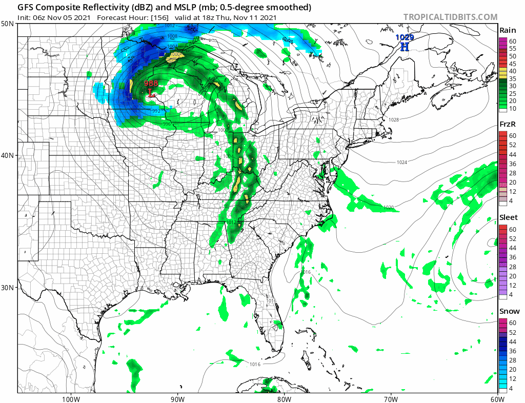
The dry stretch ends Thursday as a stronger cold front approaches and it looks like we will get into some showers late Thursday into early Friday. There might be a few heavier downpours with this front as it goes by. That may be followed by another cold front and storm system for next weekend. That storm for next weekend will possibly be a catalyst for a cold Thanksgiving week.
BE SURE TO DOWNLOAD THE FREE METEOROLOGIST JOE CIOFFI WEATHER APP &
ANGRY BEN’S FREE WEATHER APP “THE ANGRY WEATHERMAN!

MANY THANKS TO TROPICAL TIDBITS & F5 WEATHER FOR THE USE OF MAPS
Please note that with regards to any severe weather, tropical storms, or hurricanes, should a storm be threatening, please consult your local National Weather Service office or your local government officials about what action you should be taking to protect life and property.


