Sunday of Sunshine, Franklin To Pass Near Bermuda Tuesday,
Idalia Heads for Florida West Coast

Sunday of Sunshine, Franklin To Pass Near Bermuda Tuesday,
Idalia Heads for Florida West Coast
It is a Sunday that has Hurricane Franklin in the Southwest Atlantic and we have Tropical Depression 10 which will likely become a tropical storm later today and be named Idalia. Those two systems are the primary features of the week ahead. In between we have the Northeast and Northern Mid Atlantic states which are sitting in a good spot at the moment.

Weak high pressure with slightly drier air has settled in and we will be dealing with a developing east wind later today. Skies should be no worse than partly sunny. The east wind will help to keep temperatures a little lower than the otherwise would be. Highs will be in the mid along the coast and around or just over 80 inland. Humidity levels will be tolerable though the further south of NYC you go, the higher the dew points and the discomfort level. No rain issues are in the forecast today. It should be a quiet day as far as showers and thunderstorms are concerned.
SATELLITE WITH LIGHTNING STRIKES

WEATHER RADAR

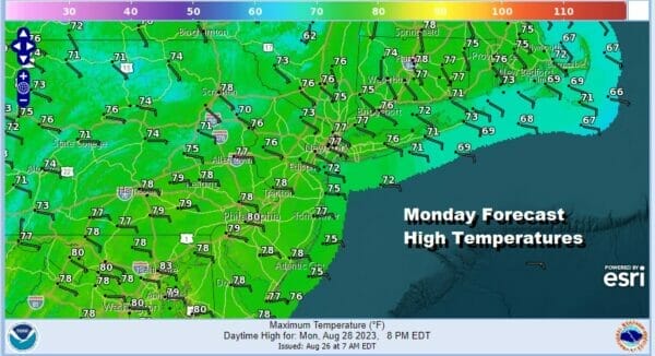
Tonight should be mostly clear with most lows in the 60s except for 50s in the coolest spots. Monday the east wind continues so edew points come up a bit more into the middle and upper 60s. Temperatures will hinge on how much cloud cover. Skies should be partly sunny to mostly cloudy depending on location and time of day. Highs Monday will be in the mid to upper 70s. We will throw in the chance for a shower or thunderstorm developing inland during the afternoon and early evening.
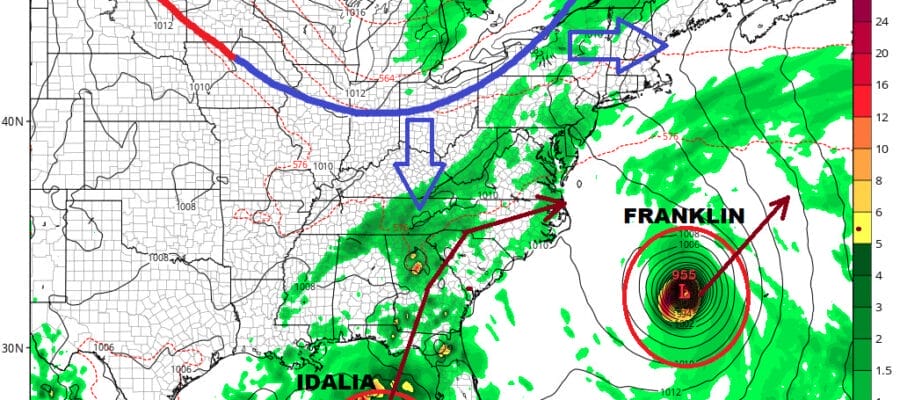
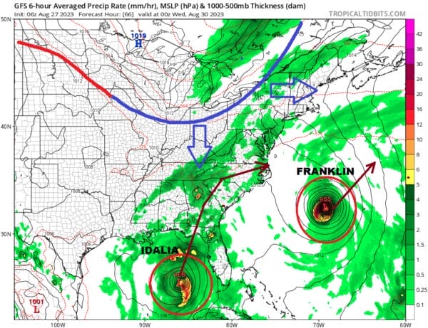
The next round of changes will get underway Monday night as we watch Hurricane Franklin, which is likely to be a major hurricane at this point. It is also likely that we will have Tropical Storm Idalia in the Eastern Gulf of Mexico. Add to this we have a cold front that will be moving southeast from Canada and then across the Great Lakes and Ohio Valley during Tuesday, reaching the coast Tuesday night.
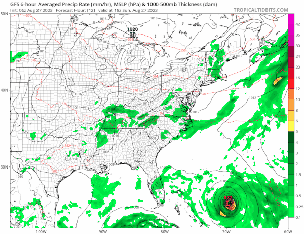
Hurricane Franklin is likely to track west of Bermuda and well east of the North Carolina coast, turning north and then northeast or even east northeast. The center may pass west of Bermuda but it will be close enough to produce some issues with rain and possibly some wind as the center will move to the west, and then northwest and north around the Island. Then we have the system that will likely become Idalia later today which is drifted south overnight as it responds to Franklin to the east. Eventually it will respond to an upper air trough over the Central Gulf States and move northward toward the Florida west coast. A landfall may wait until later Wednesday as everything is slowing down. This system has the potential to become a hurricane and conditions are favorable for strengthening so we aren’t sure yet how strong Idalia will get.
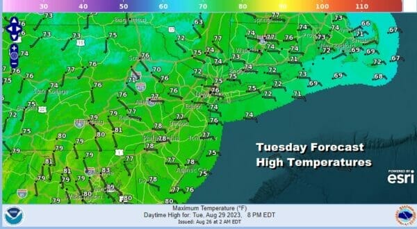
The storms are also going to react to an approaching front and we will see the east wind continue Tuesday with clouds around along with a few showers. Most highs will be in the 70s. Then the front should pass offshore which will help to sweep Franklin away to the east Tuesday night and Wednesday. The southern end of the front will line up through the Mid Atlantic into the Appalachians and Idalia will likely track somewhere to the east of that frontal boundary once inland. Aside from impacts to where landfall occurs, very heavy rains are likely to spread across much of the Southeast US and into the Southern Mid Atlantic late in the week. Right now we see dry weather and sunshine in the Northeast Wednesday and Thursday. Odds are the northern jet will keep any tropical rains to the south of us Friday and into the Labor Day holiday weekend though that is not as yet written 100 percent in stone. For now we continue to lean optimistic and wait to see how Idalia evolves in the coming days.
BE SURE TO DOWNLOAD THE FREE METEOROLOGIST JOE CIOFFI WEATHER APP &
ANGRY BEN’S FREE WEATHER APP “THE ANGRY WEATHERMAN!
MANY THANKS TO TROPICAL TIDBITS FOR THE USE OF MAPS
Please note that with regards to any severe weather, tropical storms, or hurricanes, should a storm be threatening, please consult your local National Weather Service office or your local government officials about what action you should be taking to protect life and property.
(Amazon is an affilate of Meteorologist Joe Cioffi & earns commissions on sales.)


