Summer Begins With No Hot Weather Ocean Temps Remain Cold
Summer Begins With No Hot Weather Ocean Temps Remain Cold
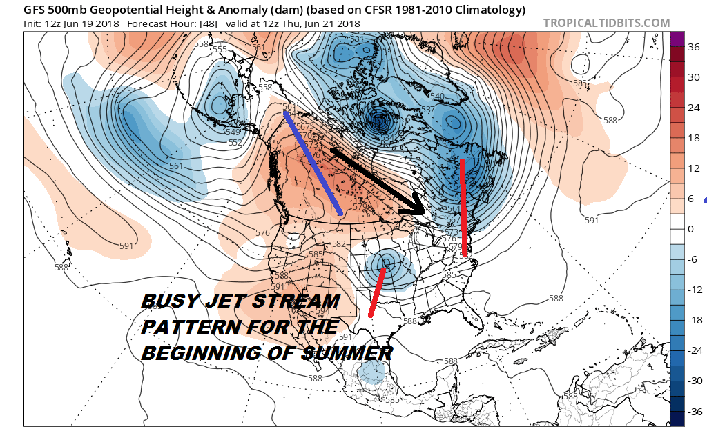
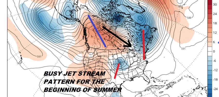
The summer season is about to begin and we have a rather active jet stream pattern for the latter part of June. There continues to be persistent troughing from the North Pole to the Canadian Maritime Provinces. This feeds cool air masses from Canada southeastward. The jet stream across the US is split with weather systems moving across the middle of the US (along 35 degrees north roughly) from west to east, This keeps warm humid air across the South (which is where it usually is). The pattern has been very persistent and though every so often a big ridge builds in the Eastern US to bring some hot humid weather it rarely lasts for more than a day or two and then its back to average or even a bit below average. This weekend will bring a weather system through the east and another trough will swing into the Eastern US early next week bringing cooler than average temperatures.
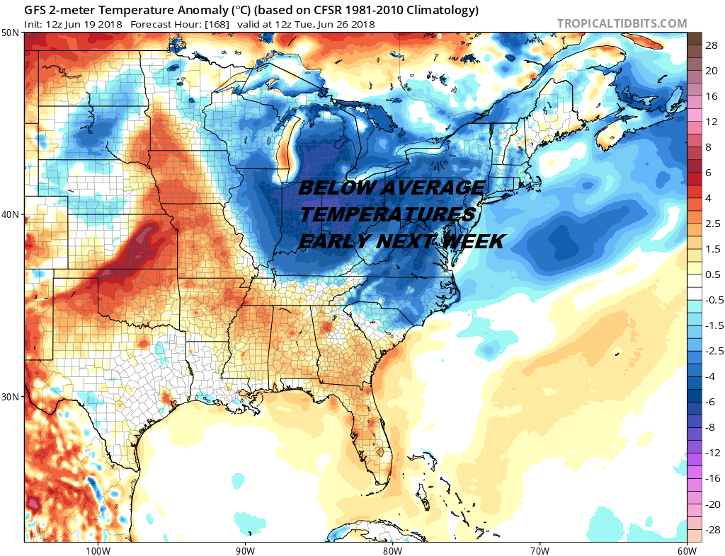
We don’t see much change going forward into the end of the month and the beginning of July. Could it get very warm or hot for a day or two? Sure it could but the persistent trough off the east coast has to get out of the way for any sustained heat or humidity to occur.
OCEAN WATER TEMPERATURES BELOW AVERAGE
ACROSS MUCH OF THE ATLANTIC BASIN
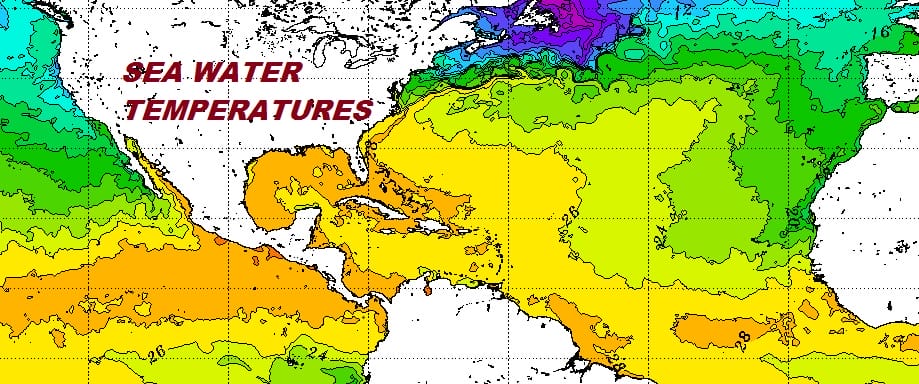
A large portion of the Tropical and Subtropical Atlantic Ocean remains near or below average in terms of sea surface temperatures. We haven’t seen much change in the profile over the least couple of weeks. The maps reflect data through June 18th. There remains a persistent area of below average ocean water temperatures from Southeastern Canada across the the Atlantic and then bleeding southward into the Tropical Atlantic. Water temperatures are below average in the Caribbean which is usually where we might see tropical storm development this time of year.
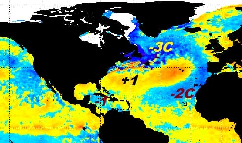
Much of the subtropical Atlantic to the Southeast US coast is near or slightly above average at the moment. The actual temperature profile shows continues to show a weakening of the Gulf Stream in the Central Atlantic . This water temperature profile remains the second coldest on record with 1985 being the coldest. The question is whether this profile remains through the summer or does it change as we move through July and August. This could have an impact on the hurricane season by perhaps lessening activity but to what degree remains a big question. Also what we see know and what we see two months from now can easily be two different things so we will continue to watch the developments here in the coming weeks and months.
SHOP THE JOESTRADAMUS STORE
MANY THANKS TO TROPICAL TIDBITS FOR THE WONDERFUL USE OF THE MAPS

GET JOE A CIGAR IF YOU LIKE!
FiOS1 News Weather Forecast For Long Island
FiOS1 News Weather Forecast For New Jersey
FiOS1 News Weather Forecast For Hudson Valley
NATIONAL WEATHER SERVICE SNOW FORECASTS
LATEST JOESTRADAMUS ON THE LONG RANGE