Strong Storm Brings Rain Wind Thursday Windy Drier Friday Into the Weekend
The next storm system is getting ready to move into the Eastern US and it should be potent enough to dump an inch or two of rain Thursday. Ahead of this today we have clouds coming up from the southwest as well as cloud cover that is coming in from off the ocean. Patchy areas of light rain are showing up on the radars today mostly offshore but some of them might sneak in later today and this evening. Overall we will have a cloudy day. It is on the raw side outside with temperatures that will top out in the 50s.
SATELLITE WITH LIGHTNING STRIKES
WEATHER RADAR
Hurricane Melissa is coming into view on the eastern satellite loop. It will be over the Southeast Bahamas today and then head for Bermuda Thursday so it is no issue for Eastern Pennsylvania to Southern New England. The developing storm in the lower Ohio and Tennessee Valley will head to the Appalachians tonight and then into New England later Thursday.
Rain develops overnight and then spreads northward into New England. An area of heavy rain and some thunderstorms will develop on a cold front that will be whipping through late Thursday afternoon and early evening. Southeast winds will pick up to 20 to 30 mph with higher gusts at the coast. Temperatures Thursday will be in the upper 50s and lower 60s. Rain should be long gone during the evening hours as winds shift to the northwest behind the front. Thursday temperatures will be in the upper 50s and lower 60s.
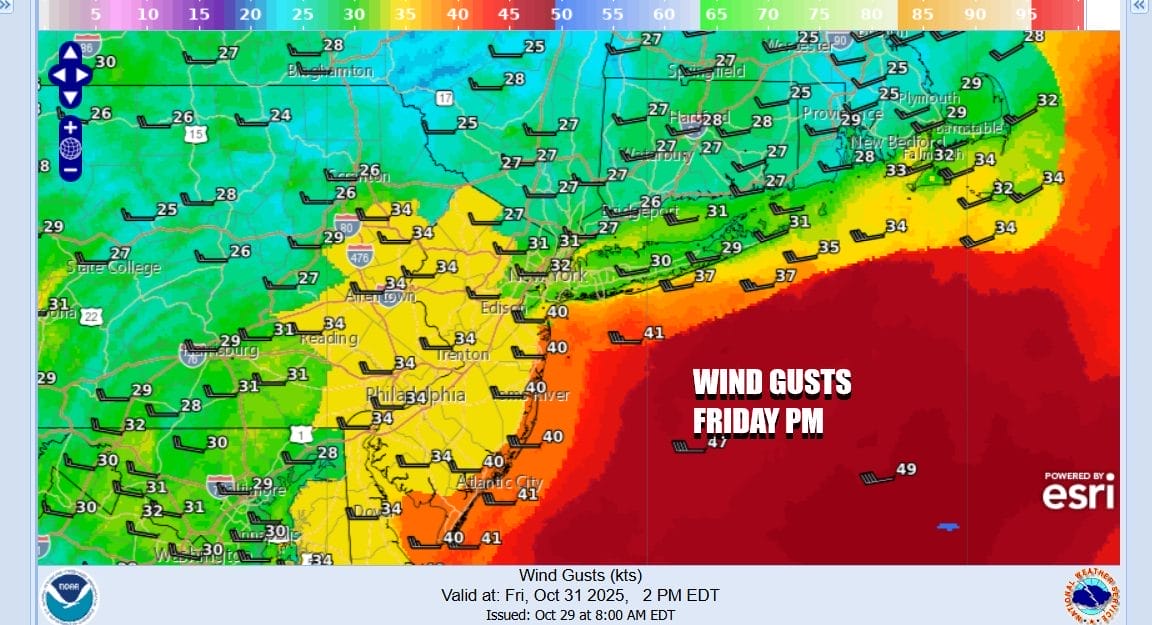
The storm system strengthens as it reaches New England and the gradient tightens up across Eastern Pennsylvania to Southern New England. Northwest winds will pick up to 20 to 35 mph with gusts to 40 mph or more at times. Wind advisories may be issued for some areas for Friday. Skies Friday will feature a mix of sun and clouds. Most highs will be in the mid to upper 50s.
Gusty winds will continue into Saturday though the gradient will loosen up a bit so the gusts should be a little lower. The weekend will be dry with at least some sunshine for both Saturday and Sunday. High temperatures both days will be mostly in the low to mid 50s for highs. Another storm system will develop in the Gulf States early next week but for now it seems that this low will track to our south. This means we should be dry through the middle part of next week.
BE SURE TO DOWNLOAD THE FREE METEOROLOGIST JOE CIOFFI WEATHER APP &
ANGRY BEN’S FREE WEATHER APP “THE ANGRY WEATHERMAN!
MANY THANKS TO TROPICAL TIDBITS FOR THE USE OF MAPS
Please note that with regards to any severe weather, tropical storms, or hurricanes, should a storm be threatening, please consult your local National Weather Service office or your local government officials about what action you should be taking to protect life and property.