
Storm Issues Next Week, JOESTRADAMUS Long Range
Storm systems will be impacting the weather at the beginning and possibly at the end of next week as we take a look at today’s weather models. Earlier today you may recall by my early morning post that I was becoming utterly frustrated with models flipping back and forth on the large scale pattern. Today we have a little bit of clarity on next week so we will deal with the first storm which will be heading for the Great Lakes. That storm will push a cold front through here early Tuesday morning and put an end to the record high temperature streak. We will probably see an 8 hour period of rain and thunderstorms ! (this is December???). Once that front passes through the air behind it is cooler but it is not cold air. We will go from being 20 degrees above normal to 10 degrees above normal which technically is still a cool off.
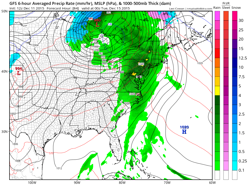

Rainfall amounts on the GFS weather forecast model have gotten a little more bullish and if a solid area of showers can develop ahead of the front we could manage some 1 inch plus amounts of this. Also with the strong cyclone to the north and the influx of warm tropical air ahead of it we could even see a rare December thunderstorm out of this.
Now on to the end of next week where all weather forecast models are back on with the idea of a second storm system developing on a cold front that moves through. The air mass behind this may wind up being fairly cold but alot is going to depend on depth and position. Actually the models seem to be getting a little more impressive with the upper feature coming down.

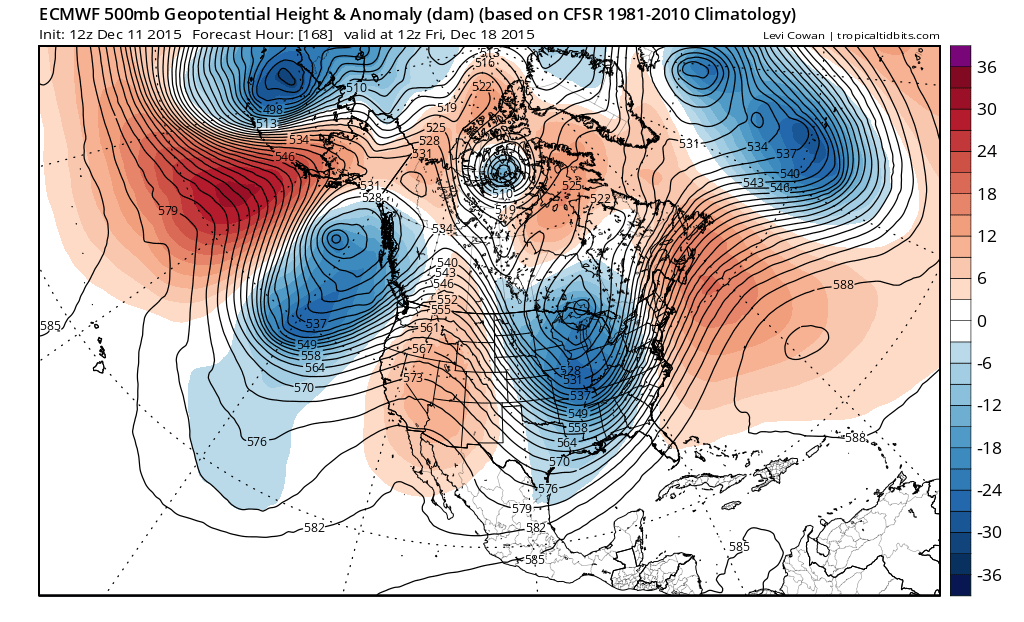
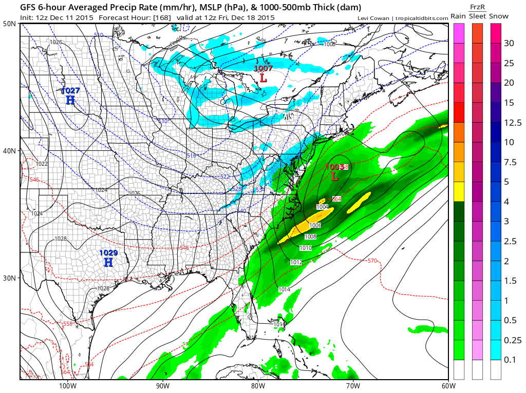
All the models show an impressive northern feature here and strength and depth will depend on the next system coming into the west coast and whether it is a little slower which would allow for a little more room. Right now as I pointed out last night, my confidence factor in this is very low given the models ability to flip on a dime. Room is going to be a big issue here so it will all have to happen almost perfectly. There is no blocking so regardless of what happens, we will turn colder for a few days before the ridge pops back up. One longer term change may be that the southeast ridge while still there may not come up as strongly as in the past few weeks. We will see about that. One of the possibilities from something like this is if it is cold enough someone could see some flakes out of this but again, right now I want to see how this progresses on the models through the weekend.
Short range watch for some dense fog that could develop in some areas tonight into Saturday morning before it burns off and we go to some sunshine and near record high temperatures again. The same will hold for Sunday. Sunday night into Monday morning might be a it tricky with the fog issue. Enjoy your weekend.
JOESTRADAMUS OVERNIGHT LONG RANGE ANALYSIS


