
Springlike Pattern Long Range
![]()
Its a Springlike Pattern Long Range that is setting up. The entire jet stream pattern appears to be in some sort of upheaval. Where it winds up is hard to say but the pattern as it evolves does have a few obvious features. First off the cold air flow from Canada is basically shut off.
Springlike Pattern Long Range UPPER AIR PATTERN WEDNESDAY

The upper air jet stream flow over Canada is west to east which means we are talking Pacific air. The two standout features are a strong ridge in the eastern states and a deep upper air low that moves into Northern Mexico. The ridge in the east will bring rising temperatures through Wednesday peaking in the 70s! The upper low in Northern Mexico eventually opens up and lifts northeastward into East Texas bringing rains and severe weather there.
Springlike Pattern Long Range SURFACE MAP THURSDAY

For our area a back door cold front arrives on the scene on Thursday with some showers. The GFS typically is in a bit of a rush with bringing the front through while the European is about 6 hours slower. This is going to perhaps prolong the mild temperatures into Thursday before it cools off. Some showers are probable with all this.
Springlike Pattern Long Range UPPER AIR NEXT WEEKEND
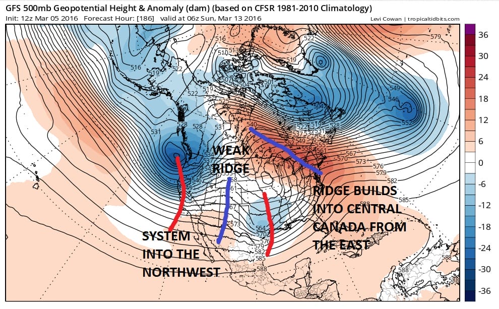
Once that Texas system lifts up well to the west of us next weekend models diverge greatly going forward. The GFS keeps the troughs active in the west. The European model on the other hand brings a somewhat colder look.
Springlike Pattern Long Range UPPER AIR PATTERN EURO VS GFS MARCH 15th
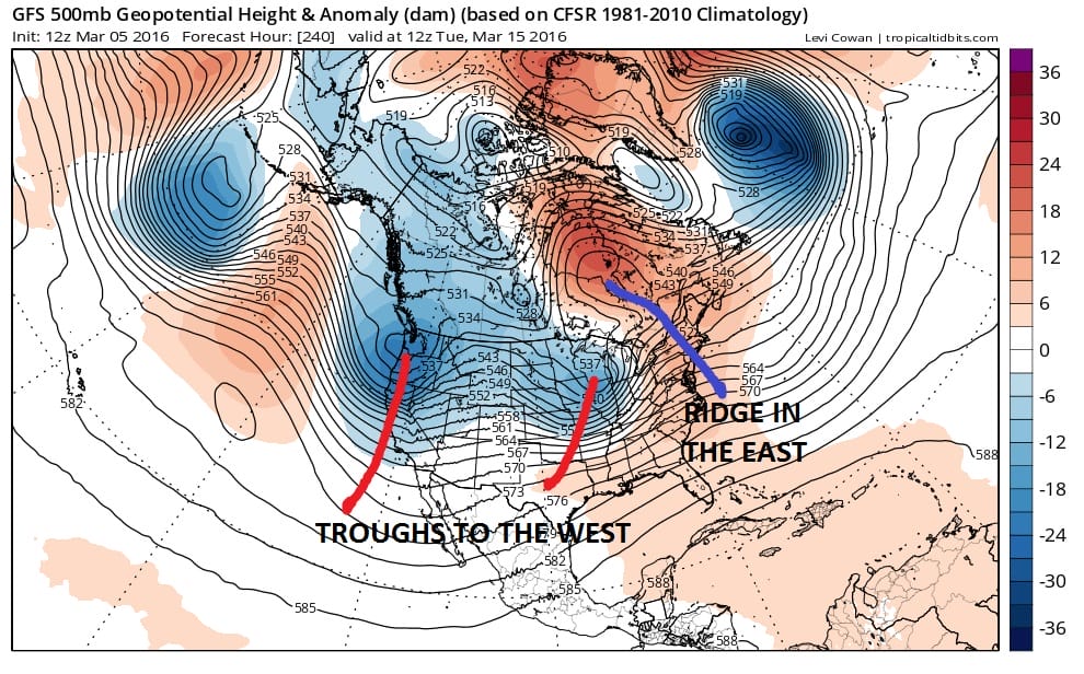
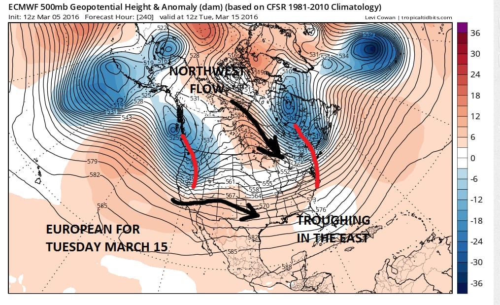
Actually the two models go in drastically opposite directions here. The European has had the better longer term performance. It isn’t too often that you see differences this radical. It seems that the European wants to hold back part of the vortex west of Greenland and drop it down into Northeastern Canada while the GFS takes that entire system out to the east and forces a ridge to build north. Such is the puzzle going forward. We can say that with both models that no major storms are on the horizon for us. But the big warmup this week is. And there is nothing here that really suggests any winter weather for the next 10 days.
FiOS1 News Weather Forecast For Long Island
FiOS1 News Weather Forecast For New Jersey
FiOS1 News Weather Forecast For Hudson Valley
NATIONAL WEATHER SERVICE SNOW FORECASTS
LATEST JOESTRADAMUS ON THE LONG RANGE
Weather App

Don’t be without Meteorologist Joe Cioffi’s weather app. It is really a meteorologist app because you get my forecasts and my analysis and not some automated computer generated forecast based on the GFS model. This is why your app forecast changes every 6 hours. It is model driven with no human input at all. It gives you an icon, a temperature and no insight whatsoever.
It is a complete weather app to suit your forecast needs. All the weather information you need is right on your phone. Android or I-phone, use it to keep track of all the latest weather information and forecasts. This weather app is also free of advertising so you don’t have to worry about security issues with your device. An accurate forecast and no worries that your device is being compromised.
Use it in conjunction with my website and my facebook and twitter and you have complete weather coverage of all the latest weather and the long range outlook. The website has been redone and upgraded. Its easy to use and everything is archived so you can see how well Joe does or doesn’t do when it comes to forecasts and outlooks.
Just click on the google play button or the apple store button on the sidebar for my app which is on My Weather Concierge. Download the app for free. Subscribe to my forecasts on an ad free environment for just 99 cents a month.
Get my forecasts in the palm of your hand for less than the cost of a cup of Joe!
![]()
