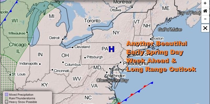
Spring Weather All Week No Major Issues Shower Chance Friday

Weather in 5/Joe & Joe Weather Show Latest Podcast
Spring Weather All Week No Major Issues Shower Chance Friday
The first full week of spring will be unusual in that the weather is actually going to be like spring all week long. This time of year the ocean is cold which has an impact on temperatures especially along the coast. We are also going to be seeing our nice weather from the weekend continue today with clear skies still dominating the satellite picture.
SATELLITE

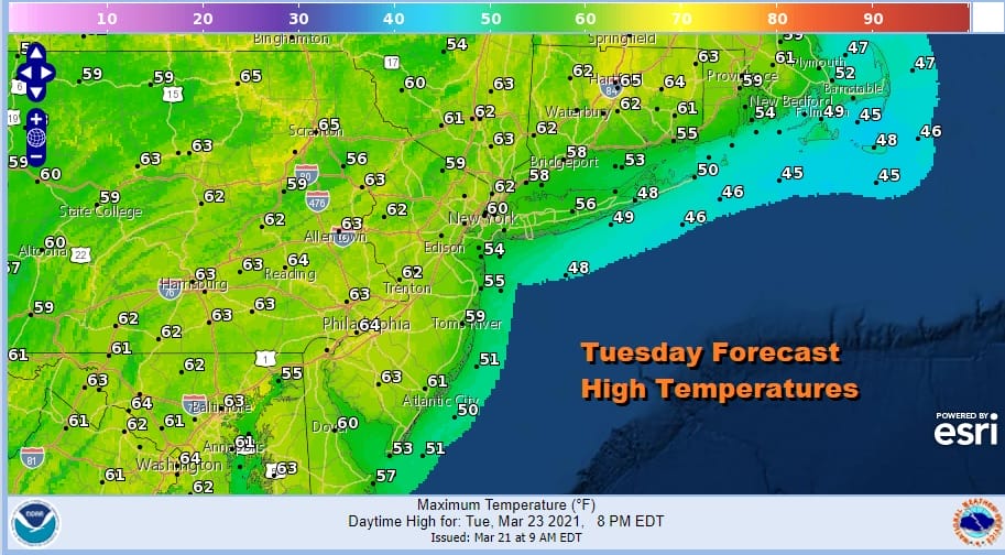
Low pressure is well off the North Carolina coast and the satellite does show a swirl of clouds offshore. So far the low and the high to the northeast of it are not shooting in low level moisture and low clouds so we should be in good shape here through Tuesday. Temperatures today will top out in the upper 50s to lower 60s in most places.

The exception to the forecast highs will be along east and south facing shorelines where the east wind will keep temperatures at least 10 degrees lower and in some cases 15. Tonight we should see clear skies inland but some clouds could come into the mix along the coast. Most lows will be in the 30s with 20s in cold spots. Tuesday looks good with sunshine again. Highs should reach into the low and middle 60s away from the coast with the ocean wind again keeping south and east facing shore areas noticeably cooler.
Wednesday the high offshore gets dirtier. In other words the persistent east winds starts to bring more clouds and limiting the amount of sunshine. This will hold high temperatures back in the mid 50s to lower 60s. However Thursday we should start to see the wind turn more southwest and that could take temperatures up through the 60s to near 70 away from the ocean.
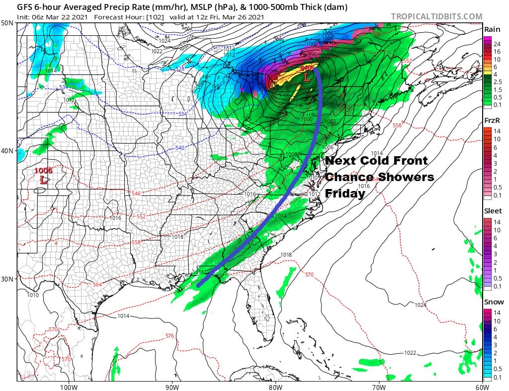
Friday brings the next chance for showers as a cold front approaches. This front looks less impressive as each day passes so I’m not looking for a lot of rain out of this. Weather improves after it passes. it turns cooler over the weekend.
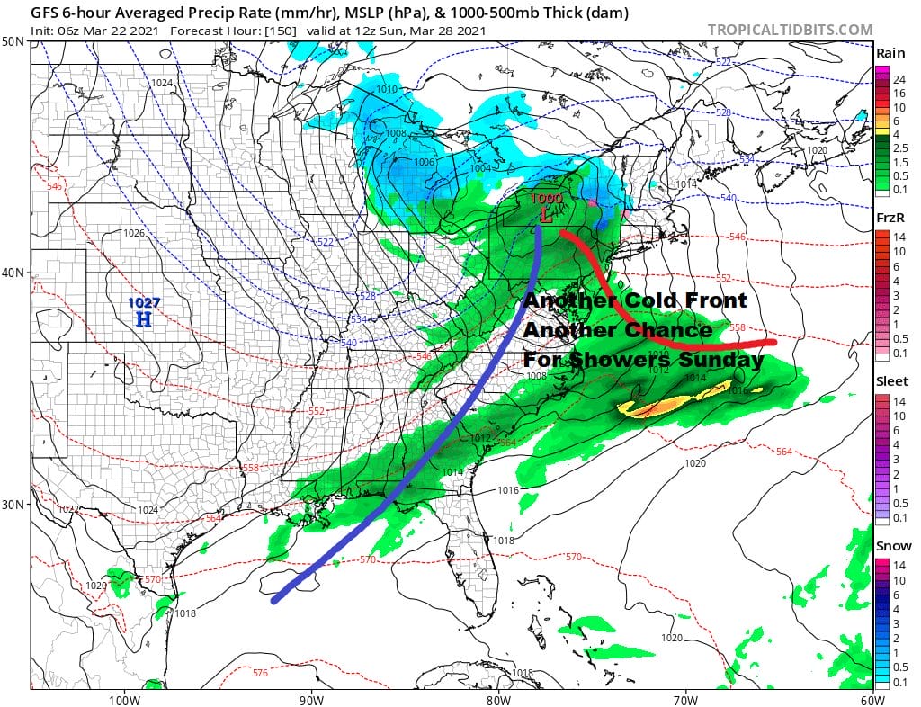
As far as the weekend is concerned Saturday looks dry but another cold front and another chance for showers will likely arrive on Sunday. No major storms are on the horizon nor are there any serious risks for severe weather being indicated through next Sunday.
BE SURE TO DOWNLOAD THE FREE METEOROLOGIST JOE CIOFFI WEATHER APP &
ANGRY BEN’S FREE WEATHER APP “THE ANGRY WEATHERMAN!
MANY THANKS TO TROPICAL TIDBITS FOR THE USE OF MAPS
Please note that with regards to any severe weather, tropical storms, or hurricanes, should a storm be threatening, please consult your local National Weather Service office or your local government officials about what action you should be taking to protect life and property.


