
Spring Pattern Going Forward
![]()
Looking out to the long range we seemed to be locked in a warmer than normal pattern ahead of the vernal equinox in 2 weeks or so. There is absolutely nothing in the long range models that indicates any kind of cold air intrusions other than minor ones via the back door.
Spring Pattern Going Forward UPPER AIR PATTERN NEXT SUNDAY
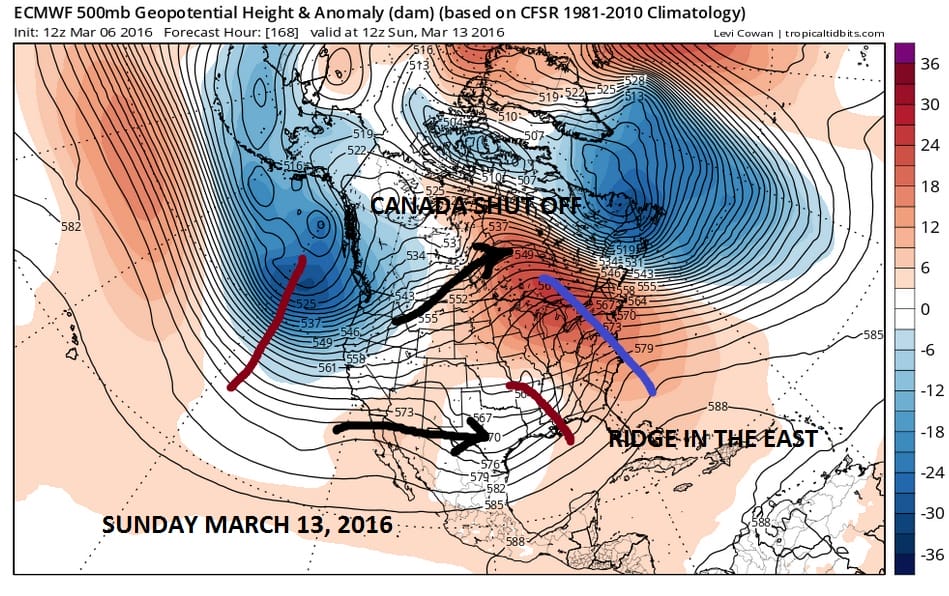 Today’s Euro model shows a week from today a continuation of a ridge in the east. The flow across Canada is basically westerly which means cold air from the north is cut off. The only thing showing up later next weekend is another back door type cold front pushing down from New England.
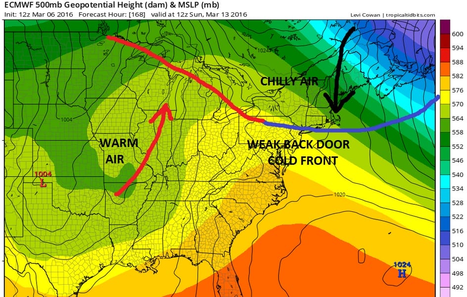
Spring Pattern Going Forward Euro Model Surface Next Weekend
Other than that it seems that major storms are not in the cards through the next 10 days and just minor systems will be impacting us. Even out to day 10 the pattern remains very much the same and very much springlike with no polar flow at all.
Spring Pattern Going Forward Euro Model Upper Air Day 10
 Now beyond day 10 the unreliable GFS is splitting the polar vortex at the highest levels of the atmosphere and drops one of the split upper lows at the highest levels of the atmosphere toward the northeast. This “split” concept was something that the GFS often predicts and never occurs.
GFS UPPER AIR STRATOSPHERE PATTERN DAY 12
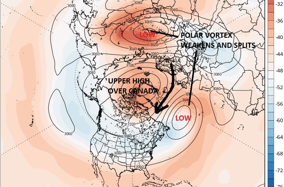
Since what happens way upstairs takes about 10 days to 2 weeks to play through, this would suggest a colder pattern toward the end of March and the beginning of April. However the GFS has done this so many times over the last couple of months. The previous splits never happened. And just because we go to a colder than normal pattern, doesn’t necessarily mean anything regarding specifics or an early spring snowfall. It does suggests more pattern churning is ahead beyond mid March assuming that it is even correct. For the time being enjoy the warmth. At least it gives you an early start on yard cleanups and some spring gardening, or maybe even a little fishing.
FiOS1 News Weather Forecast For Long Island
FiOS1 News Weather Forecast For New Jersey
FiOS1 News Weather Forecast For Hudson Valley
NATIONAL WEATHER SERVICE SNOW FORECASTS
LATEST JOESTRADAMUS ON THE LONG RANGE
Weather App

Don’t be without Meteorologist Joe Cioffi’s weather app. It is really a meteorologist app because you get my forecasts and my analysis and not some automated computer generated forecast based on the GFS model. This is why your app forecast changes every 6 hours. It is model driven with no human input at all. It gives you an icon, a temperature and no insight whatsoever.
It is a complete weather app to suit your forecast needs. All the weather information you need is right on your phone. Android or I-phone, use it to keep track of all the latest weather information and forecasts. This weather app is also free of advertising so you don’t have to worry about security issues with your device. An accurate forecast and no worries that your device is being compromised.
Use it in conjunction with my website and my facebook and twitter and you have complete weather coverage of all the latest weather and the long range outlook. The website has been redone and upgraded. Its easy to use and everything is archived so you can see how well Joe does or doesn’t do when it comes to forecasts and outlooks.
Just click on the google play button or the apple store button on the sidebar for my app which is on My Weather Concierge. Download the app for free. Subscribe to my forecasts on an ad free environment for just 99 cents a month.
Get my forecasts in the palm of your hand for less than the cost of a cup of Joe!
![]()
