
Some Sunshine Slightly Lower Humidity Next Two Days But
Humidity Remains High South of New York City
Yesterday’s cold front that produced severe weather across the area has now passed offshore however that front is slowing down now to a crawl and will likely linger offshore into the weekend. It is a weak front thanks to the upper trough that is basically lagging behind and not completely moving east and offshore. This is bringing lower humidity across New York State and New England. Some of that dry air is bleeding southward to about the latitude of NYC and nearby. South of this area though across South Jersey and Southeastern Pennsylvania and points southward, dew points here will remain in the mid to upper 60s making it uncomfortable when we combine them with highs in the mid to upper 80s.

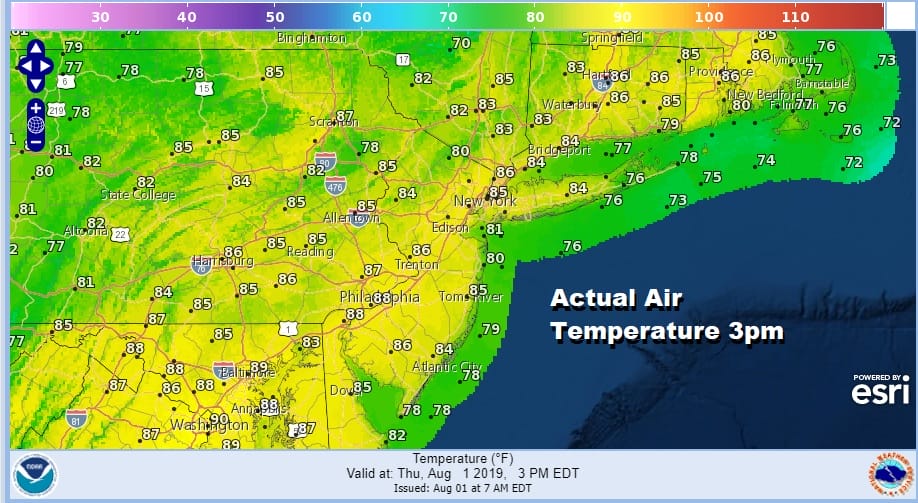
You can see the impact of the humidity today as most high temperatures today across this zone will be in the mid to upper 80s but the apparent temperature (impact of humidity) reaches into the 90s south of New York City. If you are along the latitude of NYC northward and northeastward the the feels like temperature is equal to or lower than the actual temperature.
The satellite loop shows the clouds lingering along the coast from New England southward to off the Middle Atlantic Coast. There isn’t much happening on the regional and local radar this morning. We don’t expect much of anything to happen today precipitation wise though an odd shower or thunderstorm in areas where the humidity remains high (South Jersey, Southeast Pa southward) can’t be ruled out. Otherwise much of the area today from Eastern Pennsylvania to Southern New England sees nothing worse than a mix of sun and clouds.
SATELLITE

REGIONAL RADAR

We are actually going to see slightly cooler air bleed southward from New England and upstate NY tonight and Friday lows overnight in the 60s to near 70. This will keep temperatures on Friday in a range of 80 to 85 with a mix of sun and clouds.
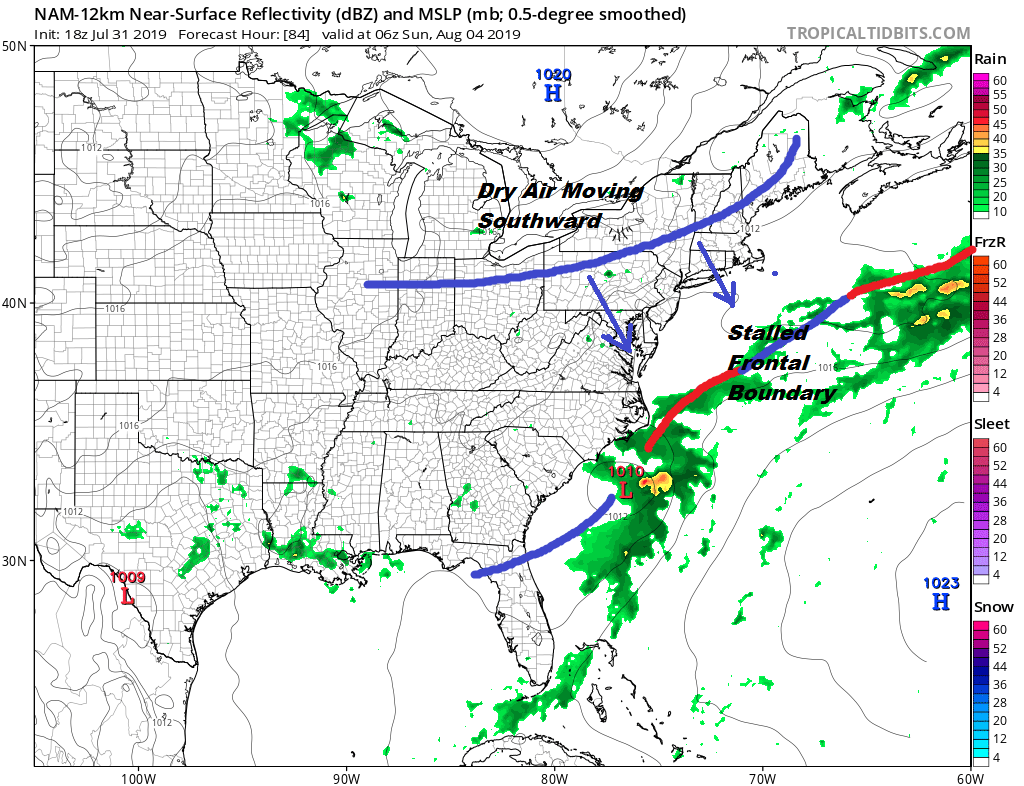
We don;t see much change to our outlook for the weekend. Look for clouds and some sun on Saturday.Saturday will be very warm with highs in the mid 80s to near 90 degrees. Humidity will be going up because we do have another cold front approaching from the north. I am going to include the chance for an odd shower or thunderstorm Saturday afternoon or evening. A wave developing on the front offshore likely limits and shower or thunderstorm development here Saturday. The front will pass through and we will see some sunshine on Sunday. It will be very warm and somewhat humid early in the day but humidity levels could start to drop later in the day. Highs will be in the mid to upper 80s. Dry weather with low humidity and some sunshine kicks off next week before the next round of weather fronts and weather changes get underway for later next week.
MANY THANKS TO TROPICAL TIDBITS FOR THE USE OF MAPS
Please note that with regards to any tropical storms or hurricanes, should a storm be threatening, please consult your local National Weather Service office or your local government officials about what action you should be taking to protect life and property.


