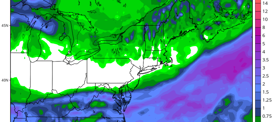
There are some thunderstorms that formed this afternoon and they seem to now have shifted eastward however the radar still shows some potential cells west of rt 87 that might develop into something so we need to keep an eye on these.
Elsewhere across the region it is very quiet. There is the chance that there could be a shower or thunderstorm popping up in South Jersey this evening where temps reached the lower 90s in many areas. Otherwise weather conditions are set to improve everywhere tonight with humidity continuing to drop and skies at least partially clearing out.
Sunshine for Wedneday and probably for Thursday and temps should cool off a bit. Low to mid 80s. Parts of Ne Pennsylvania might just reach 80 or so.
With regards to the next weather system and the potential for a soaking rain Friday into Saturday that potential is dimimishing as models continue to shift southward.
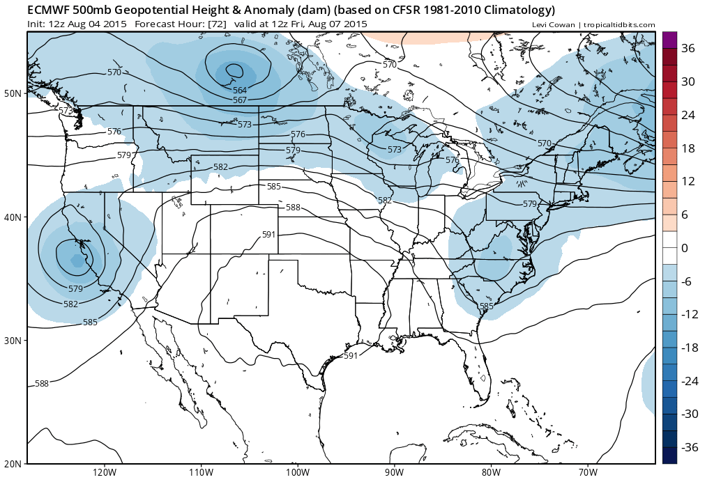
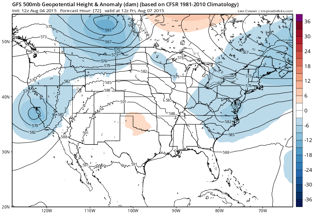
The difference between the European and the GFS is that the gfs has a much more suppressed look with a northwest flow over the northeast that forces the disturbance to our south on an east track and not lifting up. The European is less suppressed but more so than yesterday and seems to be grabbing on the gfs idea that there will be no soaking rain here.
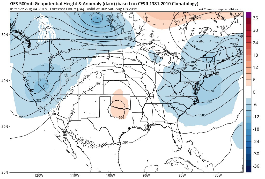
A jet stream that looks like this at 84 hrs on the gfs would keep the weekend dry and a little cooler than normal around here. Should this trend continue we will be taking any mention of rain out of the weekend forecast. We will wait for tomorrow.


