Some Rain Over Night Possible, Clouds Saturday Into Sunday Warming Up Monday
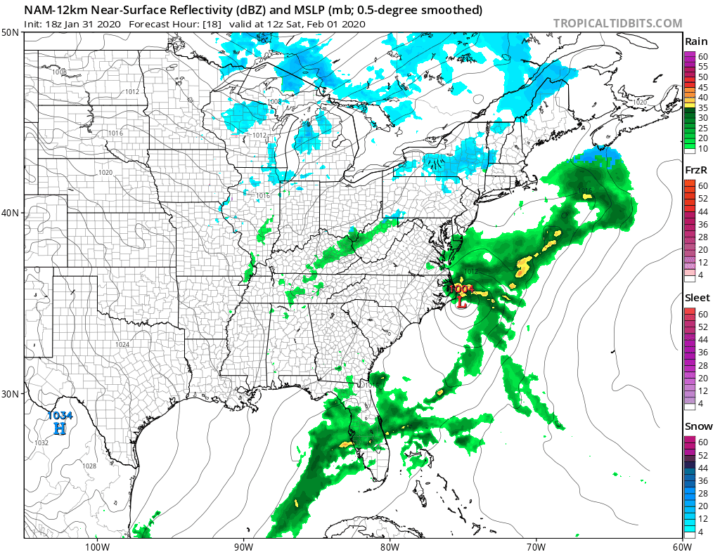
Clouds rolled in during the afternoon ahead of low pressure coming out of the Northeast Gulf of Mexico and heading off the Southeast coast of the US. There really hasn’t been much change in the outlook with this. Some rain will likely graze the coastal areas and perhaps areas inland for a short time. Overall this is a light event and a minor inconvenience overnight into Saturday morning.
SATELLITE

REGIONAL RADAR

Regional radar is picking up on rain moving from North Carolina into Western Virginia. Some of the rain is on the heavy side. The rain area this evening looks impressive however it will start to get strung out and weaker overnight with the bulk of it passing offshore. Local radars are out of range of this rain for now but will start to pick up on it later this evening and tonight.
LOCAL RADAR NEW YORK CITY

LOCAL RADAR PHILADELPHIA


Once the rain plays through during the early morning hours on Saturday low pressure l make its way northeastward. Weather conditions will try to improve with leftover clouds around and highs in the low to mid 40s. Then an upper air disturbance will come through Saturday night with a few scattered inconsequential rain or snow showers.
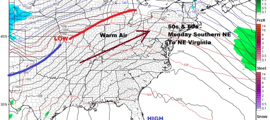
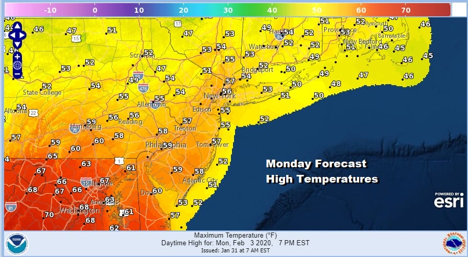
After that second area moves by it should get better on Sunday with clouds giving way to some sunshine and highs in the 40s. The west wind that develops Sunday night will keep temperatures from falling much. That sets us up for Monday with some sunshine and a west wind. Highs will reach the mid 50s to near 60 in areas around NYC and low or even middle 60s in areas surrounding Philadelphia and points south.
Tuesday will still be mild to warm at least for part of the day until a cold front back doors its way southward and likely stalls out somewhere across the Delmarva Peninsula or Virginia. This will likely put us in line for some rain or showers Tuesday night and on Wednesday as a series of lows goes by. We may be dealing with a stalled front and on and off rain into Friday of next week. Colder air could becoming involved well north and west of the coast. This will create the next round of winter weather speculation in the midst of a terrible weather pattern.
BE SURE TO DOWNLOAD THE FREE METEOROLOGIST JOE CIOFFI WEATHER APP &
ANGRY BEN’S FREE WEATHER APP “THE ANGRY WEATHERMAN!
MANY THANKS TO TROPICAL TIDBITS FOR THE USE OF MAPS
Please note that with regards to any severe weather, tropical storms, or hurricanes, should a storm be threatening, please consult your local National Weather Service office or your local government officials about what action you should be taking to protect life and property.


