Solar Eclipse Weather Weekend Weather Outlook Hot
Solar Eclipse Weather Weekend Weather Outlook Hot
We are getting to the time of year where 90 degree days are a little bit harder to come by. Average temperatures have started to drop. Daylight is decreasing by a couple of minutes a day. This weekend could wind up being the last chance or next to last chance to string 90 degree highs. The last few months we seen to get these 3 to 4 day appearances every four or 5 weeks and this is the August version. The satellite loop shows dry air overhead so we should see partly to mostly sunny skies today with highs in the mid 80s to near 90. With a northwest wind there won’t be much of a sea breeze at the beaches so even there it will probably get close to 90 degrees.
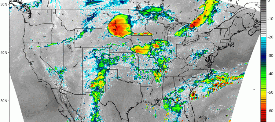
SATELLITE LOOP

Upstream on the satellite loop there is an upper air disturbance swinging through the Great Lakes this morning and this will move over us tonight with a few clouds. Some showers and thunderstorms could pop up in Northeastern Pennsyvlania late this afternoon and evening but they should weaken and die out long before reaching the coast. Northwest New Jersey and perhaps western and northern areas of the Hudson valley might see a brief shower or thunderstorm but it will be just that…brief.
REGIONAL RADAR

LOCAL RADAR NEW YORK CITY

LOCAL RADAR PHILADELPHIA


Sunday is wash rinse repeat with partly to mostly sunny skies with highs in the 80s to near 90. Then of course Monday August 21st is the solar eclipse and what we want is cloud free or virtually cloud free conditions.
SOLAR ECLIPSE CLOUD COVER FORECAST 8AM TO 2PM MONDAY CLICK TO ANIMATE
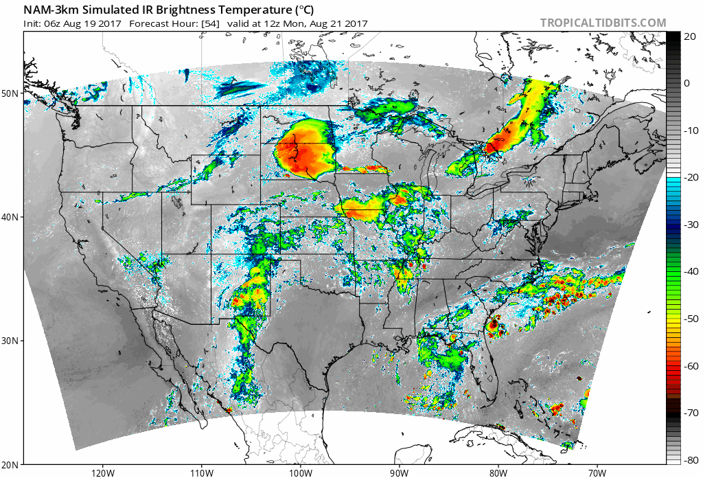
The NAM model satellite loop for Monday morning into the afternoon Monday through 2pm does pose an issue of a weak disturbance moving through at midday with some high clouds. The timing of this cloudiness is not good as it would come right at the time the eclipse is reaching its peak coverage. Remember we only see about 75% here. The darker gray is where skies should be mostly clear. The Southeast coast may be in trouble with clouds ans will the Northern Plains. and the Middle Mississippi Valley. Nashville may be in a good spot in between the two areas and they are in the path of totality. The west and northwest look best.
 GET JOE A CIGAR IF YOU LIKE

FiOS1 News Weather Forecast For Long Island
FiOS1 News Weather Forecast For New Jersey
FiOS1 News Weather Forecast For Hudson Valley


