
Snowstorm Action Continues Western U.S.
Snowstorm after snowstorm continues in the Western United States and if you are thinking about a Christmas to New Years Ski weekend, you want to go west because the snow continues over the next 10 days and there is snow everywhere. All the ski resorts out west are reporting excellent conditions. Ski resorts in the east however are having their worst start in years with hardly any snow except in the northern mountains in Maine. Even there there isn’t a lot of snow for skiers and snowboarders to play on. Here are the snowfall forecast amounts over the next 10 days in the east and in the west.
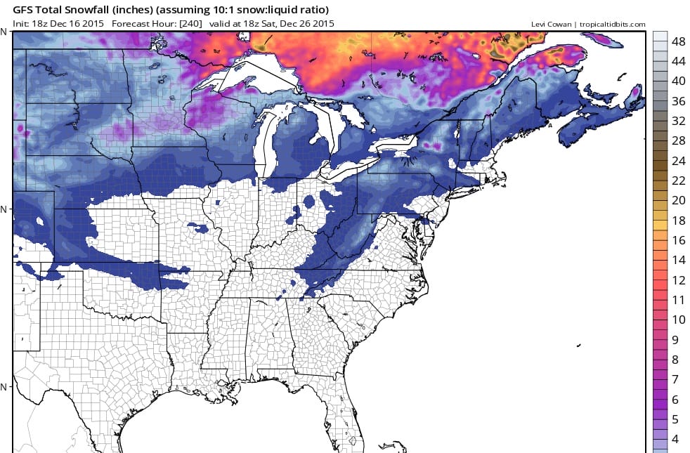
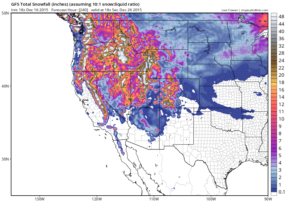
The snow forecast for the west is on top of the many feet of snow that is already on the ground. In the east the snow forecast amounts are minimal and much of what is show will be melting in between weather systems . Warm tropical air is destined to move all the way up into Northern New England during the middle of next week.
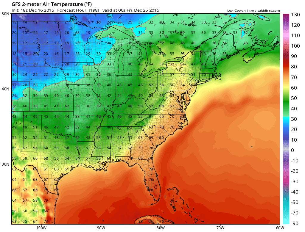 This is the temperature map for Christmas Eve. The gfs has backed off from the blast furnace it showed yesterday with 60s all the way into Maine. The reason it has backed off from this is that the long range model is showing an onshore flow and a warm front that develops south of Southern New England and does not make it all the way up north. This idea is certainly possible and would be the one way that warm air doesn’t make it all the way up north. Except for this weekend when it will be cold enough for snow making, even those machines will be useless as a strong southerly flow attempts to carry warm air northward.
After Christmas and into New Years there appears to be one more system that will run up well to the west of New England and the northeast so there could be another warm up though not as extreme.
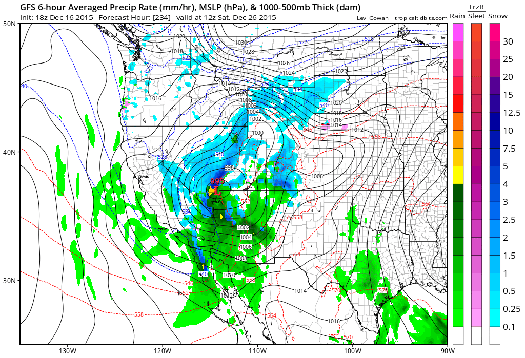
In the west snows will be on and off through the period but this may be the one snowstorm that has the greatest impact around and just after Christmas as it dives into the southwest and eventually makes its northeastward from there.
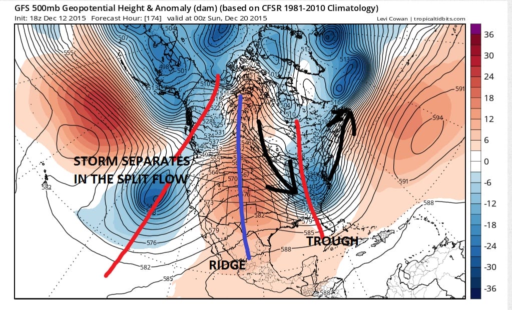
Longer term we discussed the earlier that there are some signs of changes in the uppermost atmosphere that could lead to a pattern change down the road and it will be have to watched closely. JOESTRADAMUS has more on this.
Also earlier today we have this video concerning last night’s model run and the blast furnace it shows for the northeast. Book you plane tickets and hotels and ski resorts for a trip out west for this Christmas holiday season.


Clouds have taken over and we have seen some drizzle move in along coastal areas. Widespread rain is beginning to develop on the radar and is supported by a cold front that is evident on the satellite loop. Rain will move into Southern Pennsylvania and Southern New Jersey during the early morning hours and spread northward during the day Thursday into Thursday night. Friday will be drying out and turning colder. Colder air comes in for Friday night and the weekend and it is the one genuine cold shot we will see in the next 10 days. Even this air mass only means that temperatures get down to near normal for 2 days before rising again next week.
JOESTRADAMUS GOES STRATOSPHERIC ON THE LONG RANGE
SHORT RANGE FORECAST FOR SOUTHERN PENNSYLVANIA TO SOUTHERN NEW ENGLAND