
Snowfall Forecast NY NJ CT Confidence Very Low

Snowfall Forecast NY NJ Confidence Very Low which sums this whole thing up pretty much. Here is what we are dealing with regarding the first ocean storm and what is running through my head at the moment.
OCEAN STORM GOES OUT TO SEA
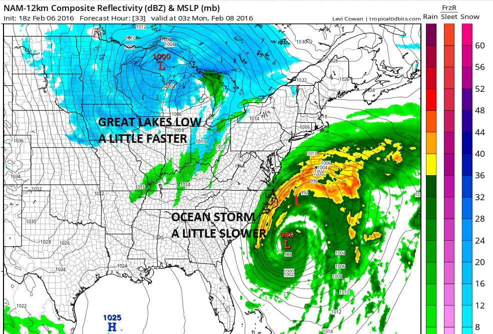
There isn’t any doubt with regards to the track of the ocean low. It will only get so far north before it gets ejected to the northeast. THAT IS NOT THE ISSUE. The issue is that even with the offshore track the circulation of the coastal storm is very large and there will be bands of precipitation on the northern and western side that will run far west of normal given a low that tracks east of 70 West Longitude
COMPLEX UPPER AIR PATTERN
Snowfall Forecast NY NJ CT
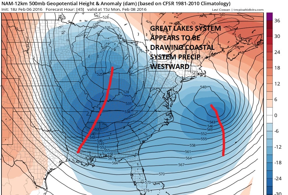
This would be a whole lot simpler a forecast were it not for a very complex upper air pattern that is taking shape across the northeast. So much energy is running around and I am yet to fully grasp the influence of the diving upper system into the Great Lakes. It seems that it wants to tilt the storms circulation to where the bands of precipitation remain distorted northwestward.
COASTAL EVENT
Snowfall Forecast NY NJ CT
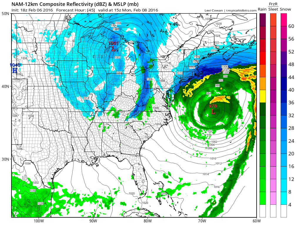
If this becomes an event it will be primarily a coastal one. The bands of snow will precipitation will weaken as they move westward. The great chance for anything on the order of accumulations will be for coastal New Jersey, Long Island and Eastern Connecticut with less to the west.
LAST MINUTE WESTWARD TREND
We have seen 3 snowfalls here in the last 3 weeks and all three systems wound up trending westward at the last minute. This includes yesterday’s. Lovers of the global models need to accept the fact that the European GFS and Canadian were among the LAST to shift westward. You can scream all you want about the European however the fact remains that it blew the northern extent of the Blizzard of 2016 and it did not accurately display the precipitation extent of the last event. The GFS was the last to shift westward on each occasion. The NAM has been better with all three inside the 48 hour timeframe. It was exceptional in the Blizzard of 2016 but less so with the other 2. The RGEM did very well in all three.
Snowfall Forecast NY NJ CT Confidence Very Low

Since I need to put out something this is what I’m going with. BUST POTENTIAL VERY HIGH!!!! There is time here to go higher IF the other models start showing a similar idea. Here is a rundown of what the other models do with this.
EUROPEAN OUT TO SEA
GFS OUT TO SEAT
CANADIAN CLOSE TO THE COAST FOR SOME SNOW
NAM CLOSE TO THE COAST FOR SOME SNOW
RGEM CLOSE TO THE COAST SNOW JUST OFFSHORE
SREF MODELS AGGRESSIVE WITH 6 INCH PLUS SNOWS FOR LONG ISLAND LOWER WEST AND NORTH
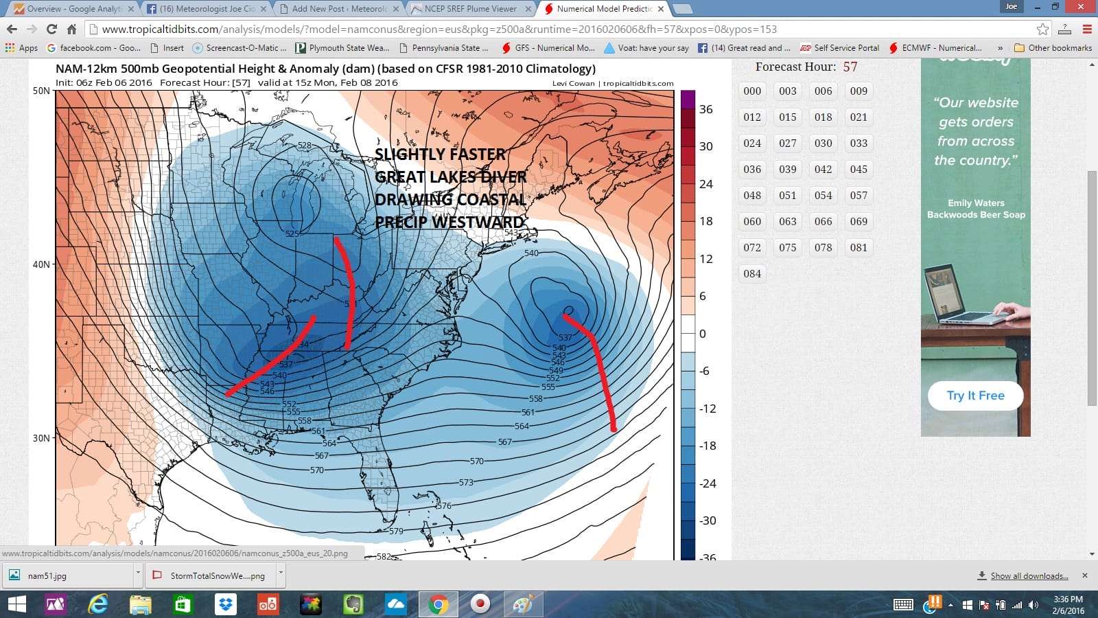
This pretty much sums it up. The NAM is very aggressive on this run and this is now 5 runs in a row where the model is throwing precipitation pretty far westward from the coastal low. This by the way is not that different from the European about 3 or 4 days ago which showed this very same idea. It would not be the first time a global model showed something days ago only to have it wind up happening. If this forecast winds up busting then so be it. I think I’m entitiled to a pass after the first three events.
NATIONAL WEATHER SERVICE SNOW FORECASTS
LATEST JOESTRADAMUS ON THE LONG RANGE
Weather App

Winter is here! Don’t be without Meteorologist Joe Cioffi’s weather app. It is a complete weather app to suit your forecast needs. All the weather information you need is right on your phone. Android or I-phone, use it to keep track of all the latest weather information and forecasts. This weather app is also free of advertising so you don’t have to worry about security issues with your device. An accurate forecast and no worries that your device is being compromised.
Use it in conjunction with my website and my facebook and twitterand you have complete weather coverage of all the latest weather and the long range outlook. The website has been redone and upgraded. Its easy to use and everything is archived so you can see how well Joe does or doesn’t do when it comes to forecasts and outlooks.
Just click on the google play button or the apple store button on the sidebar for my app which is onMy Weather Concierge. Download the app for free. Subscribe to my forecasts on an ad free environment for just 99 cents a month.
Get my forecasts in the palm of your hand for less than the cost of a cup of Joe!

![]()