
Snow Thursday North Carolina Southern Virginia Cold Dry Northeast Through Friday
The ultimate slap in the face for snow lovers will be accumulating snows for North Carolina and Southeastern Virginia with not so much as a flake or an ice pellet for Eastern Pennsylvania to Southern New England. That is the way the winter has played out. While this is going on we will be turning colder and drier for the rest of the week so at least we have no rain in the forecast.
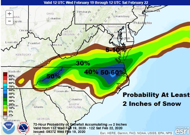
The Weather Prediction Center has upped the ante on the potential for at least 2 inches for Western North Carolina and Eastern North Carolina with a little hole in between. This matches up well with our initial early call snow forecast maps from yesterday which remains unchanged for now. I will be updating this later today with a final call snow forecast and expanding the map geography.

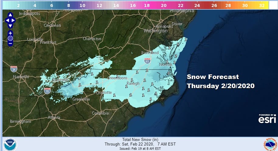
The National Weather Service digital forecast for comparison (because everyone forecast shops) is a little lower than mine but it is on a similar path regarding the highest snow amounts in Eastern North Carolina as well as Western North Carolina with a bit of a hole in between.
Overnight weather models have been doing their last minute juggles a little to the north and a little to the south but essentially remain on track. The rather impressive nature of the radar today might lead one to lean a little more aggressively as the NAM model shows on its latest run though I think the northern extent of this is a little too far north.
Snow develops Thursday morning and is mostly done by Friday morning as the wave moves east northeastward. There is no way this system moves northward up the East Coast as the upper air flow remains mostly northwest and west down to the Mid Atlantic States.
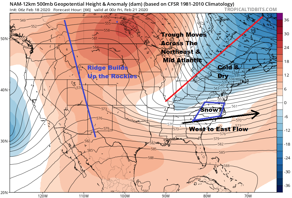
After the storm moves away weather conditions improve on Friday in the Middle and South Atlantic states though it will be cold. Then of course temperatures will bounce for the weekend.
BE SURE TO DOWNLOAD THE FREE METEOROLOGIST JOE CIOFFI WEATHER APP &
ANGRY BEN’S FREE WEATHER APP “THE ANGRY WEATHERMAN!
MANY THANKS TO TROPICAL TIDBITS FOR THE USE OF MAPS
Please note that with regards to any severe weather, tropical storms, or hurricanes, should a storm be threatening, please consult your local National Weather Service office or your local government officials about what action you should be taking to protect life and property.