
Snow Threats Possible But We Need A Ridge In The East

Snow Threats Possible But We Need A Ridge In The East
Every winter a distinct pattern develops in how weather systems play out and it appears that we have developed a pattern of weather systems being influenced by a very strong northern jet stream from Canada. This is supplying ample amounts of cold air going forward for the next 10 days to 2 weeks. But the problem is that there is always the need for a delicate balance with the cold air that wants to overwhelm and suppress weather systems to the south and the warmer moist air trying to move northward. Too much of one or the other creates forecast headaches regarding rain or snow or nothing. The character of these weather systems has been to produce only small to moderate amounts of precipitation. A few weeks ago we had three snow events in one week. Yesterday began the next in a series of weather systems that will be possibly impacting us.
GFS MODEL JET STREAM THURSDAY NIGHT 12/28/2017
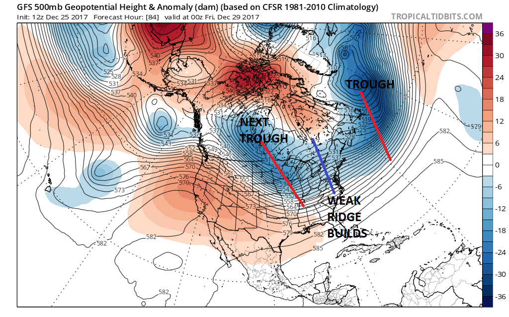
Rather than drive yourself crazy from weather model run to weather model run with what the weather models are showing literally, it might be easier emotionally to understand what is really happening here. Whether we get snow or not here will depend on an East Coast ridge. Yes indeed we need more of a ridge in the East, not less. Note the GFS jet stream for Thursday night shows two troughs with a weak ridging along 80 degrees west. Here lies the issue. We don’t have enough of one. A stronger ridge would correspond to a deeper trough swinging around in the Upper Midwest. If we can get a stronger ridge, the trough will dig a bit more (or the reverse is true as well). This as forecast by the model will not pick up a weak southern stream system northward. A deeper northern trough would likely produce its own low to our southeast and bring some snow later Friday into early Saturday. Too much of a ridge and you wind up with a repeat performance of last night into this morning.
OVERNIGHT GFS WEATHER MODEL SUNDAY DECEMBER 31ST
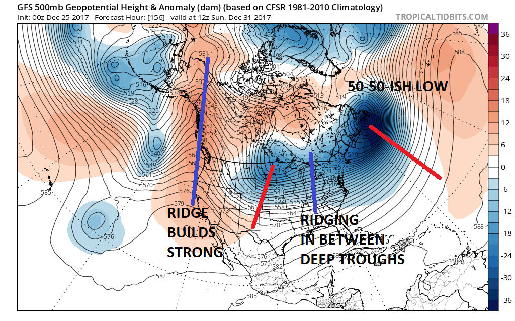
The same problem lies with a system for early next week. Here is the GFS from overnight which should ridging in between two deep systems. The ridge was enough to allow the system in the Northern Plains to dig down and around producing a major storm along the East Coast. However today’s GFS shows again the issue. There is not enough ridging in between the two systems according to today’s run at least.
GFS SUNDAY DECEMBER 31 NEW DAY TIME RUN
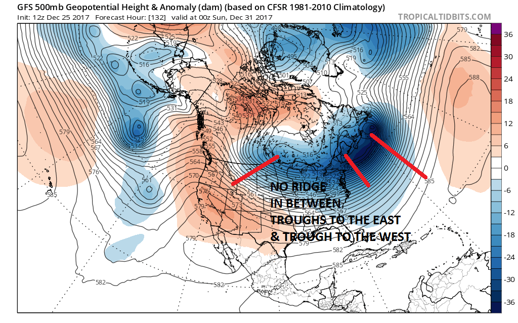
When you compare the two you can see the difference. The new run just overwhelms with very cold dry air and their is simply no room for anything to happen. This is why the surface maps are do different with regard to the outcome early next week.
OVERNIGHT GFS RUN FOR TUESDAY JANUARY 2ND

NEW GFS RUN FOR TUESDAY JANUARY 2ND
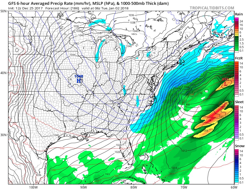
What a difference no ridge makes! The lack of one means no room along the coast and a suppressed look with overwhelming cold dry air and all the development offshore. At the moment it seems that judging from recent performance, the overwhelming of cold air will win out preventing any major event and possibly any minor ones. The key will be to look to see whether we can get a little bit of ridging in the east to alter the outcome. Otherwise it will be cold and dry kiss it goodbye!
MANY THANKS TO TROPICAL TIDBITS FOR THE WONDERFUL USE OF THE MAPS

GET JOE A CIGAR IF YOU LIKE!
FiOS1 News Weather Forecast For Long Island
FiOS1 News Weather Forecast For New Jersey
FiOS1 News Weather Forecast For Hudson Valley
NATIONAL WEATHER SERVICE SNOW FORECASTS
LATEST JOESTRADAMUS ON THE LONG RANGE
Weather App

Don’t be without Meteorologist Joe Cioffi’s weather app. It is really a meteorologist app because you get my forecasts and my analysis and not some automated computer generated forecast based on the GFS model. This is why your app forecast changes every 6 hours. It is model driven with no human input at all. It gives you an icon, a temperature and no insight whatsoever.
It is a complete weather app to suit your forecast needs. All the weather information you need is right on your phone. Android or I-phone, use it to keep track of all the latest weather information and forecasts. This weather app is also free of advertising so you don’t have to worry about security issues with your device. An accurate forecast and no worries that your device is being compromised.
Use it in conjunction with my website and my facebook and twitter and you have complete weather coverage of all the latest weather and the long range outlook. The website has been redone and upgraded. Its easy to use and everything is archived so you can see how well Joe does or doesn’t do when it comes to forecasts and outlooks.
Just click on the google play button or the apple store button on the sidebar for my app which is on My Weather Concierge. Download the app for free. Subscribe to my forecasts on an ad free environment for just 99 cents a month.
Get my forecasts in the palm of your hand for less than the cost of a cup of Joe!