Snow Threats Going Forward
Snow Threats Going Forward
Looking ahead to the coming week or so there are 3 weather systems that we are watching the first is a clipper system that is going to be dropping southeastward from the Great Lakes and redeveloping off the New Jersey coast. The second is Tuesday with a second clipper that is going to be moving by just to our north. The third comes next Sunday into Monday with low pressure coming out of the Gulf States and straddle along or just off the east coast. With respect to the first two clippers is that they are running to close together which basically leaves little room for either one. These will be minor events and snow areas will be limited.
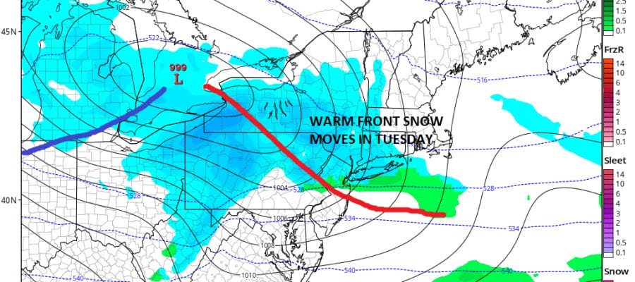
SNOW THREATS CLIPPER SYSTEM MONDAY MORNING
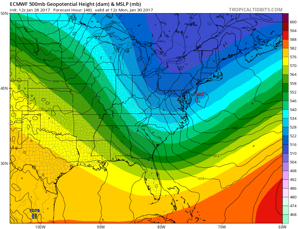
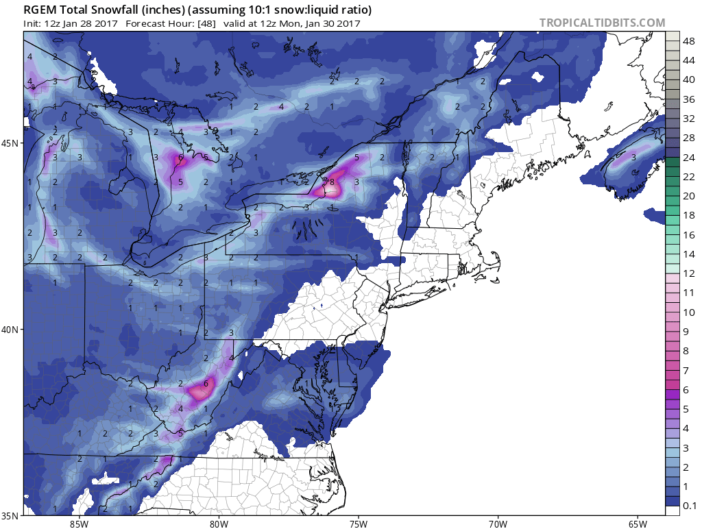
The European model is going back to what models were suggesting a few days ago as a low drops from the Great Lakes and redevelops just southeast of Cape May. The European model gets this thing going but it keeps all the important precipitation just offshore. I think the RGEM model has the best representation of this in terms of snow amounts and the map below shows snow totals through Monday 7am so there maybe a little more to add to this before it is done. A coating to a couple of inches seems likely from Southern New Jersey, Southeastern Pennsylvania down to Maryland and Delaware and Northern Virginia.
SNOW THREAT MONDAY MORNING RGEM SNOW FORECAST
The second clipper right behind it has slightly better dynamics but the surface low is forecast to pass to our north. It does show a weak warm front with some snow ahead of it that makes some sense.
SNOW THREATS GFS MODEL TUESDAY MORNING
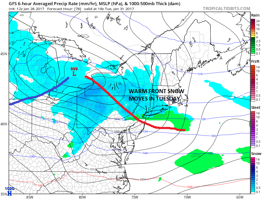
From this it seems to me that a coating to an inch or 2 is possible north of the warm front depending on how it sets up. The closeness of the two systems keeps things weak.
SNOW THREATS EUROPEAN NEXT MONDAY 2/6/2017
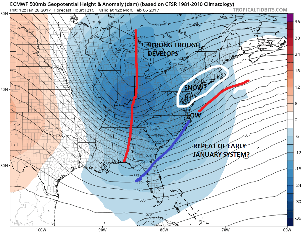
Models have been pointing to the 2/6-7 time frame for the last 5 days are so. What seems to be coming in my view is perhaps a repeat of the Early January set up of a coastal system that eventually winds up shifting leftward. The GFS has a coastal event while the European keeps things further east. The European model was the last to come on board with that system and it never seemed to come left enough. With the NAO forecast to go positive later this week it would seem that the model may be too far to the right (offshore) and a leftward solution could be in order. Of course this is very early in the game so we have lots of time to see how this winds up playing out.
MANY THANKS TO TROPICAL TIDBITS FOR THE WONDERFUL USE OF THE MAPS
SNOW REMOVAL COMPANIES FOR YOUR WINTER NEEDS
LONG ISLAND ROCKLAND COUNTY Connecticut

![]()

ROCKLAND COUNTY TRI STATE SNOW REMOVAL JOHNSTOWN PA


FiOS1 News Weather Forecast For Long Island
FiOS1 News Weather Forecast For New Jersey
FiOS1 News Weather Forecast For Hudson Valley
NATIONAL WEATHER SERVICE SNOW FORECASTS
LATEST JOESTRADAMUS ON THE LONG RANGE
Weather App

Don’t be without Meteorologist Joe Cioffi’s weather app. It is really a meteorologist app because you get my forecasts and my analysis and not some automated computer generated forecast based on the GFS model. This is why your app forecast changes every 6 hours. It is model driven with no human input at all. It gives you an icon, a temperature and no insight whatsoever.
It is a complete weather app to suit your forecast needs. All the weather information you need is right on your phone. Android or I-phone, use it to keep track of all the latest weather information and forecasts. This weather app is also free of advertising so you don’t have to worry about security issues with your device. An accurate forecast and no worries that your device is being compromised.
Use it in conjunction with my website and my facebook and twitter and you have complete weather coverage of all the latest weather and the long range outlook. The website has been redone and upgraded. Its easy to use and everything is archived so you can see how well Joe does or doesn’t do when it comes to forecasts and outlooks.
Just click on the google play button or the apple store button on the sidebar for my app which is on My Weather Concierge. Download the app for free. Subscribe to my forecasts on an ad free environment for just 99 cents a month.
Get my forecasts in the palm of your hand for less than the cost of a cup of Joe!
![]()