Snow Threat NAM Canadian Models Thursday Night
Snow Threat NAM Canadian Models Thursday Night
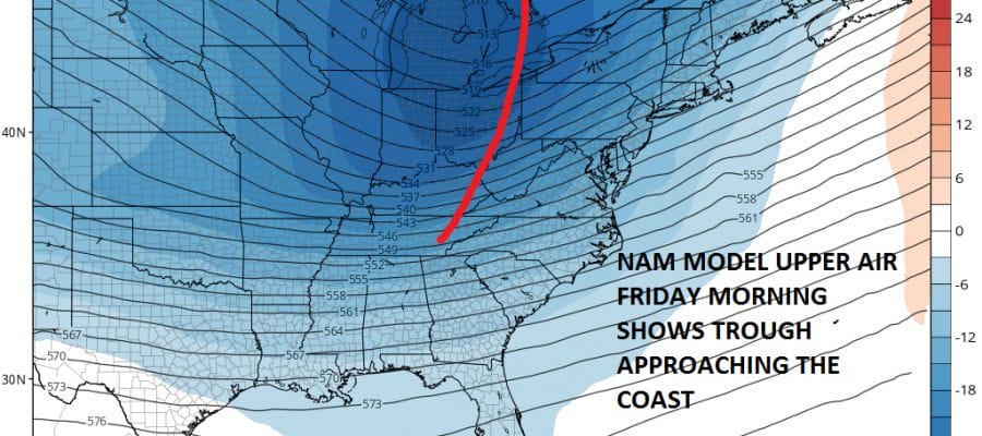
With all the attention focused on a potential snow event for the weekend, the lead wave that is going to move offshore Thursday night has not gotten much attention up until now. Some weather models like the European and the Canadian model have been putting more attention on the lead wave then on the second. The NAM model now joins these two and even the GFS now recognizes this is going to be a closer call than origianlly forecast.
CANADIAN MODEL FORECAST THURSDAY NIGHT THROUGH SATURDAY MORNING
CLICK TO ANIMATE

The key issue through all of this is how the models handle cold air. The GFS model has been guilty of overwhelming cold air and suppressing weather systems to the south. With regards to the first system this is becoming an increasingly false notion. Weather models are showing that it will take the development of at least the first wave to pull down more of the cold air southward. The result is the possibility of a minor snow fall later Thursday night into Friday on the order of a few inches if everything falls in the right place with higher amounts as you go south.
CANADIAN MODEL SNOW FORECAST

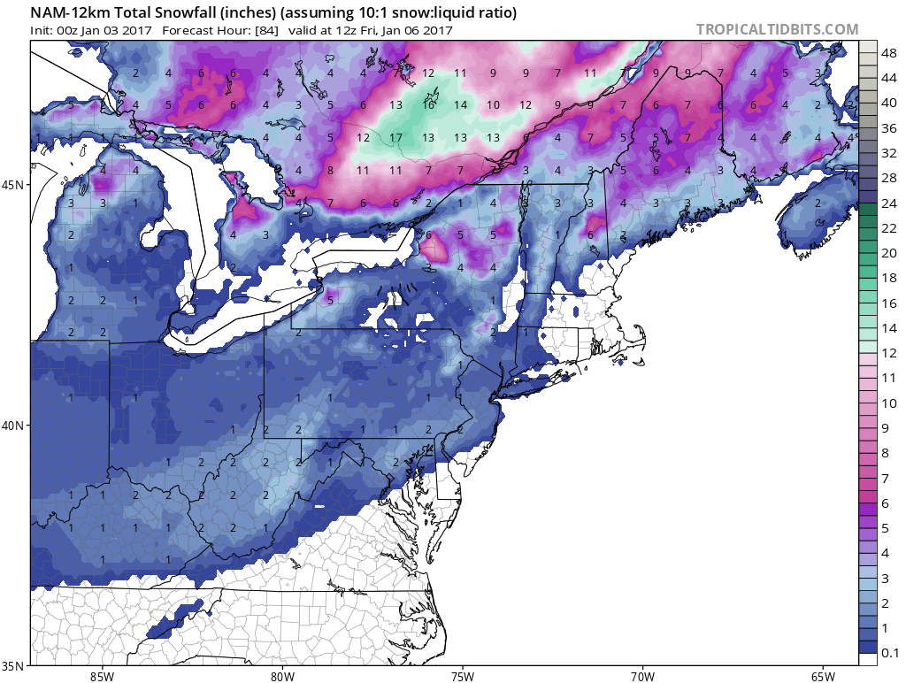
The NAM model tonight is on the same page as the European of the last few days and the Canadian model tonight.

NAM MODEL SURFACE MAPS FOR THURSDAY INTO FRIDAY MORNING
CLICK TO ANIMATE
The NAM model reflection of the radar would suggest a coating to an inch or so of snow into Friday morning with perhaps a few more hours to follow which is outside the NAM’s range at the moment but will be in range on the next model run.
NAM MODEL SNOW FORECAST THROUGH FRIDAY MORNING
Now assuming that these models are correct the big question becomes what impact does that have on the second system behind it. Will there be room left? The GFS again overwhelms cold air and has a less deep upper air structure than the Canadian which is far more dynamic and leaves some room.
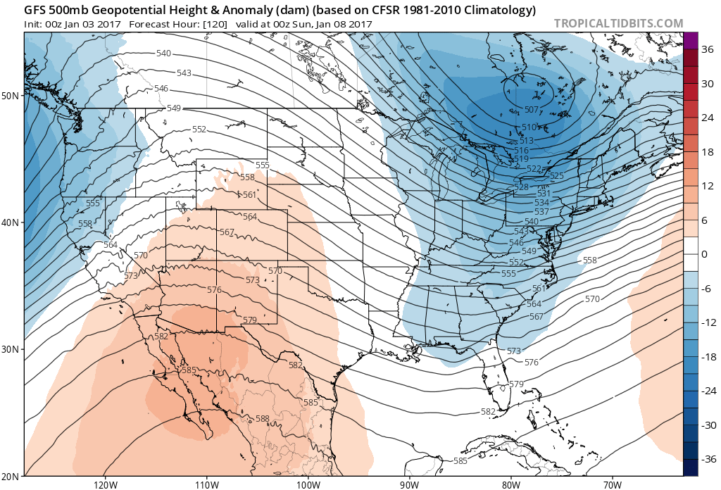

The Canadians view would take an intensifying wave off shore with a near miss while the GFS would be so far out that except for the Carolinas and possibly Southern Virginia there will be little consequence. Since the Canadian model has been right maybe twice since the Crimean War, and the GFS loves to overdo cold air, we will at this point lay the second event aside for the moment until we can resolve the first one. If the European lines up with the NAM and Canadian, look for an early call snow forecast to pop up sometime Tuesday morning.
SNOW REMOVAL COMPANIES FOR YOUR WINTER NEEDS
LONG ISLAND ROCKLAND COUNTY Connecticut

![]()

ROCKLAND COUNTY TRI STATE SNOW REMOVAL JOHNSTOWN PA


FiOS1 News Weather Forecast For Long Island
FiOS1 News Weather Forecast For New Jersey
FiOS1 News Weather Forecast For Hudson Valley
NATIONAL WEATHER SERVICE SNOW FORECASTS
LATEST JOESTRADAMUS ON THE LONG RANGE
Weather App

Don’t be without Meteorologist Joe Cioffi’s weather app. It is really a meteorologist app because you get my forecasts and my analysis and not some automated computer generated forecast based on the GFS model. This is why your app forecast changes every 6 hours. It is model driven with no human input at all. It gives you an icon, a temperature and no insight whatsoever.
It is a complete weather app to suit your forecast needs. All the weather information you need is right on your phone. Android or I-phone, use it to keep track of all the latest weather information and forecasts. This weather app is also free of advertising so you don’t have to worry about security issues with your device. An accurate forecast and no worries that your device is being compromised.
Use it in conjunction with my website and my facebook and twitter and you have complete weather coverage of all the latest weather and the long range outlook. The website has been redone and upgraded. Its easy to use and everything is archived so you can see how well Joe does or doesn’t do when it comes to forecasts and outlooks.
Just click on the google play button or the apple store button on the sidebar for my app which is on My Weather Concierge. Download the app for free. Subscribe to my forecasts on an ad free environment for just 99 cents a month.
Get my forecasts in the palm of your hand for less than the cost of a cup of Joe!


