
DOWNLOAD MY NEW FREE JOESTRADAMUS WEATHER APP FOR ALL DEVICES
THE APP IS ABSOLUTELY FREE TO ALL BUT CONSIDERING SUBSCRIBING TO PATREON FOR A WEATHER EXPERIENCE FREE OF ADS, EXCLUSIVE VIDEOS FOR MEMBERS ONLY AND MUCH MORE…STARTS AT $2 A MONTH..MESSAGE ME AT ANY TIME
Snow Threat Grows Late Sunday Early Monday
Winter Storm Watch Southern & Eastern Pennsylvania New Jersey,
NYC, Long Island, Hudson Valley & Connecticut
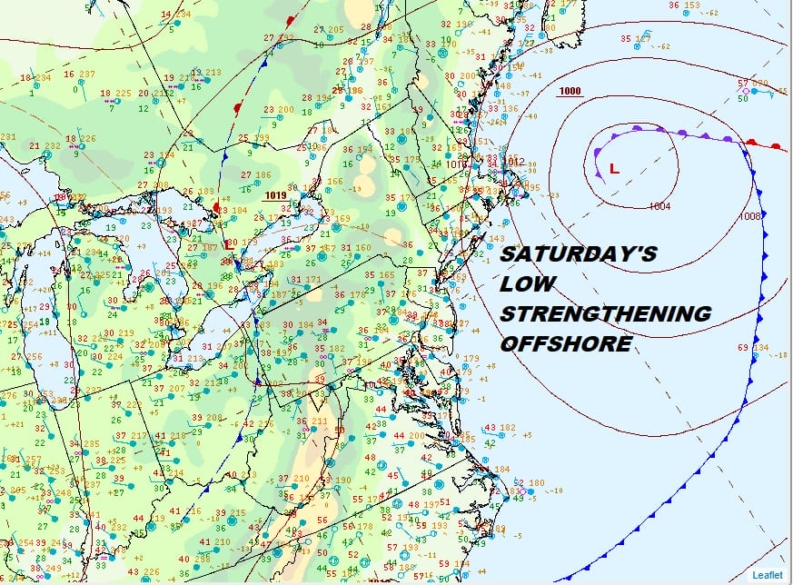
Today’s storm system continues to do its job strengthening offshore. It is heading to pass south of Nova Scotia. More importantly it is leaving a weakness behind it that the next storm will follow. We have been saying for days this system would be suppressed and further south and that trend continues today. This means the snow threat grows for late Sunday into early Monday and Winter Storm Watches are posted as a result. Additional watches could be required in areas to the East and we will likely see warnings go into effect on Sunday. In fact watches have now be extended southward into much of Central and South Jersey.
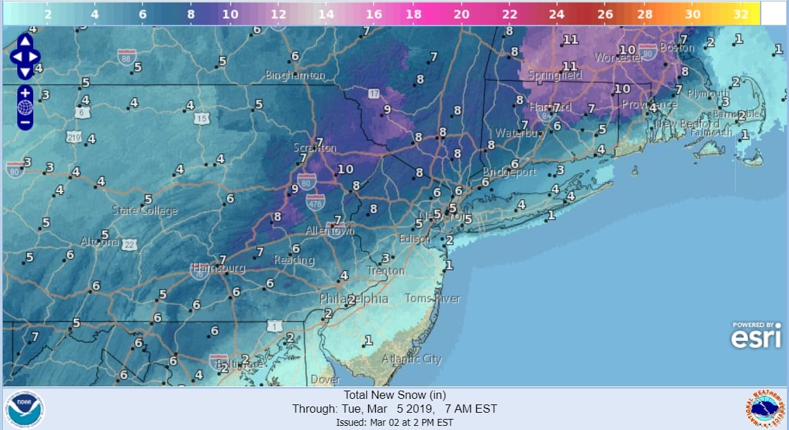
The map above shows the National Weather Service numbers as of 3pm today for Sunday’s storm system and we don’t have too much issue with this. I think at this point regarding models we are going to see them tuck in a little bit north, a little bit south. The primary trend however is more east than anything else which means that the rain snow line gets only so far north before it comes to a grinding halt. Long Island again is in one of those tenuous spots regarding snow and whether a change to sleet or rain occurs. It may not matter in the end.

My early call remains the same and i might beef it up just a bit tomorrow but in general a 3 to 6 inch band with some 8 inch amounts embedded inside that band is likely. Perhaps an addition of a 6 inch plus band inside the 3 to 6 area is warranted. We shall see. It is always tough to nail the upside trying to take into account local effects. I think the message is pretty clear. This is an 8 hour event from start to finish so if you grind out some good moderates for 4 or 5 hours you got your six inches.
REGIONAL RADAR

Not much is happening this evening as an upper air disturbance moves across upstate NY and into Northern New England. The back edge of our storm from last night is beginning to pull away from Southeastern Massachusetts. Tonight into Sunday morning there are no issues other than patchy clouds. Lows tonight will be in the 20s to lower 30s and highs Sunday with thickening clouds in the 30s to near 40 in some places.
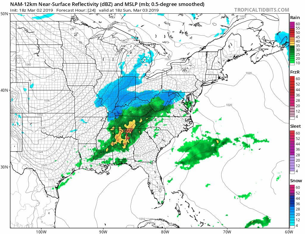
The new NAM model takes us from 1pm Sunday to 7am Monday and you can see the snow moving northeast Sunday afternoon. It arrives in Philadelphia around 4pm, NYC around 6pm and Southern New England an hour or two later. We put down what we put down. After 1am it ends rapidly from southwest to northeast it is long gone by the time the morning commute gets underway Monday. This could be the last chance for accumulating snow as a pattern change looms after next week. It is possible we could squeeze in one more opportunity next weekend though I have not really given the long range a solid look as the short range has obviously kept me occupied.
MANY THANKS TO TROPICAL TIDBITS FOR THE USE OF MAPS
Please note that with regards to any tropical storms or hurricanes, should a storm be threatening, please consult your local National Weather Service office or your local government officials about what action you should be taking to protect life and property.


