Snow Threat Friday Nam Model Analysis

GET JOE A CIGAR IF YOU LIKE
Snow Threat Friday Nam Model Analysis
There are a few issues with regards to Friday’s weather system The first is how much of a system are you actually going to have when it moves by. The second is time of day and temperatures because while it will be cold enough aloft for snow, the very bottom of the atmosphere might be a tad warm or at least warm enough where snow won’t stick to much except colder surfaces. This time of year it sticks when it snows hard and im not sure that we will see it snow hard enough to cause problems, even if somebody winds up with a coating to a couple of inches on grass. The main threat time in my view would be from 1am Friday to 1pm Friday.
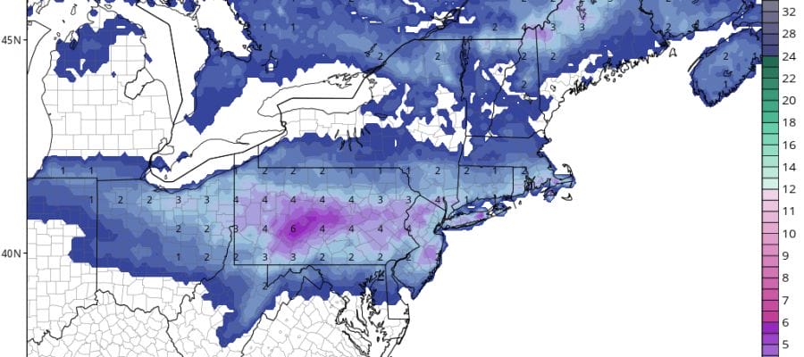
NAM MODEL SNOW FORECAST FRIDAY
Last nights NAM model did get a tad more aggressive with the surface low and today’s model run seems to be following along with this idea. Today’s run gets a bit more aggressive as it has a well defined surface low developing just to our south.
The NAM is also faster with snow developing during the early morning hours on Friday so there will be some accumulation before daybreak and even on roads depending on intensity. I think the best approach to this is to cover for the possibility of a coating to a couple of inches for much of the area at least for the time being at least via the NAM view of things. Basically I’m taking the NAM forecast and cut it in half…at least for now.
Meanwhile we are seeing showers moving eastward on the radars at the moment and this is our short range problem for the rest of today and tonight though we should see a break in the action at some point. Showers should be done around daybreak Wednesday before weather conditions improve.


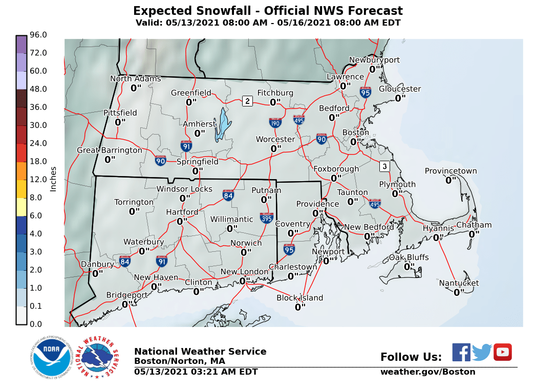
The maps below are the National Weather Service forecast snow maps with the most likely snowfall prediction.