Snow Possible Saturday Bitter Cold Air Mass Follows
Snow Possible Saturday Bitter Cold Air Mass Follows
One of the things about a bitter cold air mass is that while it is very dry, it also doesn’t take much for snow to develop from even the weakest of disturbances. This has our attention a bit regarding Saturday into Saturday night. Weather models have been battling over just exactly what the jet stream is going to look like Saturday and whether there will be just enough of a disturbance to create a nice fluffy snowfall. We think there will be.
GFS MODEL OVERNIGHT SATURDAY EVENING
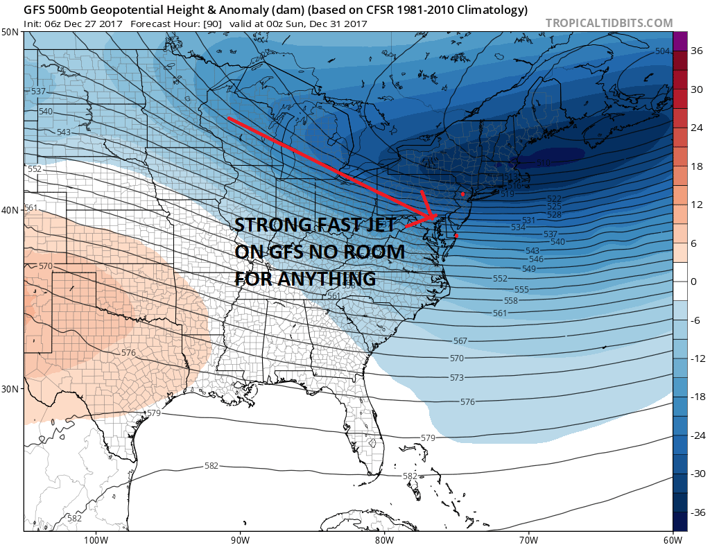
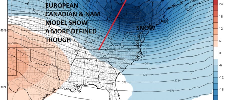
The GFS model has been suffering lately of having a very difficult time handling the strong northern jet stream. If it looks like this there you probably wouldn’t see a flake out of this or at most a snow shower. The flow is too fast and there simply is no room for anything to even remotely maintain an identity as it moves across. The European, Canadian, and NAM model all have a much different look as a trough is able to develop and swing around. This would produce a period of snow that could whiten the ground at least and possibly leave a few places with a couple of inches.
EUROPEAN UPPER AIR JET STREAM SATURDAY EVENING
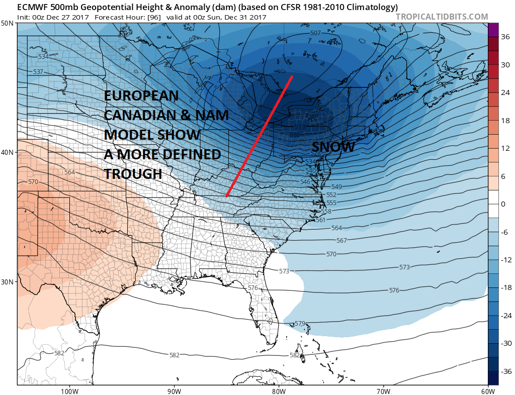
A number of other short term models are coming around to this idea as well so we think it isn’t a reach to forecast a period of snow or snow showers on Saturday into Saturday evening and cover for anything from a coating to a couple of inches. The highest amounts might be biased to the east rather than to the west with this system. If it snows Saturday temperatures at best will be in the lower 20s and probably the upper teens which means a big fluff factor. If models start grinding out a couple of tenths of liquid precipitation, it could mean for a little upside especially to the east on Long Island and Connecticut.
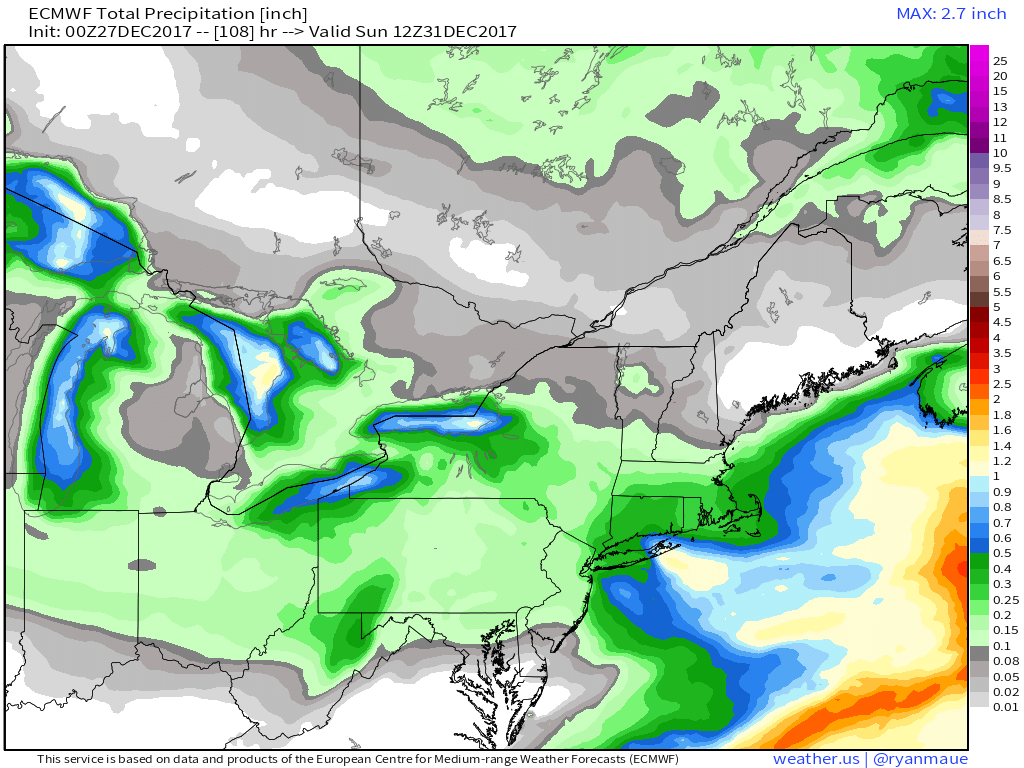
The European courtesy of WX.GRAPHICS and the Canadian model both manage to produce a quarter of an inch of liquid and the European model has done this for several runs in a row as has the Canadian. A bit concerning is the 1/2 inch of liquid precip is not that far away and it is covering Eastern Long Island. The European has also done a pretty good job with snow lately as it nailed Christmas Eve night into Christmas morning almost to the flake.
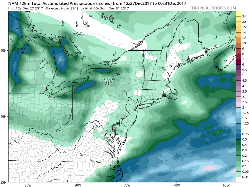
The new NAM model just out is supporting the European model and other models on the Saturday chance for snow giving about .05 to .10 of liquid which i think justifies the idea of anywhere from a coating to an inch or two in some places. We’ll come back to this later today to see how the European model handles it as well as which way the trends are going.
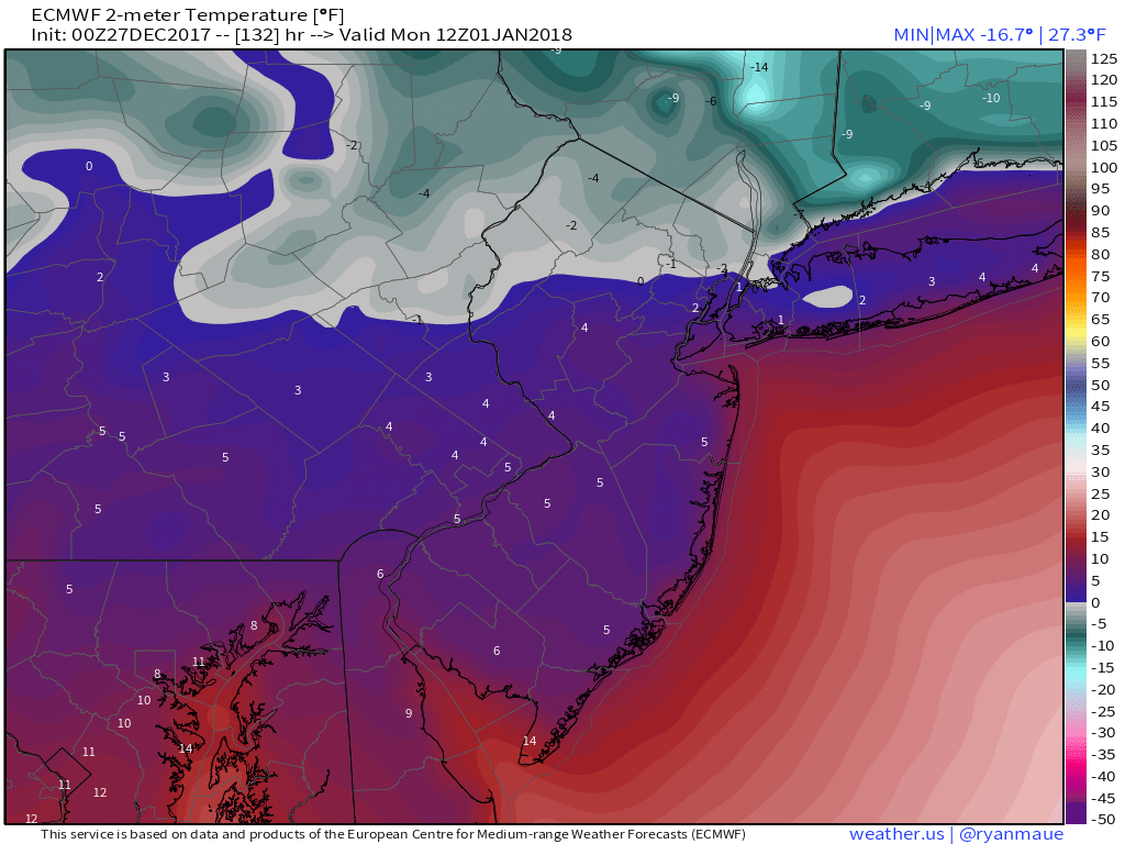
Regardless of snow temperatures are going below zero New Years morning with the next shot of bitter cold air. Temperature map courtesy of WX.GRAPHICS.
MANY THANKS TO TROPICAL TIDBITS FOR THE WONDERFUL USE OF THE MAPS

GET JOE A CIGAR IF YOU LIKE!
FiOS1 News Weather Forecast For Long Island
FiOS1 News Weather Forecast For New Jersey
FiOS1 News Weather Forecast For Hudson Valley
NATIONAL WEATHER SERVICE SNOW FORECASTS
LATEST JOESTRADAMUS ON THE LONG RANGE
Weather App

Don’t be without Meteorologist Joe Cioffi’s weather app. It is really a meteorologist app because you get my forecasts and my analysis and not some automated computer generated forecast based on the GFS model. This is why your app forecast changes every 6 hours. It is model driven with no human input at all. It gives you an icon, a temperature and no insight whatsoever.
It is a complete weather app to suit your forecast needs. All the weather information you need is right on your phone. Android or I-phone, use it to keep track of all the latest weather information and forecasts. This weather app is also free of advertising so you don’t have to worry about security issues with your device. An accurate forecast and no worries that your device is being compromised.
Use it in conjunction with my website and my facebook and twitter and you have complete weather coverage of all the latest weather and the long range outlook. The website has been redone and upgraded. Its easy to use and everything is archived so you can see how well Joe does or doesn’t do when it comes to forecasts and outlooks.
Just click on the google play button or the apple store button on the sidebar for my app which is on My Weather Concierge. Download the app for free. Subscribe to my forecasts on an ad free environment for just 99 cents a month.
Get my forecasts in the palm of your hand for less than the cost of a cup of Joe!