Snow Possible Carolinas Southern Virginia Late Week
Showers Northeast Tuesday Colder Dry Wednesday Into the Weekend
We at least manage to pull off a very nice Presidents Day with sunshine through some high clouds and temperatures in the 40s. The next weather system and probably the only one of consequence for the Northeast and Northern Mid Atlantic states arrives for Tuesday. Ahead of it skies are clear this evening with just some wispy high clouds but more clouds will arrive late tonight. Temperatures have dropped in areas that respond to clear skies and light winds and many areas have already dropped into the 30s and even the lower 30s in some areas. However once the clouds move in temperatures will likely steady or even rise a bit toward morning. The radars are quiet and calm and will remain so overnight.
SATELLITE
REGIONAL RADAR
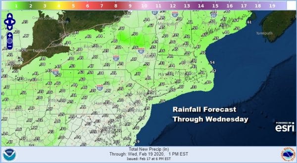
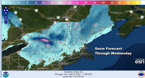
Tuesday starts off cloudy and then as the cold front nears us some showers are likely from mid morning to late afternoon. Well north and west of the coast from the Catskills to the mid Hudson Valley it could start as snow that won’t amount to much. North of I-90 we are looking at a 1-3/2-4 type event for most before it is all said and done Tuesday evening. Everywhere else it is rain on the order of a quarter of an inch or less.
Snow will fall where it has been falling pretty much all winter long which is in upstate NY mainly north of I-90 and in Northern New England. Again this is nothing major and is just another event to add to the above average snow totals for that area that we have seen this winter season.
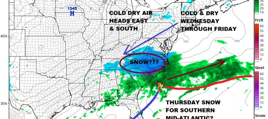
Once this front clear the coast it will stall across the Southeast US back across the Gulf States. Cold air will be pouring into the Northeast and Middle Atlantic States and will bleed southward. Now we have a situation on the other end of the spectrum. We are actually going to be overwhelmed with cold air to the point where the front to the south will produce a flat wave that runs east northeast and passes well south of our area but it could bring snow from Southern Virginia and in the Carolinas for Thursday!
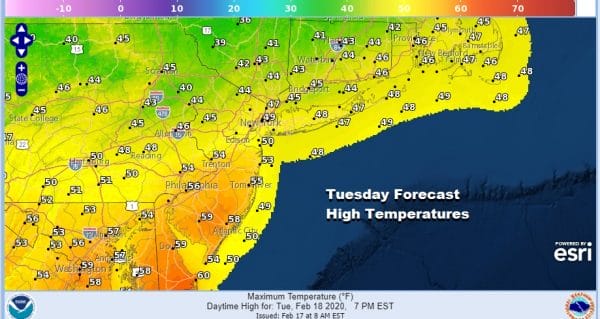
This isn’t written in stone yet. It will depend on the strength of the system in the southern part of the jet stream and there is always the chance this could be weaker or just fall apart. The NAM model is on the aggressive side and it has some support from a few other models. We will have to wait and see how much comes out of the Pacific to determine whether it is on the right track here. Meanwhile from Eastern Pennsylvania to Southern New England we will some sunshine Wednesday through Friday. Wednesday’s highs will be in the upper 30s and lower 40s. Thursday and Friday highs will be just in the 30s. Longer range we still think the window for snow for the I-95 urban corridor might open up just a crack late month and into the first 10 or so days of March but this still remains way out in the long range and it would shock anyone if the window winds up slamming shut as we draw closer.
BE SURE TO DOWNLOAD THE FREE METEOROLOGIST JOE CIOFFI WEATHER APP &
ANGRY BEN’S FREE WEATHER APP “THE ANGRY WEATHERMAN!
MANY THANKS TO TROPICAL TIDBITS FOR THE USE OF MAPS
Please note that with regards to any severe weather, tropical storms, or hurricanes, should a storm be threatening, please consult your local National Weather Service office or your local government officials about what action you should be taking to protect life and property.


