Snow & Ice Storm Moving East
Cold High To The North Remains Key To The Forecast

Snow & Ice Storm Moving East
Cold High To The North Remains Key To The Forecast
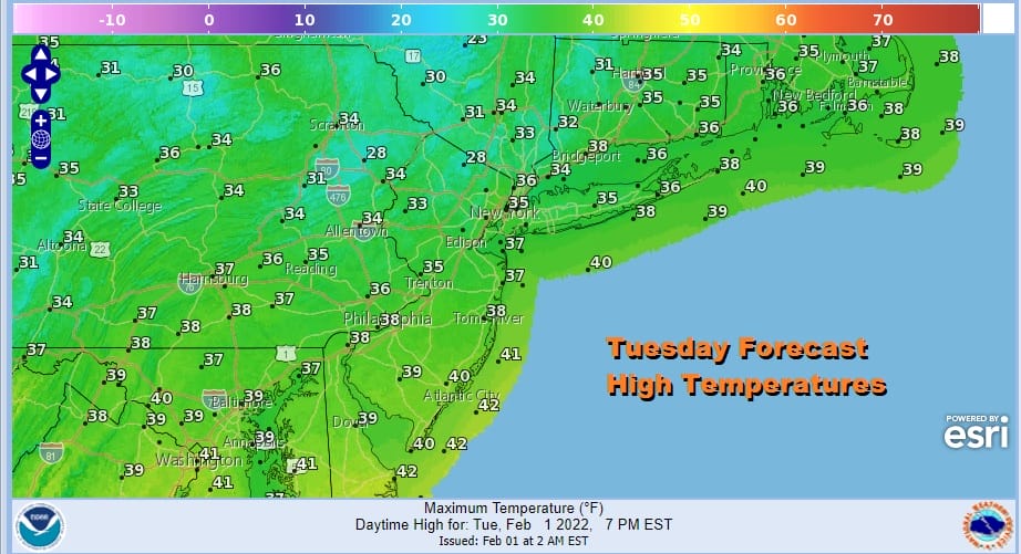
This will be the last truly cold morning across the area for the next few days as temperatures continue to moderate. In fact today will feel downright balmy compared to the last several days as highs reach the mid to upper 30s. We should also have a decent amount of sunshine today and those two factors will reduce the snow cover a bit more. There are no issues on the satellite or on the radar that we need to worry about probably through the daytime Thursday. In the meantime the rise in temperatures continues albiet at a slow pace. Tonight won’t be as cold as past night’s with lows in the 20s to near 30.

Wednesday we will likely have some cloud issue. There is a little weak system sitting off the Mid Atlantic coast. There isn’t much to it other than a small little low pressure area but it will create winds from off the ocean and it will bring some clouds so Wednesday’s highs will be just in the low to mid 40s.
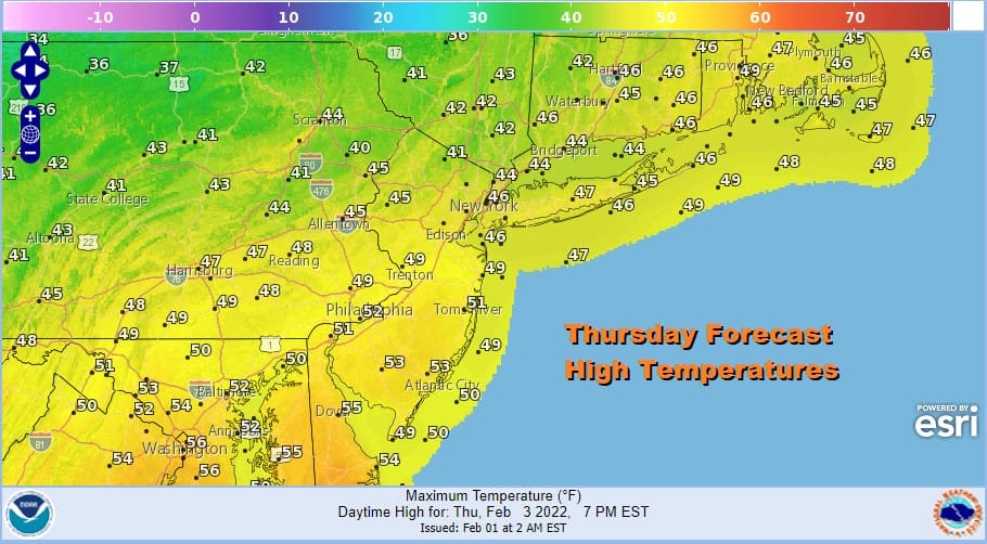
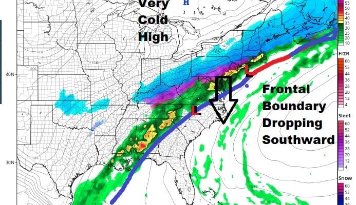
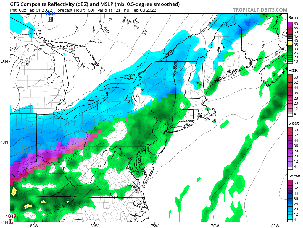
Thursday is the warmest day of the week but we continue to back away from the aggressive highs in the mid to upper 50s though that will occur across Southern New Jersey and Delaware west and south. Further north highs will likely have a tougher time getting out of the mid to upper 40s unless we wind up getting a few hours of sun early in the day which is not impossible Either way attention then turns to a snow and ice storm that will be raging across the Middle Mississippi Valley to the Northern Ohio Valley to Western NY where we have lots of Winter Storm Watches and Warnings posted.
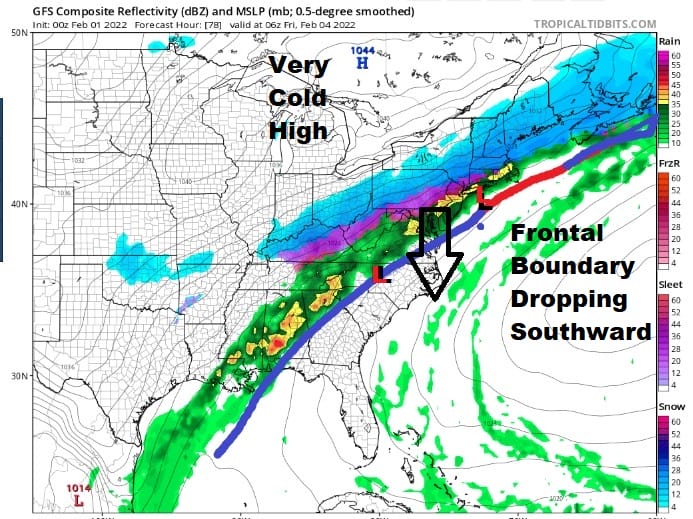
This isn’t like the blizzard. This a different sort of system. We have a cold front that is creeping eastward. To the north is a very cold high which early Thursday morning is sitting north of Lake Huron. On the front we have weak waves of low pressure moving along it. Most importantly we have a strong and very warm southwest flow aloft, mainly above 5000 feet that is creating overrunning and producing a lot of precipitation north of the frontal boundary.
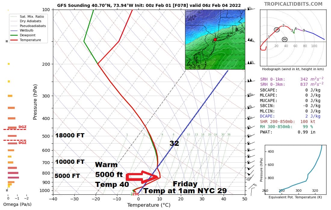
I’ve put up a vertical profile of what is known as a sounding. National Weather Service offices around the country send up weather balloons every day to measure conditions in the upper atmosphere and that data along with satellite, radar data etc go into the weather models. This is actually a forecast sounding of NYC AT 1am Friday. Many of you have been asking why is this freezing rain and not snow? The sounding forecast for 1am reveals that while the ground temperature is forecast to be 29 degrees by the very cold GFS model, at around 5000 feet you will see what we often call a “warm nose” and the temperature at that level is forecast to be close to 40 degrees! Above 7500 feet the temperature is back below freezing. Snow falls into that warm layer and melts to rain. Then it falls to the ground and freezes. If the layer between the warm layer and the ground were large enough, then the rain drop could refreeze and you would get sleet (which is totally different from hail).
There are two main differences between the GFS and the other models. The first is the timing of the arrival of the colder air. That is a bitter cold high to the north and weather models are notorious for not handling those types of air masses well. The GFS is showing that cold air draining southward aggressively and quickly. While the other models continue to slowly shift the frontal boundary southward they are not nearly as aggressive as the GFS.
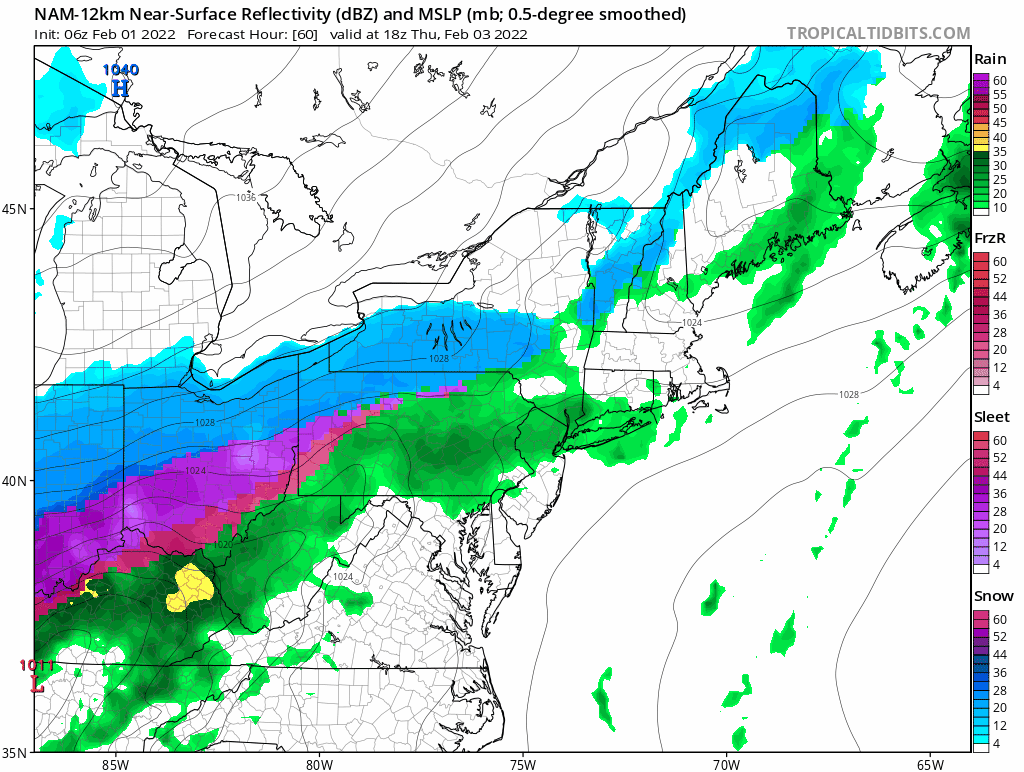
The other models are struggling as well with the frontal position, the timing and the arrival of cold and the timing of waves moving along the front. The GFS model has what would amount to a serious freezing rain and icing event with ice accretion forecasts of a half inch or more. The freezing rain would also reach southward through New Jersey and into Southern Pennsylvania and Delaware. The other models show icing but because of timing issues they show the change to freezing rain being delayed, though it should be noted that those models including the European continue to shift colder and southward.
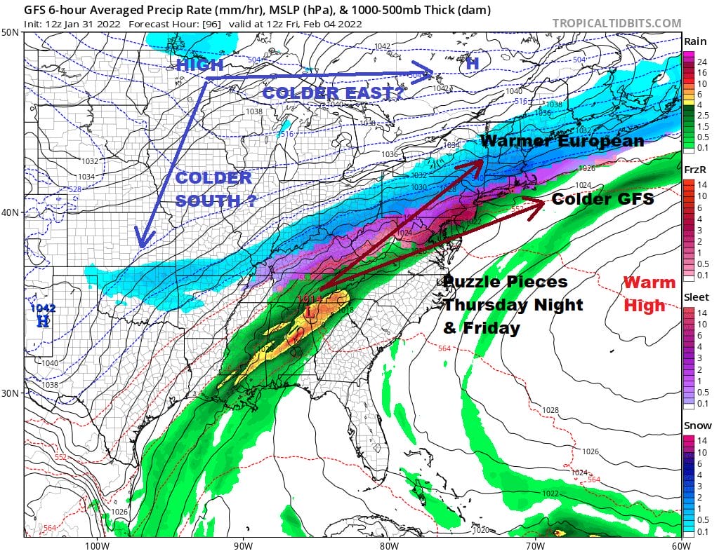
We go back to this graphic from yesterday which shows the puzzle pieces. None of this is likely to get resolved today and we will probably have to wait another day or two before this all becomes clearer. Let me add that while dealing with snow is one thing, dealing with ice is quite another. Ice storms are potentially destructive and have huge impacts. We see what happens with glaze from freezing drizzle and suddenly there are hundreds of car accidents everywhere. Let’s hope that the aggressive models are wrong and that we deal with something far less and more manageable with just a little common sense come Thursday and Friday.
BE SURE TO DOWNLOAD THE FREE METEOROLOGIST JOE CIOFFI WEATHER APP &
ANGRY BEN’S FREE WEATHER APP “THE ANGRY WEATHERMAN!
MANY THANKS TO TROPICAL TIDBITS & F5 WEATHER FOR THE USE OF MAPS
Please note that with regards to any severe weather, tropical storms, or hurricanes, should a storm be threatening, please consult your local National Weather Service office or your local government officials about what action you should be taking to protect life and property.


