Snow Forecast Updated 01312017
Snow Forecast Updated 01312017
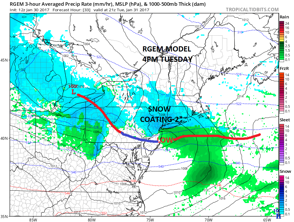
Based on the afternoon model runs my snow forecast for Tuesday for the next clipper remains unchanged. We have a low that will be moving southeast from the Eastern Great Lakes and it will redevelop east of the Central New Jersey coast. The RGEM model probably has the best idea on how this plays out. It is also the most south of all the models. This will be important for where the southern edge of the accumulating snow will be.
Where that warm front sets up will be critical but remember this is a MINOR event. The only thing that I would be careful of is sometimes the snow can get enhanced a bit north of that warm front.
JOE’S SNOW FORECAST FOR TUESDAY

Right now the idea of a coating to a couple of inches remains the most likely outcome with the southern edge of the snow along Route 195 in New Jersey and the southern end of the 1 inch line along Route 78 in New Jersey and Eastern Pennsylvania. North of Route 80 in New Jersey/NE Pennsylvania, North of 287 in the Hudson Valley and north of Route 15 in Connecticut 2 to perhaps some local amounts to 3 inches are possible. Snow begins sometime between 9am and noon and ends between 6pm-9pm from west to east.


The national radar above shows the snow from the clipper in Eastern Minnesota and Wisconsin at the moment while the regional radar shows some rain and snow showers behind today’s clipper over Pennsylvania and moving into parts of Southern New Jersey.
The maps below are the National Weather Service forecast snow maps with the most likely snowfall prediction.