Snow Forecast Ski Resorts
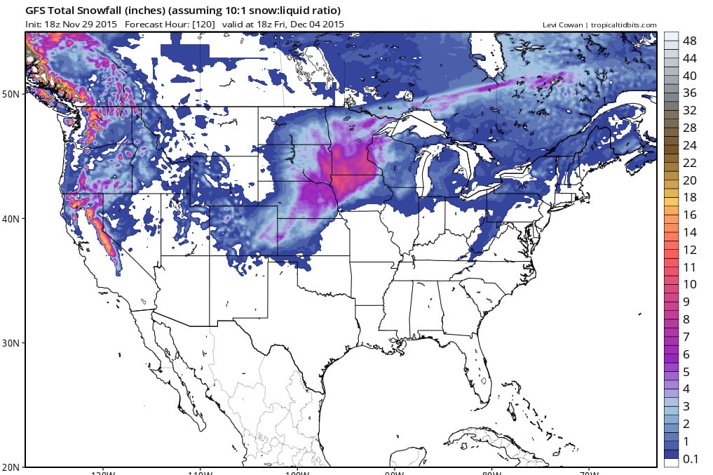
As usual it is a tale of 2 worlds with the way the weather pattern is set up right now. Those of you who ski and are thinking of early adventures in New England had better set their sights on northernmost areas judging from the forecast over the next 10 days. The action will remain in the west as the 5 day snowfall forecast maps indicate.
Snow will continue to be heavy in the west with another 1 to 2 feet of snow likely in many ski areas from Western and Northern California northward System after system continues to crash into the west which is the one place where it is cold enough to support heavy snows. The story in the east is quite different of course with a lack of storms coming up from favorable tracks and a total lack of cold Canadian air. Whatever snow falls is from whatever cold air is produced aloft from passing systems and as the map indicates for the next 5 days it isn’t much. Much of what you see here is of the snow shower variety and even there it is not likely to last long on the ground except in the highest elevations. Temperatures will continue to run above normal across much of upstate New York and New England for at least the next 10 days.
JOESTRADAMUS LONG RANGE OUTLOOK
SHORT RANGE FORECAST LONG ISLAND
SHORT RANGE FORECAST NEW YORK NEW JERSEY CONNECTICUT PENNSYLVANIA
WINTER FORECAST JOESTRADAMUS 2015-2016