
Snow Forecast Saturday 01142017
Snow Forecast Saturday 01142017
After looking at the overnight weather models i’ve decided to leave things as is and emphasize that for most areas it will be a coating to an inch or so. The best chance for perhaps an inch or 2 will be south.
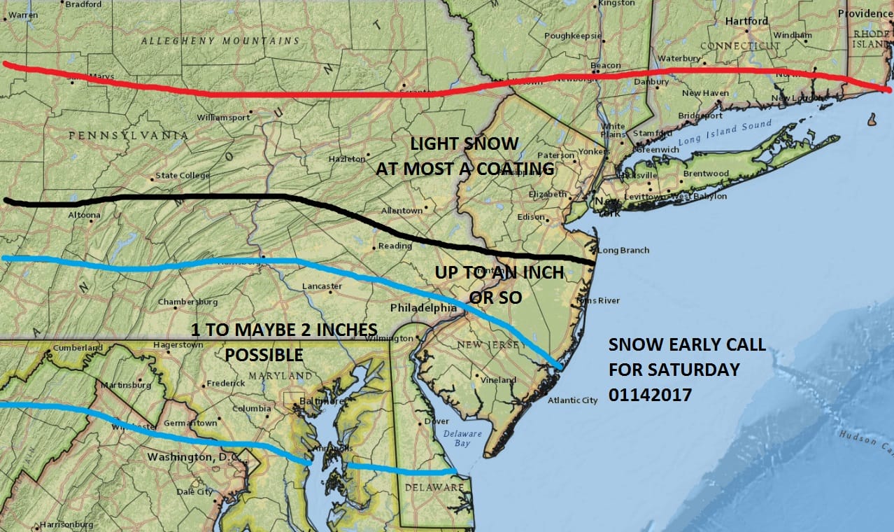
The NAM model is the only model at the moment that would have a wider area of an inch or 2 further north at it has the most robust look of all the models.
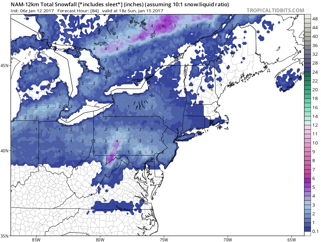
The forecast dilemma with this is that in cases such as this, you get this general area of a coating to an inch and then there will be small pockets where somebody winds up with 2 or 3 while surrounding areas see very little. For now I will leave things as is. The National Weather Service maps below indicate all areas getting less than an inch and I have no argument with that idea at the moment. Those maps are below. Radars meanwhile show a cold front to the northwest with some showers that probably will fall apart before they make it to the coast. We will see highs reach into the 60s in some areas today especially if we get some breaks of sun.


The maps below are the National Weather Service forecast snow maps with the most likely snowfall prediction.


